Saint-Denis-lès-Bourg
Saint-Denis-lès-Bourg (French pronunciation: [sɛ̃ dəni lɛ buʁ], literally Saint-Denis near Bourg) is a commune in the Ain department in eastern France.
Saint Denis les Bourg | |
|---|---|
Commune | |
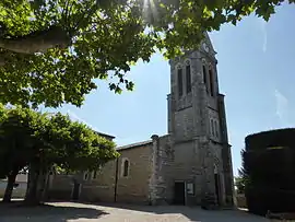 Church of Saint Denis | |
.svg.png.webp) Coat of arms | |
Location of Saint Denis les Bourg  | |
 Saint Denis les Bourg  Saint Denis les Bourg | |
| Coordinates: 46°12′09″N 5°11′24″E | |
| Country | France |
| Region | Auvergne-Rhône-Alpes |
| Department | Ain |
| Arrondissement | Bourg-en-Bresse |
| Canton | Bourg-en-Bresse-2 |
| Intercommunality | Bassin de Bourg-en-Bresse |
| Government | |
| • Mayor (2020–2026) | Guillaume Fauvet[1] |
| Area 1 | 12.58 km2 (4.86 sq mi) |
| Population | 5,943 |
| • Density | 470/km2 (1,200/sq mi) |
| Time zone | UTC+01:00 (CET) |
| • Summer (DST) | UTC+02:00 (CEST) |
| INSEE/Postal code | 01344 /01000 |
| Elevation | 209–242 m (686–794 ft) |
| 1 French Land Register data, which excludes lakes, ponds, glaciers > 1 km2 (0.386 sq mi or 247 acres) and river estuaries. | |
Geography
The Veyle forms the commune's western border.
Population
| Year | Pop. | ±% |
|---|---|---|
| 2004 | 4,910 | — |
| 2006 | 4,967 | +1.2% |
| 2007 | 5,101 | +2.7% |
| 2008 | 5,229 | +2.5% |
| 2009 | 5,357 | +2.4% |
| 2010 | 5,405 | +0.9% |
| 2011 | 5,492 | +1.6% |
| 2012 | 5,504 | +0.2% |
| 2013 | 5,505 | +0.0% |
| 2014 | 5,505 | +0.0% |
| 2015 | 5,530 | +0.5% |
| 2016 | 5,667 | +2.5% |
See also
References
- "Répertoire national des élus: les maires". data.gouv.fr, Plateforme ouverte des données publiques françaises (in French). 2 December 2020.
- "Populations légales 2019". The National Institute of Statistics and Economic Studies. 29 December 2021.
| Wikimedia Commons has media related to Saint-Denis-lès-Bourg. |
This article is issued from Wikipedia. The text is licensed under Creative Commons - Attribution - Sharealike. Additional terms may apply for the media files.