Wulverdinghe
Wulverdinghe is a commune in the Nord department in northern France.
Wulverdinghe | |
|---|---|
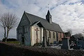 The church in Wulverdinghe | |
.svg.png.webp) Coat of arms | |
Location of Wulverdinghe  | |
 Wulverdinghe  Wulverdinghe | |
| Coordinates: 50°49′56″N 2°15′23″E | |
| Country | France |
| Region | Hauts-de-France |
| Department | Nord |
| Arrondissement | Dunkerque |
| Canton | Wormhout |
| Intercommunality | Hauts de Flandre |
| Government | |
| • Mayor (2020–2026) | Michel Kerfyser[1] |
| Area 1 | 2.92 km2 (1.13 sq mi) |
| Population | 317 |
| • Density | 110/km2 (280/sq mi) |
| Demonym(s) | Wulverdinghois |
| Time zone | UTC+01:00 (CET) |
| • Summer (DST) | UTC+02:00 (CEST) |
| INSEE/Postal code | 59664 /59143 |
| Elevation | 14–72 m (46–236 ft) (avg. 6 m or 20 ft) |
| 1 French Land Register data, which excludes lakes, ponds, glaciers > 1 km2 (0.386 sq mi or 247 acres) and river estuaries. | |
Population
| Year | Pop. | ±% |
|---|---|---|
| 2006 | 253 | — |
| 2007 | 259 | +2.4% |
| 2008 | 260 | +0.4% |
| 2009 | 271 | +4.2% |
| 2010 | 287 | +5.9% |
| 2011 | 303 | +5.6% |
| 2012 | 313 | +3.3% |
| 2013 | 323 | +3.2% |
| 2014 | 319 | −1.2% |
| 2015 | 314 | −1.6% |
| 2016 | 310 | −1.3% |
Heraldry
.svg.png.webp) Arms of Wulverdinghe |
The arms of Wulverdinghe are blazoned : Barry Or and azure, in chief in fess 3 annulets gules. (Wulverdinghe and Westrehem use the same arms.)
|
See also
References
- "Répertoire national des élus: les maires". data.gouv.fr, Plateforme ouverte des données publiques françaises (in French). 2 December 2020.
- "Populations légales 2019". The National Institute of Statistics and Economic Studies. 29 December 2021.
| Wikimedia Commons has media related to Wulverdinghe. |
This article is issued from Wikipedia. The text is licensed under Creative Commons - Attribution - Sharealike. Additional terms may apply for the media files.