Séron
Séron (French pronunciation: [seʁɔ̃]; Occitan: Seron) is a commune in the Hautes-Pyrénées department in south-western France.
Séron | |
|---|---|
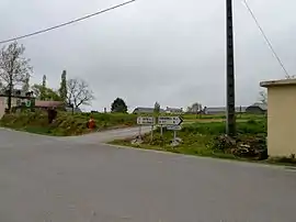 A general view of the village | |
.svg.png.webp) Coat of arms | |
Location of Séron  | |
 Séron  Séron | |
| Coordinates: 43°19′23″N 0°05′54″W | |
| Country | France |
| Region | Occitania |
| Department | Hautes-Pyrénées |
| Arrondissement | Tarbes |
| Canton | Ossun |
| Intercommunality | CA Tarbes-Lourdes-Pyrénées |
| Government | |
| • Mayor (2020–2026) | Chantal Paulien[1] |
| Area 1 | 9.29 km2 (3.59 sq mi) |
| Population | 332 |
| • Density | 36/km2 (93/sq mi) |
| Time zone | UTC+01:00 (CET) |
| • Summer (DST) | UTC+02:00 (CEST) |
| INSEE/Postal code | 65422 /65320 |
| Elevation | 290–386 m (951–1,266 ft) (avg. 370 m or 1,210 ft) |
| 1 French Land Register data, which excludes lakes, ponds, glaciers > 1 km2 (0.386 sq mi or 247 acres) and river estuaries. | |
Together with Escaunets and Villenave-près-Béarn, the commune forms an enclave of Hautes-Pyrénées within the department of Pyrénées-Atlantiques. A neighbouring second enclave comprises the communes of Gardères and Luquet.
References
- "Répertoire national des élus: les maires". data.gouv.fr, Plateforme ouverte des données publiques françaises (in French). 9 August 2021.
- "Populations légales 2019". The National Institute of Statistics and Economic Studies. 29 December 2021.
| Wikimedia Commons has media related to Séron. |
This article is issued from Wikipedia. The text is licensed under Creative Commons - Attribution - Sharealike. Additional terms may apply for the media files.