Rambucourt
Rambucourt (French pronunciation: [ʁɑ̃bykuʁ]) is a commune in the Meuse department in Grand Est in north-eastern France.
Rambucourt | |
|---|---|
 The church in Rambucourt | |
 Coat of arms | |
Location of Rambucourt 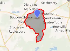 | |
 Rambucourt  Rambucourt | |
| Coordinates: 48°50′41″N 5°45′32″E | |
| Country | France |
| Region | Grand Est |
| Department | Meuse |
| Arrondissement | Commercy |
| Canton | Saint-Mihiel |
| Intercommunality | CC Côtes de Meuse Woëvre |
| Government | |
| • Mayor (2020–2026) | Bernard Carle[1] |
| Area 1 | 14.86 km2 (5.74 sq mi) |
| Population | 187 |
| • Density | 13/km2 (33/sq mi) |
| Time zone | UTC+01:00 (CET) |
| • Summer (DST) | UTC+02:00 (CEST) |
| INSEE/Postal code | 55412 /55300 |
| Elevation | 224–274 m (735–899 ft) (avg. 257 m or 843 ft) |
| 1 French Land Register data, which excludes lakes, ponds, glaciers > 1 km2 (0.386 sq mi or 247 acres) and river estuaries. | |
Geography
The Rupt de Mad forms part of the commune's north-western border.
References
- "Répertoire national des élus: les maires". data.gouv.fr, Plateforme ouverte des données publiques françaises (in French). 2 December 2020.
- "Populations légales 2019". The National Institute of Statistics and Economic Studies. 29 December 2021.
| Wikimedia Commons has media related to Rambucourt. |
This article is issued from Wikipedia. The text is licensed under Creative Commons - Attribution - Sharealike. Additional terms may apply for the media files.