Bislée
Bislée (French pronunciation: [bile]) is a commune in the Meuse department in Grand Est in northeastern France.
Bislée | |
|---|---|
_%C3%A9glise_(02).JPG.webp) The church in Bislée | |
.svg.png.webp) Coat of arms | |
Location of Bislée 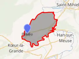 | |
 Bislée  Bislée | |
| Coordinates: 48°52′10″N 5°29′43″E | |
| Country | France |
| Region | Grand Est |
| Department | Meuse |
| Arrondissement | Commercy |
| Canton | Saint-Mihiel |
| Intercommunality | Sammiellois |
| Government | |
| • Mayor (2020–2026) | Aurore Pannetier[1] |
| Area 1 | 4.96 km2 (1.92 sq mi) |
| Population | 61 |
| • Density | 12/km2 (32/sq mi) |
| Time zone | UTC+01:00 (CET) |
| • Summer (DST) | UTC+02:00 (CEST) |
| INSEE/Postal code | 55054 /55300 |
| Elevation | 217–311 m (712–1,020 ft) (avg. 220 m or 720 ft) |
| 1 French Land Register data, which excludes lakes, ponds, glaciers > 1 km2 (0.386 sq mi or 247 acres) and river estuaries. | |
Population
| Year | Pop. | ±% |
|---|---|---|
| 1962 | 77 | — |
| 1968 | 83 | +7.8% |
| 1975 | 89 | +7.2% |
| 1982 | 77 | −13.5% |
| 1990 | 79 | +2.6% |
| 1999 | 68 | −13.9% |
| 2009 | 62 | −8.8% |
See also
References
- "Répertoire national des élus: les maires". data.gouv.fr, Plateforme ouverte des données publiques françaises (in French). 9 August 2021.
- "Populations légales 2019". The National Institute of Statistics and Economic Studies. 29 December 2021.
| Wikimedia Commons has media related to Bislée. |
This article is issued from Wikipedia. The text is licensed under Creative Commons - Attribution - Sharealike. Additional terms may apply for the media files.