Marcenod
Marcenod (French pronunciation: [maʁsəno]) is a commune in the Loire department in central France.
Marcenod | |
|---|---|
Location of Marcenod 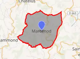 | |
 Marcenod  Marcenod | |
| Coordinates: 45°34′22″N 4°28′58″E | |
| Country | France |
| Region | Auvergne-Rhône-Alpes |
| Department | Loire |
| Arrondissement | Saint-Étienne |
| Canton | Sorbiers |
| Intercommunality | Saint-Étienne Métropole |
| Government | |
| • Mayor (2020–2026) | Gilles Thizy |
| Area 1 | 9 km2 (3 sq mi) |
| Population | 695 |
| • Density | 77/km2 (200/sq mi) |
| Time zone | UTC+01:00 (CET) |
| • Summer (DST) | UTC+02:00 (CEST) |
| INSEE/Postal code | 42133 /42140 |
| Elevation | 655–946 m (2,149–3,104 ft) (avg. 760 m or 2,490 ft) |
| 1 French Land Register data, which excludes lakes, ponds, glaciers > 1 km2 (0.386 sq mi or 247 acres) and river estuaries. | |
Population
| Year | Pop. | ±% |
|---|---|---|
| 1872 | 527 | — |
| 1881 | 486 | −7.8% |
| 1891 | 540 | +11.1% |
| 1901 | 546 | +1.1% |
| 1911 | 538 | −1.5% |
| 1921 | 531 | −1.3% |
| 1931 | 504 | −5.1% |
| 1946 | 447 | −11.3% |
| 1954 | 432 | −3.4% |
| 1962 | 443 | +2.5% |
| 1968 | 453 | +2.3% |
| 1975 | 440 | −2.9% |
| 1982 | 422 | −4.1% |
| 1990 | 410 | −2.8% |
| 1999 | 515 | +25.6% |
| 2009 | 638 | +23.9% |
| 2016 | 718 | +12.5% |
See also
References
- "Populations légales 2019". The National Institute of Statistics and Economic Studies. 29 December 2021.
| Wikimedia Commons has media related to Marcenod. |
This article is issued from Wikipedia. The text is licensed under Creative Commons - Attribution - Sharealike. Additional terms may apply for the media files.