Ludiès
Ludiès (French pronunciation: [lydjɛs]; Occitan: Ludièrs) is a commune in the Ariège department in southwestern France. Ludiès is a rural commune with 94 inhabitants in 2019, having experienced a sharp increase in population since 1975. It is part of the Pamiers attraction area. Its inhabitants are called Ludéens or Ludéennes.
Ludiès | |
|---|---|
.svg.png.webp) Coat of arms | |
Location of Ludiès 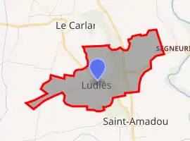 | |
 Ludiès  Ludiès | |
| Coordinates: 43°07′10″N 1°42′55″E | |
| Country | France |
| Region | Occitania |
| Department | Ariège |
| Arrondissement | Pamiers |
| Canton | Pamiers-2 |
| Government | |
| • Mayor (2020–2026) | Danielle Bouché[1] |
| Area 1 | 1.87 km2 (0.72 sq mi) |
| Population | 94 |
| • Density | 50/km2 (130/sq mi) |
| Time zone | UTC+01:00 (CET) |
| • Summer (DST) | UTC+02:00 (CEST) |
| INSEE/Postal code | 09175 /09100 |
| Elevation | 257–329 m (843–1,079 ft) (avg. 350 m or 1,150 ft) |
| 1 French Land Register data, which excludes lakes, ponds, glaciers > 1 km2 (0.386 sq mi or 247 acres) and river estuaries. | |
Geography
The town is located in the department of Ariegè, in the region of Occitania.[3]
It is located 19km away from Foix, prefecture of the department, and 8km away from Pamiers which is the subprefecture.
The village neighbours several places: Saint-Amadou 1.9km away, La Bastide-de-Lordat (2.8km), Le Carlaret (2.9km), Saint-Félix- de-Tournegat (3.1km), Les Pujols (3.4km), Lapenne (4.2km), Trémoulet (4.3km), Vals (4.5km).
Geology and relief
The town is located in the Aquitaine Basin, the second largest sedimentary basin in France after the Paris Basin, the entire territory being covered by superficial formations . The outcropping land on the municipal territory is made up of sedimentary rocks dating from the Cenozoic, the most recent geological era on the geological time scale, beginning 66 million years ago. The detailed structure of the outcropping layers is described in sheet "n°1057 - Pamiers" aboutthe harmonized geological map at approximately about 1/50,000th of the department of Ariège.[4][5]
The cadastral area of the town published by Insee, which serves as a reference in all statistics, is 1.87km.[6]
Population
| Year | Pop. | ±% |
|---|---|---|
| 1962 | 36 | — |
| 1968 | 46 | +27.8% |
| 1975 | 41 | −10.9% |
| 1982 | 33 | −19.5% |
| 1990 | 43 | +30.3% |
| 1999 | 49 | +14.0% |
| 2008 | 77 | +57.1% |
See also
References
- "Répertoire national des élus: les maires". data.gouv.fr, Plateforme ouverte des données publiques françaises (in French). 2 December 2020.
- "Populations légales 2019". The National Institute of Statistics and Economic Studies. 29 December 2021.
- "Métadonnées de la commune de Ludiès". Retrieved 21 August 2021..
- "Caractéristiques géologiques et hydrogéologiques de la commune de Ludiès". le Système d’information pour la gestion des eaux souterraines (SIGES) en Occitanie. Retrieved 22 April 2022.
- "Notice associée à la feuille n°1057 - Pamiers de la carte géologique harmonisée au 1/50 000ème de la France métropolitaine" (PDF). Infoterre, le site du BRGM. Retrieved 22 April 2022.
- Insee. "Comparateur de territoire - Commune de Ludiès". le site de l'Insee. Retrieved 22 April 2022.
- "Le réseau hydrographique du bassin Adour-Garonne" (pdf). draaf.occitanie.agriculture.gouv.fr. Retrieved 29 October 2021.
- "Fiche communale de Ludiès". le système d'information pour la gestion des eaux souterraines en Occitanie. Retrieved 29 October 2021.
{{cite web}}: External link in|website= - Template:Géoportail
| Wikimedia Commons has media related to Ludiès. |