Liginiac
Liginiac (French pronunciation: [liʒinjak]; Occitan: Liginhac) is a commune in the Corrèze department in central France.
Liginiac | |
|---|---|
 The church in Liginiac | |
.svg.png.webp) Coat of arms | |
Location of Liginiac 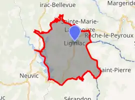 | |
 Liginiac  Liginiac | |
| Coordinates: 45°24′59″N 2°20′03″E | |
| Country | France |
| Region | Nouvelle-Aquitaine |
| Department | Corrèze |
| Arrondissement | Ussel |
| Canton | Haute-Dordogne |
| Intercommunality | Haute-Corrèze Communauté |
| Government | |
| • Mayor (2020–2026) | Frédéric Bivert |
| Area 1 | 28.53 km2 (11.02 sq mi) |
| Population | 644 |
| • Density | 23/km2 (58/sq mi) |
| Demonym(s) | Liginiacois, Liginiacoises |
| Time zone | UTC+01:00 (CET) |
| • Summer (DST) | UTC+02:00 (CEST) |
| INSEE/Postal code | 19113 /19160 |
| Elevation | 351–692 m (1,152–2,270 ft) |
| 1 French Land Register data, which excludes lakes, ponds, glaciers > 1 km2 (0.386 sq mi or 247 acres) and river estuaries. | |
Geography
The Triouzoune forms most of the commune's western boundary.
Population
| Year | Pop. | ±% |
|---|---|---|
| 2004 | 611 | — |
| 2006 | 607 | −0.7% |
| 2007 | 617 | +1.6% |
| 2008 | 629 | +1.9% |
| 2009 | 641 | +1.9% |
| 2010 | 641 | +0.0% |
| 2011 | 642 | +0.2% |
| 2012 | 618 | −3.7% |
| 2013 | 596 | −3.6% |
| 2014 | 574 | −3.7% |
| 2015 | 583 | +1.6% |
| 2016 | 583 | +0.0% |
| 2017 | 606 | +3.9% |
See also
References
- "Populations légales 2019". The National Institute of Statistics and Economic Studies. 29 December 2021.
 La Mairie
 L'Église
| Wikimedia Commons has media related to Liginiac. |
This article is issued from Wikipedia. The text is licensed under Creative Commons - Attribution - Sharealike. Additional terms may apply for the media files.