Jindo County
Jindo County (Jindo-gun) is a county in South Jeolla Province, South Korea. It consists of the island of Jindo and several smaller nearby islands. Jindo Bridge connects Jindo county with Haenam county.
Jindo
진도군 | |
|---|---|
| Korean transcription(s) | |
| • Hangul | 진도군 |
| • Hanja | 珍島郡 |
| • Revised Romanization | Jindo-gun |
| • McCune-Reischauer | Chindo-gun |
 Flag Emblem of Jindo | |
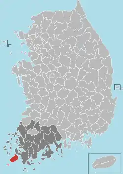 Location in South Korea | |
| Country | South Korea |
| Region | Honam |
| Administrative divisions | 1 eup, 6 myeon |
| Area | |
| • Total | 420.32 km2 (162.29 sq mi) |
| Population (2015[1]) | |
| • Total | 29,538 |
| • Density | 70/km2 (200/sq mi) |
| • Dialect | Jeolla |
Together with Jindo Island, Jindo County contains an archipelago of about 230 small islands, of which only 45 are inhabited by 4,855 people. Women made up 50.4% of the total county population of 29,538 in 2015.[1] Most of the land is covered by forests (60%) and cultivated fields (30%).[2][3] The county tree is Malchilus thunbergii, the flower camellia and the bird the swan.[4] The local food specialties are wolfberry, which is used for liquor, tea and paste; cheongju red-colored rice wine, brown seaweed and black rice.[5]
References
- "Population, Households and Housing Units". KOSIS. 2015. Retrieved 2017-01-10.
- Present situation Archived 2012-03-12 at the Wayback Machine, Jindo County
- Greetings from Mayor, Jindo County
- Symbols, Jindo County
- Chinese Matrimony Vines(Gugija), Jindo County

This article is issued from Wikipedia. The text is licensed under Creative Commons - Attribution - Sharealike. Additional terms may apply for the media files.