Duranus
Duranus (French pronunciation: [dyʁanys]; Occitan: Duranús) is a commune in the Alpes-Maritimes department in southeastern France.
Duranus | |
|---|---|
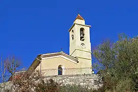 The church of Duranus | |
 Coat of arms | |
Location of Duranus  | |
 Duranus  Duranus | |
| Coordinates: 43°53′39″N 7°15′35″E | |
| Country | France |
| Region | Provence-Alpes-Côte d'Azur |
| Department | Alpes-Maritimes |
| Arrondissement | Nice |
| Canton | Tourrette-Levens |
| Intercommunality | Métropole Nice Côte d'Azur |
| Government | |
| • Mayor (2020–2026) | Jean-Michel Maurel[1] |
| Area 1 | 16.10 km2 (6.22 sq mi) |
| Population | 150 |
| • Density | 9.3/km2 (24/sq mi) |
| Time zone | UTC+01:00 (CET) |
| • Summer (DST) | UTC+02:00 (CEST) |
| INSEE/Postal code | 06055 /06670 |
| Elevation | 194–1,500 m (636–4,921 ft) |
| 1 French Land Register data, which excludes lakes, ponds, glaciers > 1 km2 (0.386 sq mi or 247 acres) and river estuaries. | |
Population
| Year | Pop. | ±% |
|---|---|---|
| 1982 | 118 | — |
| 1990 | 142 | +20.3% |
| 1999 | 156 | +9.9% |
| 2008 | 170 | +9.0% |
Tourism
Duranus is one of sixteen villages grouped together by the Métropole Nice Côte d'Azur tourist department as the Route des Villages Perchés (Route of Perched Villages). The others are: Aspremont, Carros, Castagniers, Coaraze, Colomars, Èze, Falicon, La Gaude, Lantosque, Levens, La Roquette-sur-Var, Saint-Blaise, Saint-Jeannet, Tourrette-Levens and Utelle.[3]
References
- "Répertoire national des élus: les maires". data.gouv.fr, Plateforme ouverte des données publiques françaises (in French). 2 December 2020.
- "Populations légales 2019". The National Institute of Statistics and Economic Studies. 29 December 2021.
- "The route of perched villages" (PDF). Métropole Nice Côte d'Azur. 2013.
External links
| Wikimedia Commons has media related to Duranus. |
This article is issued from Wikipedia. The text is licensed under Creative Commons - Attribution - Sharealike. Additional terms may apply for the media files.