Campoussy
Campoussy is a commune located in the Pyrénées-Orientales department, in southern France.[3]
Campoussy | |
|---|---|
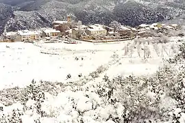 Campoussy in the snow | |
.svg.png.webp) Coat of arms | |
Location of Campoussy  | |
 Campoussy  Campoussy | |
| Coordinates: 42°42′40″N 2°27′33″E | |
| Country | France |
| Region | Occitania |
| Department | Pyrénées-Orientales |
| Arrondissement | Prades |
| Canton | La Vallée de l'Agly |
| Government | |
| • Mayor (2020–2026) | Alain Boyer[1] |
| Area 1 | 17.04 km2 (6.58 sq mi) |
| Population | 40 |
| • Density | 2.3/km2 (6.1/sq mi) |
| Time zone | UTC+01:00 (CET) |
| • Summer (DST) | UTC+02:00 (CEST) |
| INSEE/Postal code | 66035 /66730 |
| Elevation | 391–1,144 m (1,283–3,753 ft) |
| 1 French Land Register data, which excludes lakes, ponds, glaciers > 1 km2 (0.386 sq mi or 247 acres) and river estuaries. | |
Geography
Localisation
Campoussy is located in the canton of La Vallée de l'Agly and in the arrondissement of Prades.

Map of Campoussy and its surrounding communes
Places adjacent to Campoussy | ||||||||||||||||
|---|---|---|---|---|---|---|---|---|---|---|---|---|---|---|---|---|
| ||||||||||||||||
Population
| Year | Pop. | ±% p.a. |
|---|---|---|
| 1968 | 14 | — |
| 1975 | 24 | +8.00% |
| 1982 | 33 | +4.65% |
| 1990 | 40 | +2.43% |
| 1999 | 35 | −1.47% |
| 2007 | 41 | +2.00% |
| 2012 | 46 | +2.33% |
| 2017 | 37 | −4.26% |
| Source: INSEE[4] | ||
References
- "Répertoire national des élus: les maires". data.gouv.fr, Plateforme ouverte des données publiques françaises (in French). 2 December 2020.
- "Populations légales 2019". The National Institute of Statistics and Economic Studies. 29 December 2021.
- INSEE commune file
- Population en historique depuis 1968, INSEE
| Wikimedia Commons has media related to Campoussy. |
This article is issued from Wikipedia. The text is licensed under Creative Commons - Attribution - Sharealike. Additional terms may apply for the media files.