California County Routes in zone J
There are 45 routes assigned to the "J" zone of the California Route Marker Program, which designates county routes in California. The "J" zone includes county highways in Alameda, Calaveras, Contra Costa, Fresno, Kern, Inyo, Mariposa, Merced, Sacramento, San Benito, San Joaquin, Stanislaus, and Tulare counties.
J1
County Road J1 | |
|---|---|
| Location | Fresno – San Benito Counties |
| Length | 70.48 mi[1] (113.43 km) |
| Existed | 1958–present[1] |
County Route J1 is a county road in San Benito and Fresno counties. The route begins in Paicines, San Benito County, at State Route 25. Between Paicines and Panoche Valley, J1 is known as Panoche Road. Its north–south portion between Panoche Valley and Fresno County is called Little Panoche Road. In Fresno County, the route then intersects with Interstate 5 and terminates in Mendota at State Route 33 near State Route 180 in the Central Valley. East of Interstate 5, the alignment of J1 follows Fresno County's West Shields Avenue (which is Exit 379 off of Interstate 5). Shields Avenue ends at North Fairfax Avenue. J1 continues south 2 miles (3.2 km) on Fairfax Avenue to West Belmont Avenue, at which location J1 proceeds east on Belmont Avenue until its end at State Routes 33 and 180.
Panoche Road lies within the corridor of an unbuilt Route 180 segment. No current plan exists to extend Route 180 westward from Mendota past Interstate 5 and into San Benito County.[2]
Parts of J1 just west of I-5 are gravel rather than paved.[3]
 Paicines General Store.
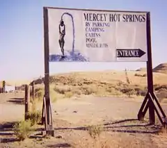 Mercey Hot Springs Resort sign.
- Major intersections
| County | Location | mi | km | Destinations | Notes |
|---|---|---|---|---|---|
| San Benito | Paicines | Western terminus | |||
| | Panoche Road – New Idria | CR J1 east transitions onto Little Panoche Road | |||
| Fresno | | Interchange; I-5 exit 379; CR J1 east transitions onto Shields Avenue | |||
| | Fairfax Avenue north – Firebaugh | CR J1 east transitions onto Fairfax Avenue south | |||
| | Fairfax Avenue south | CR J1 east transitions onto Belmont Avenue | |||
| Mendota | Eastern terminus; road continues as Belmont Avenue east to SR 180 | ||||
| 1.000 mi = 1.609 km; 1.000 km = 0.621 mi | |||||
J2
County Road J2 | |
|---|---|
| Location | Alameda – San Joaquin Counties |
| Length | 39.22 mi[1] (63.12 km) |
| Existed | 1960–present[1] |
County Route J2 or I-580 Alt. is a series of streets and roads in the California counties of Alameda and San Joaquin.
J2 begins at the Portola Avenue overcrossing of Interstate 580 in Livermore. The route follows Portola to Livermore Avenue, where J2 turns southward to pass through Livermore's downtown. The highway continues past the southeast edge of Livermore to become Tesla Road and rise into the Diablo Range, which separates the outer San Francisco Bay Area from the San Joaquin Valley.
At the Alameda-San Joaquin county line, J2 becomes Corral Hollow Road and enters the narrow valley of the same name. Upon approaching the San Joaquin Valley, the road turns northward, meeting Interstate 580 again and arriving at the southern subdivisions of Tracy. After passing through this city, the road intersects Interstate 205, shifts briefly onto Lammers Road, and soon turns northward onto Tracy Boulevard. Here J2 crosses the sea-level Union and Roberts Islands in the San Joaquin-Sacramento River Delta before terminating at State Route 4.
- Major intersections
| County | Location | mi | km | Destinations | Notes |
|---|---|---|---|---|---|
| Alameda | Livermore | Overpass over I-580; no access | Western terminus; former westbound exit and eastbound entrance interchange; road continues as Portola Road | ||
| North Livermore Avenue north, Portola Avenue east | CR J2 east transitions onto North Livermore Avenue south | ||||
| Railroad Avenue | CR J2 east transitions onto South Livermore Avenue south | ||||
| First Street | Former SR 84 | ||||
| | CR J2 east transitions onto Tesla Road | ||||
| | South Vasco Road | ||||
| | Cross Road | Juan Bautista de Anza National Historic Trail | |||
| Alameda–San Joaquin county line | | CR J2 east transitions onto Corral Hollow Road | |||
| San Joaquin | | Interchange; I-580 exit 72; cardinal direction change: east to north; south to west | |||
| Tracy | Eleventh Street (I-205 BL) | Former US 50 | |||
| Grant Line Road (CR J4) | |||||
| Underpass under I-205; no access | |||||
| | Lammers Road west | CR J2 north transitions onto Lammers Road | |||
| | CR J2 north transitions onto Tracy Boulevard north | ||||
| | Drawbridge over the Grant Line Canal | ||||
| | Northern terminus | ||||
1.000 mi = 1.609 km; 1.000 km = 0.621 mi
| |||||
J3
County Road J3 | |
|---|---|
| Location | San Joaquin – Stanislaus Counties |
| Length | 35.37 mi[1] (56.92 km) |
| Existed | 1960–present[1] |
County Route J3 is a county road in central California that runs 35 miles (56 km) north-south through Stanislaus and San Joaquin Counties.
The route begins 2 miles (3.2 km) east of Vernalis as Kasson Road, running northward from the road's intersection with State Route 132. After almost 3 miles (4.8 km) the route meets Airport Way and follows it northward 21 miles (34 km) past Manteca, Lathrop, and French Camp into Stockton. J3 then follows West Lane 10 miles (16 km) out from Stockton and becomes Hutchins Street for the route's last 1 mile (1.6 km). The route reaches its northern end at State Route 12 near Lodi.
The highway is also known as Stanislaus County Route J3 and San Joaquin County Route J3, though all but 1 mile (1.6 km) of the route is within San Joaquin County.
- Major intersections
| County | Location | mi | km | Destinations | Notes |
|---|---|---|---|---|---|
| Stanislaus | | Southern terminus; road continues as River Road | |||
| San Joaquin | | CR J3 north transitions onto Airport Way | |||
| Manteca | Interchange; SR 120 exit 3 | ||||
| Yosemite Avenue | Former SR 120 | ||||
| | Lathrop Road | ||||
| | Roth Road | ||||
| | |||||
| Stockton | Dr. Martin Luther King Jr. Boulevard (SR 4 Bus.) | Former US 50 / SR 4 / Charter Way | |||
| Underpass under SR 4; no access | |||||
| Harding Way | CR J3 north transitions onto West Lane | ||||
| March Lane | |||||
| Hammer Lane (CR J8) | |||||
| | Eight Mile Road | ||||
| Lodi | Harney Lane | CR J3 north transitions onto Hutchins Street | |||
| Northern terminus; road continues as Hutchins Street | |||||
| 1.000 mi = 1.609 km; 1.000 km = 0.621 mi | |||||
J4
County Road J4 | |
|---|---|
| Location | Alameda – Contra Costa – San Joaquin Counties |
| Length | 27.99 mi[1] (45.05 km) |
| Existed | 1960–present[1] |
County Route J4 is a county road in central California that runs 28 miles (45 km) nominally north–south across portions of San Joaquin County, Alameda County and Contra Costa County that are growing in population and suburbanization. The highway connects the suburbs of the far outer East Bay and the Sacramento River Delta with the northern San Joaquin Valley.
The route begins 9 miles (14 km) southeast of Tracy at County Route J3, passes through Tracy and Byron, and terminates at State Route 4 between Discovery Bay and Brentwood.
The portion between Tracy and Brentwood lies along the unconstructed corridor of State Route 239. SAFETEA-LU, federal legislation enacted in 2005, authorized $14 million in federal appropriations toward construction of the route.
- Major intersections
| County | Location | mi | km | Destinations | Notes |
|---|---|---|---|---|---|
| San Joaquin | | Southern terminus | |||
| | Durham Ferry Road | CR J4 north transitions onto Kasson Road | |||
| | Interchange; I-5 exit 457 | ||||
| | Roundabout; former US 50; CR J4 north transitions onto Grant Line Road | ||||
| Tracy | Tracy Boulevard (CR J13) | ||||
| Corral Hollow Road (CR J2) | |||||
| Interchange; I-205 exit 6 | |||||
| | Byron Road south | CR J4 north transitions onto Byron Road north | |||
| | Grant Line Road west | Roundabout | |||
| Mountain House | Mountain House Parkway | ||||
| San Joaquin–Alameda county line | | CR J4 north transitions onto Byron Bethany Road | |||
| Alameda–Contra Costa county line | | CR J4 north transitions onto Byron Highway | |||
| Contra Costa | | Northern terminus | |||
| 1.000 mi = 1.609 km; 1.000 km = 0.621 mi | |||||
J5
County Road J5 | |
|---|---|
| Location | San Joaquin County |
| Length | 30.45 mi[1] (49.00 km) |
| Existed | 1960–present[1] |
County Route J5 is a county road in San Joaquin County, California that runs for about 30 miles (49 km). It begins at State Route 99's interchange with Jack Tone Road in Ripon. Following Jack Tone Road, CR J5 passes through SR 120 east of Manteca and State Routes 4 and 26 east of Stockton. Eventually, it curves northwest where it is then co-routed with SR 88 at a right turn in Lockeford for a short distance before leaving SR 88 at a left turn at Elliot Road. It eventually leads to Peltier Road (CR J12), where CR J5 ends.
- Major intersections
The entire route is in San Joaquin County.
| Location | mi | km | Destinations | Notes | |
|---|---|---|---|---|---|
| Ripon | Interchange; SR 99 north exit 237B, south exit 237; southern terminus; road continues as South Jack Tone Road | ||||
| | |||||
| | |||||
| | |||||
| | |||||
| | Copperopolis Road | ||||
| | |||||
| | Eight Mile Road | ||||
| | Jack Tone Road | CR J5 north transitions onto Jack Tone Bypass | |||
| Lockeford | South end of SR 88 overlap | ||||
| North end of SR 88 overlap; CR J5 north transitions onto Elliot Road | |||||
| | Northern terminus; road continues as Elliot Road | ||||
1.000 mi = 1.609 km; 1.000 km = 0.621 mi
| |||||
J6
County Road J6 | |
|---|---|
| Location | San Joaquin – Stanislaus Counties |
| Length | 22.27 mi[1] (35.84 km) |
| Existed | 1960–present[1] |
County Road J6 is a county road in San Joaquin and Stanislaus Counties. Its northern terminus is at Route 26 at Bellota, 4 miles east of Linden. South of Highway 26, it carries the name Escalon-Bellota Road, and runs due south, crossing Route 4 at Farmington. The route continues due south to a junction with Route 120 at Escalon, where it continues due south as McHenry Avenue before ending at a junction with Route 108 near Del Rio.
- Major intersections
| County | Location | mi | km | Destinations | Notes |
|---|---|---|---|---|---|
| Stanislaus | | Southern terminus; no left turn onto SR 108 east | |||
| | |||||
| Stanislaus–San Joaquin county line | | Bridge over Stanislaus River | |||
| San Joaquin | | East River Road | |||
| Escalon | South end of CR J7 overlap; CR J6 north transitions onto Escalon Avenue | ||||
| | CR J6 north transitions onto Escalon-Bellota Road | ||||
| | North end of CR J7 overlap | ||||
| Farmington | |||||
| | Northern terminus | ||||
1.000 mi = 1.609 km; 1.000 km = 0.621 mi
| |||||
J7
County Road J7 | |
|---|---|
| Location | Merced – San Joaquin – Stanislaus Counties |
| Length | 58.91 mi[1] (94.81 km) |
| Existed | 1960–present[1] |
County Route J7 is a county road in Merced, Stanislaus and San Joaquin counties in California, United States. CR J7 mostly parallels State Route 99 to the east and generally follows the BNSF Railway between Merced and Stockton. It also connects several smaller communities including Atwater, Winton, Cressey, Ballico, Denair, Hughson, Empire, Riverbank, and Escalon.
Route description
The southern terminus for County Route J7 is at SR 59 in Merced, locally known as the Snelling Highway. The route is locally signed as Santa Fe Drive. From this point, it travels north for 12 mi through Merced County, passing by the former site of Castle Air Force Base in Atwater. Upon crossing the Merced River, the route continues in Stanislaus County as Santa Fe Avenue for another 20 mi until it reaches the community of Empire. In Empire, the route briefly co-signs with SR 132 (locally signed as Yosemite Boulevard) for just over 1 mi before turning onto Claus Road, where it skirts the eastern edge of Modesto. The route follows Claus Road for approximately 6.5 mi, passing the former site of the Riverbank Army Ammunition Plant as well as the Rainbow Fields sports park.
County Route J7 then follows SR 108 (locally signed as Atchison Street) westward in Riverbank for approximately 0.9 mi before turning onto First Street and continuing on a north-south trajectory. Once it crosses the Stanislaus River and enters San Joaquin County, the route is locally signed as Santa Fe Road. At this point, it continues its parallel path with the BNSF rail line. About 4.3 mi after entering San Joaquin County, the route then enters Escalon and becomes Main Street for 0.7 mi before reaching SR 120. CR J7 very briefly co-signs with SR 120 before intersecting with CR J6. The two county routes share the same roadway (locally signed as Escalon-Bellota Road) for 2.5 mi before CR J7 follows a curve onto Mariposa Road on a northwest-southeast trajectory.
At this point, CR J7 continues on Mariposa Road, a mostly rural road. While on Mariposa Road, CR J7 passes just north of the BNSF Stockton Intermodal Yard. The county route eventually meets its northern terminus with SR 99 in eastern Stockton.
- Major intersections
| County | Location | mi | km | Destinations | Notes |
|---|---|---|---|---|---|
| Merced | Merced | Southern terminus; serves UC Merced; road continues as West Olive Avenue | |||
| Winton | Winton Way | ||||
| | El Capitan Way – Delhi, Montpelier | ||||
| Merced–Stanislaus county line | | CR J7 north transitions onto Santa Fe Avenue | |||
| Stanislaus | | East Avenue (CR J17) – Turlock | |||
| Denair | Main Street – Turlock | ||||
| | Geer Road (CR J14) – Oakdale | ||||
| Hughson | Whitmore Avenue – Ceres | ||||
| | Hatch Road | ||||
| Empire | South end of SR 132 overlap; CR J7 north transitions onto Yosemite Boulevard | ||||
| Modesto | North end of SR 132 overlap; CR J7 north transitions onto Claus Road | ||||
| Briggsmore Avenue | |||||
| Riverbank | Claribel Road | ||||
| | South end of SR 108 overlap | ||||
| Riverbank | CR J7 north transitions onto Atchison Street | ||||
| North end of SR 108 overlap; CR J7 north transitions onto First Street | |||||
| Stanislaus–San Joaquin county line | | Bridge over the Stanislaus River CR J7 north transitions onto Santa Fe Road | |||
| San Joaquin | Escalon | CR J7 north transitions onto Main Street | |||
| South end of SR 120 overlap | |||||
| North end of SR 120 overlap; south end of CR J6 overlap; CR J7 north transitions onto Escalon Avenue | |||||
| | CR J7 north transitions onto Escalon-Bellota Road | ||||
| | North end of CR J6 overlap; CR J7 north transitions onto Mariposa Road | ||||
| | |||||
| Stockton | Interchange; SR 99 exit 252A; northern terminus | ||||
| Mariposa Road (SR 99 Bus. north / SR 4 Bus. west) | Continuation beyond SR 99; former US 99 north | ||||
1.000 mi = 1.609 km; 1.000 km = 0.621 mi
| |||||
J8
County Road J8 | |
|---|---|
| Location | Sacramento – San Joaquin Counties |
| Length | 43.81 mi[1] (70.51 km) |
| Existed | 1960–present[1] |
County Route J8 is a county road in California that mostly parallels Interstate 5 to the east and generally follows the Union Pacific Railroad between Stockton and Sacramento.
Route description
County Route J8 starts at the intersection of Hammer Lane and State Route 99 in Stockton. The route proceeds west on Hammer Lane to the intersection of Thornton Road, then turns northwest, following Thornton Road and North Thornton Road from Stockton to the Sacramento County line north of Thornton. North of Thornton, the route proceeds slightly away from I-5 until it parallels the Union Pacific Railroad and crosses the Cosumnes River into Sacramento County. From here the route is known as Franklin Boulevard and proceeds north to the town of Franklin. Northbound traffic must then turn east onto Bilby Road to cross the railroad, then turn north on Willard Parkway to rejoin Franklin Boulevard south of its junction with Elk Grove Boulevard (CR E12). Southbound traffic follows the original alignment of Franklin Boulevard to cross the railroad tracks. The route continues north through Elk Grove and parts of the city of Sacramento before its junction with SR 99 at Broadway in Sacramento.
- Major intersections
| County | Location | mi | km | Destinations | Notes |
|---|---|---|---|---|---|
| San Joaquin | | Interchange; SR 99 exit 258; southern terminus; road continues as Frontage Road | |||
| Stockton | West Lane (CR J3) | ||||
| Lower Sacramento Road (CR J10) | |||||
| Hammer Lane west, Thornton Road south | CR J8 north transitions onto Thornton Road north | ||||
| Eight Mile Road | |||||
| | |||||
| | |||||
| Thornton | |||||
| San Joaquin–Sacramento county line | | CR J8 north transitions onto Franklin Boulevard | |||
| Sacramento | | ||||
| Franklin | |||||
| Bilby Road | Through traffic must turn right onto Bilby Road and turn left onto Willard Parkway to continue north on CR J8 | ||||
| Elk Grove | Whitelock Parkway, Willard Parkway | Northbound traffic is defaulted onto Willard Parkway south | |||
| Laguna Boulevard | |||||
| Sacramento | Mack Road | ||||
| Florin Road | |||||
| | 47th Avenue | ||||
| Sacramento | Fruitridge Road | ||||
| Broadway west | Former US 99W north; CR J8 north transitions onto Broadway east | ||||
| Interchange; SR 99 north exit 298B; northern terminus; former US 99W south; road continues as Broadway east | |||||
| 1.000 mi = 1.609 km; 1.000 km = 0.621 mi | |||||
J9
County Road J9 | |
|---|---|
| Location | San Joaquin – Stanislaus Counties |
| Length | 44.05 mi[1] (70.89 km) |
| Existed | 1960–present[1] |
County Route J9 is the main route between the cities of Oakdale, Waterford, and Turlock. It is especially busy during the morning and evening rush hours. This route is primarily rural, only traveling through a few cities, all with fewer than 20,000 people.
Route description
This road begins at Interstate 5 near Stockton. It then continues east through French Camp and south Stockton to SR 99. From here, the route is primarily rural. It then travels through Valley Home southbound. Next it crosses the Stanislaus River into Oakdale, passes the old Hershey's plant, and continues over the Hetch Hetchy Aqueduct. It then turns sharply left and becomes the Oakdale-Waterford Highway, through Waterford. Exiting Waterford, it crosses the Tuolumne River into Hickman and stays rural through to its terminus at J17.
- Major intersections
| County | Location | mi | km | Destinations | Notes |
|---|---|---|---|---|---|
| Stanislaus | | East Avenue (CR J17) – Ballico, Turlock, Snelling | Southern terminus | ||
| | Monte Vista Avenue | ||||
| | Keyes Road | ||||
| | Whitmore Avenue – Hughson, Ceres | ||||
| | Bridge over the Tuolumne River | ||||
| Waterford | CR J9 north transitions onto F Street | ||||
| | CR J9 north transitions onto Oakdale-Waterford Highway | ||||
| | Claribel Road | ||||
| | Albers Road south (CR J14 south) / Patterson Road – Turlock, Patterson | South end of CR J14 overlap; CR J9 north transitions onto Albers Road north | |||
| Oakdale | CR J9 north transitions onto South Yosemite Avenue | ||||
| South end of SR 120 overlap; CR J9 north transitions onto North Yosemite Avenue | |||||
| | North end of CR J14 overlap | ||||
| | North end of SR 120 overlap; CR J9 north transitions onto Valley Home Road | ||||
| Valley Home | Valley Home Road north | CR J9 north transitions onto Lone Tree Road | |||
| San Joaquin | | ||||
| | CR J9 north transitions onto French Camp Road north | ||||
| | Austin Road | ||||
| | Interchange; SR 99 exit 246; former US 99 | ||||
| | Union Road | ||||
| | Airport Way (CR J3) | Serves Stockton Metropolitan Airport | |||
| French Camp | Ash Street | Lincoln Highway | |||
| | El Dorado Street | Former US 50 | |||
| Stockton | Arch Airport Road, Frank West Circle | ||||
| Interchange; I-5 exit 468; northern terminus; road continues as French Camp Road west | |||||
1.000 mi = 1.609 km; 1.000 km = 0.621 mi
| |||||
J10
County Road J10 | |
|---|---|
| Location | Sacramento – San Joaquin Counties |
| Length | 17.63 mi[1] (28.37 km) |
| Existed | 1960–present[1] |
County Route J10 is a county road in California that connects the northern section of Stockton in San Joaquin County with the city of Galt in Sacramento County. A majority of the route is locally signed as Lower Sacramento Road. The route also connects through the city of Lodi, as well as the historic community of Woodbridge.
Route description
The route begins at Hammer Lane (also known as County Route J8) at its southern terminus. It then travels approximately 7 mi until it reaches the southern border of Lodi. From there, it continues another 2 mi to Turner Road. Briefly, Lower Sacramento Road is co-routed with Turner Road for 0.2 mi before again following a north-south route. The route continues on Lower Sacramento Road for another 10 mi before crossing into Sacramento County. At this point, the route becomes locally signed as South Lincoln Way. The route from this point travels another 4 mi, mostly through the city of Galt, before reaching its northern terminus at SR 99.
- Major intersections
| County | Location | mi | km | Destinations | Notes |
|---|---|---|---|---|---|
| San Joaquin | Stockton | Hammer Lane (CR J8) | Southern terminus; road continues as Lower Sacramento Road to Pacific Avenue | ||
| Eight Mile Road | |||||
| | Armstrong Road | ||||
| Lodi | Harney Lane | ||||
| Lodi Avenue – Downtown Lodi | |||||
| Turner Road west, Woodhaven Lane | CR J10 north transitions onto Turner Road east | ||||
| Turner Road east | CR J10 north transitions onto Lower Sacramento Road | ||||
| Woodbridge | Woodbridge Road | ||||
| | Acampo Road – Acampo | ||||
| | |||||
| San Joaquin–Sacramento county line | | CR J10 north transitions onto Lincoln Way | |||
| Sacramento | Galt | To SR 99 / C Street | |||
| A Street | |||||
| Interchange; SR 99 exit 275A; northern terminus; road continues as Lincoln Way | |||||
| 1.000 mi = 1.609 km; 1.000 km = 0.621 mi | |||||
J11
County Road J11 | |
|---|---|
| Location | Sacramento – San Joaquin Counties |
| Length | 6.18 mi[1] (9.95 km) |
| Existed | 1960–present[1] |
County Route J11 is a county road that connects the towns of Walnut Grove and Thornton. It is known as River Road and Walnut Grove Thornton Road in Sacramento County and Walnut Grove Road in San Joaquin County.
Route description
CR J11 begins at the junction of State Route 160 at the Walnut Grove Bridge in the town of Walnut Grove. At the eastern end of the bridge, it meets River Road (CR E13). The route proceeds south on River Road briefly along the levee of the Sacramento River and Georgiana Slough before leaving the levee and turning east onto Walnut Grove Thornton Road. The route crosses into San Joaquin County as Walnut Grove Road at the Mokelumne River and proceeds eastward to cross Interstate 5 before it terminates at the junction of County Route J8 (Thornton Road) in the town of Thornton.
- Major intersections
| County | Location | mi | km | Destinations | Notes |
|---|---|---|---|---|---|
| Sacramento | Walnut Grove | Western terminus | |||
| Walnut Grove Bridge over the Sacramento River | |||||
| CR J11 east transitions onto River Road south; western terminus of CR E13 | |||||
| Isleton Road – Isleton, Rio Vista, Antioch | |||||
| Race Track Road | CR J11 east transitions onto Walnut Grove Thornton Road | ||||
| Sacramento–San Joaquin county line | | Bridge over the North Mokelumne River CR J11 east transitions onto Walnut Grove Road | |||
| San Joaquin | | Interchange; I-5 exit 493 | |||
| Thornton | Eastern terminus | ||||
| 1.000 mi = 1.609 km; 1.000 km = 0.621 mi | |||||
J12
County Road J12 | |
|---|---|
| Location | San Joaquin County |
| Length | 19.65 mi[1] (31.62 km) |
| Existed | 1960–present[1] |
County Route J12 is a county road in San Joaquin County, California. It connects Interstate 5 northwest of Lodi with State Route 88 northeast of Clements. Much of the route consists of Peltier Road, along with portions of Tully Road, Jahant Road, Mackville Road and Collier Road.
- Major intersections
The entire route is in San Joaquin County.
| Location | mi | km | Destinations | Notes | |
|---|---|---|---|---|---|
| | Interchange; I-5 exit 490; western terminus; road continues as Peltier Road west | ||||
| | |||||
| | Bridge over the Mokelumne River | ||||
| | |||||
| | Interchange; SR 99 exit 270; former US 99 | ||||
| | Northern terminus of CR J5 | ||||
| | CR J12 east transitions onto Tully Road | ||||
| | Tully Road north, Jahant Road west | CR J12 east transitions onto Jahant Road east | |||
| | Mackville Road south | CR J12 east transitions onto Mackville Road north | |||
| Dogtown | Mackville Road north, Collier Road west | CR J12 east transitions onto Collier Road east | |||
| | Eastern terminus | ||||
| 1.000 mi = 1.609 km; 1.000 km = 0.621 mi | |||||
J13
County Road J13 | |
|---|---|
| Location | San Joaquin County |
J14
County Road J14 | |
|---|---|
| Location | Calaveras – Stanislaus Counties |
| Length | 47.91 mi[1] (77.10 km) |
| Existed | 1973–present[1] |
County Route J14 (CR J14) is a county road in California, United States that runs through Stanislaus and Calaveras counties.
The route is known as Lander Avenue, Olive Avenue, Golden State Boulevard, Geer Road, Albers Road, Yosemite Avenue, Twenty Six Mile Road, Sonora Road, Milton Road and Jenny Lind Road.
- Major intersections
| County | Location | mi | km | Destinations | Notes |
|---|---|---|---|---|---|
| Stanislaus | Turlock | Continuation beyond SR 99; former CR J14 south | |||
| Interchange; SR 99 exit 211; southern terminus | |||||
| West Main Street (CR J17 west) – Patterson | South end of CR J17 overlap | ||||
| West Olive Avenue west | CR J14 north transitions onto West Olive Avenue | ||||
| North 1st Street | CR J14 north transitions onto East Olive Avenue | ||||
| North end of CR J17 overlap; former US 99 south; CR J14 north transitions onto North Golden State Boulevard north | |||||
| North Golden State Boulevard north | Former US 99 north; CR J14 north transitions onto Geer Road | ||||
| Canal Road | |||||
| Monte Vista Avenue (University Way) | |||||
| Christoffersen Parkway | |||||
| Taylor Road | |||||
| | Keyes Road | ||||
| | Santa Fe Avenue (CR J7) – Denair | ||||
| | Whitmore Avenue – Hickman, Hughson | ||||
| | Hatch Road | ||||
| | Bridge over the Tuolumne River | ||||
| | CR J14 north transitions onto Albers Road | ||||
| | Claribel Road | ||||
| | Oakdale Waterford Highway (CR J9 south) / Patterson Road – Riverbank | South end of CR J9 overlap | |||
| Oakdale | CR J14 north transitions onto South Yosemite Avenue | ||||
| South end of SR 120 overlap; CR J14 north transitions onto North Yosemite Avenue | |||||
| | North end of SR 120 / CR J9 overlap; CR J14 north transitions onto Twenty-Six Mile Road | ||||
| | CR J14 north transitions onto Sonora Road | ||||
| | Sonora Road east | CR J14 north transitions onto Milton Road | |||
| | |||||
| Calaveras | Jenny Lind | Milton Road north | CR J14 north transitions onto Jenny Lind Road | ||
| | Northern terminus | ||||
1.000 mi = 1.609 km; 1.000 km = 0.621 mi
| |||||
J15
County Road J15 | |
|---|---|
| Location | Tulare County |
| Length | 29.99 mi[1] (48.26 km) |
| Existed | 1974–present[1] |
County Route J15 is an unsigned route in Tulare County, California, starting at Avenue 96 and ending at State Route 201. It follows Road 152 for its entire length (17 miles or 27 kilometers) and intersects SR 190 at mile 6.
- Major intersections
The entire route is in Tulare County.
| Location | mi | km | Destinations | Notes | |
|---|---|---|---|---|---|
| | Avenue 96 (CR J24) – Pixley, Terra Bella | Southern terminus | |||
| | Avenue 120 | ||||
| | Roundabout | ||||
| | Avenue 152 (CR J26) – Porterville, Tipton | ||||
| | Avenue 168 (CR J46) – Woodville | ||||
| | Avenue 192 | ||||
| | South end of SR 137 overlap | ||||
| | North end of SR 137 overlap; CR J15 north transitions onto Road 140 north | ||||
| | Avenue 240 | ||||
| | Avenue 248 | ||||
| Visalia | CR J15 north transitions onto Lovers Lane | ||||
| Caldwill Avenue | |||||
| Walnut Avenue | |||||
| Interchange; SR 198 exit 108; south end of SR 216 overlap | |||||
| North end of SR 216 overlap; CR J15 north transitions onto Houston Avenue west | |||||
| Ben Maddox Way south, Houston Avenue west | CR J15 north transitions onto Ben Maddox Way north | ||||
| | CR J15 north transitions onto Road 132 | ||||
| | Avenue 328 (CR J34) – Ivanhoe, Woodlake | ||||
| | Avenue 368 (CR J36) | ||||
| | Northern terminus | ||||
1.000 mi = 1.609 km; 1.000 km = 0.621 mi
| |||||
J16
County Road J16 | |
|---|---|
| Location | Mariposa – Merced – Stanislaus Counties |
| Length | 75.74 mi[1] (121.89 km) |
| Existed | 1960–present[1] |
County Route J16 (CR J16) is a county highway running through Stanislaus, Merced, and Mariposa counties in California.
The route is known as Grayson Road, Keyes Road, Merced Falls Road, Hornitos Road, and Bear Valley Road.
J17
County Road J17 | |
|---|---|
| Location | Merced – Stanislaus Counties |
| Length | 39.20 mi[1] (63.09 km) |
| Existed | 1960–present[1] |
County Route J17 (CR J17) is a county highway that runs through Stanislaus and Merced counties in California.
The route is known as Sperry Avenue from Interstate 5 to Patterson, Las Palmas Avenue from Patterson to the San Joaquin River, West Main Street from the San Joaquin River to Turlock, East Avenue from Turlock to Oakdale Road, Oakdale Road from East Avenue to Turlock Road and Turlock Road from Oakdale Road to State Route 59.
J18
County Road J18 | |
|---|---|
| Location | Merced – Stanislaus Counties |
| Length | 26.54 mi[1] (42.71 km) |
| Existed | 1960–present[1] |
County Route J18 runs through Stanislaus and Merced counties in California. It follows Stuhr Road from Interstate 5 past Newman to Hills Ferry Road. It briefly follows Hills Ferry Road to the confluence of the Merced and San Joaquin rivers. It follows River Road along the Merced River. At State Route 165, J18 diverges from River Road. It is known as Westside Boulevard from State Route 165 to State Route 99.
Bellevue Avenue continues east of State Route 99 through Atwater.
J19
County Road J19 | |
|---|---|
| Location | Fresno – Tulare Counties |
| Length | 25.65 mi[1] (41.28 km) |
| Existed | 1964–present[1] |
J20
County Road J20 | |
|---|---|
| Location | Mariposa – Tuolumne Counties |
| Length | 14.72 mi[1] (23.69 km) |
| Existed | 1965–1997[1] |
County Route J20 is a county highway in Tuolumne County, California and Mariposa County, California, United States. It ran from its western terminus at State Route 49 east and north to State Route 120. It was the continuation of State Route 132 east of Coulterville. It was renumbered as County Route J132 in 1997 for continuity with the current State Route 132.
J21
County Road J21 | |
|---|---|
| Location | Tulare County |
| Length | 18.21 mi[1] (29.31 km) |
| Existed | 1968–present[1] |
County Route J21 (Dry Creek Drive) connects State Route 245 (Millwood Drive) near Badger with State Route 216 outside of Woodlake in Tulare County. Defined in 1968, it runs 18.21 miles (29.31 km) from an elevation of approximately 3,000 feet (914 m) near Badger[4] to approximately 400 feet (122 m) near Woodlake.[5]
J22
County Road J22 | |
|---|---|
| Location | Tulare County |
| Length | 31.87 mi[1] (51.29 km) |
| Existed | 1968–present[1] |
J23
County Road J23 | |
|---|---|
| Location | Tulare County |
| Length | 17.39 mi[1] (27.99 km) |
| Existed | 1974–present[1] |
J24
County Road J24 | |
|---|---|
| Location | Tulare County |
| Length | 13.00 mi[1] (20.92 km) |
| Existed | 1970–present[1] |
J25
County Road J25 | |
|---|---|
| Location | Tulare County |
| Length | 8.45 mi[1] (13.60 km) |
| Existed | 1971–present[1] |
J26
County Road J26 | |
|---|---|
| Location | Tulare County |
| Length | 15.85 mi[1] (25.51 km) |
| Existed | 1970–present[1] |
J27
County Road J27 | |
|---|---|
| Location | Tulare County |
| Length | 31.63 mi[1] (50.90 km) |
| Existed | 1975–present[1] |
J28
County Road J28 | |
|---|---|
| Location | Tulare County |
| Length | 18.46 mi[1] (29.71 km) |
| Existed | 1970–present[1] |
J29
County Road J29 | |
|---|---|
| Location | Tulare County |
| Length | 12.45 mi[1] (20.04 km) |
| Existed | 1971–present[1] |
J30
County Road J30 | |
|---|---|
| Location | Tulare County |
| Length | 14.36 mi[1] (23.11 km) |
| Existed | 1971–present[1] |
J31
County Road J31 | |
|---|---|
| Location | Tulare County |
| Length | 6.03 mi[1] (9.70 km) |
| Existed | 1975–present[1] |
J32
County Road J32 | |
|---|---|
| Location | Tulare County |
| Length | 7.98 mi[1] (12.84 km) |
| Existed | 1972–present[1] |
J33
County Road J33 | |
|---|---|
| Location | Tulare County |
| Length | 7.56 mi[1] (12.17 km) |
| Existed | 1975–present[1] |
J34
County Road J34 | |
|---|---|
| Location | Tulare County |
| Length | 12.9 mi[1] (20.8 km) |
| Existed | 1971–present[1] |
J35
County Road J35 | |
|---|---|
| Location | Tulare County |
| Length | 7.66 mi[1] (12.33 km) |
| Existed | 1975–present[1] |
J36
County Road J36 | |
|---|---|
| Location | Tulare County |
| Length | 2.94 mi[1] (4.73 km) |
| Existed | 1975–present[1] |
J37
County Road J37 | |
|---|---|
| Location | Tulare County |
| Length | 25.17 mi[1] (40.51 km) |
| Existed | 1975–present[1] |
J38
County Road J38 | |
|---|---|
| Location | Tulare County |
J42
County Road J42 | |
|---|---|
| Location | Tulare County |
J46
County Road J46 | |
|---|---|
| Location | Tulare County |
J59
County Road J59 | |
|---|---|
| Location | Merced – Stanislaus – Tuolumne Counties |
County Route J59 is a road in the California foothills of the Sierra Nevada. It is the continuation of State Route 59 north of Snelling and is entirely signed as La Grange Road.
- Major intersections
| County | Location | mi | km | Destinations | Notes |
|---|---|---|---|---|---|
| Merced | Snelling | Southern terminus | |||
| Stanislaus | | ||||
| Tuolumne | | Northern terminus | |||
| 1.000 mi = 1.609 km; 1.000 km = 0.621 mi | |||||
J132
County Road J132 | |
|---|---|
| Location | Mariposa – Tuolumne Counties |
| Existed | 1997–present[1] |
County Route J132 is a county highway in Tuolumne County, California and Mariposa County, California, United States. It runs from its western terminus at State Route 49 east and north to State Route 120. It is the continuation of State Route 132 east of Coulterville.
CR J132 was numbered J20 until 1997.
- Major intersections
| County | Location | mi | km | Destinations | Notes |
|---|---|---|---|---|---|
| Mariposa | Coulterville | Western terminus | |||
| | Greeley Hill Road | CR J132 east transitions onto Smith Station Road | |||
| Tuolumne | | Eastern terminus | |||
| 1.000 mi = 1.609 km; 1.000 km = 0.621 mi | |||||
See also
 California Roads portal
References
- "County Routes 'J'".
- "California Highways (www.cahighways.org): Routes 177 through 184". www.cahighways.org. Archived from the original on April 17, 2018. Retrieved April 27, 2018.
- "Google Maps". Google Maps. Retrieved April 27, 2018.
- "Badger California, Topo Maps Sequoia Camping Sierra". www.totalescape.com. Archived from the original on March 11, 2016. Retrieved April 27, 2018.
- "City of Woodlake – A city with true western hospitality". www.cityofwoodlake.com. Archived from the original on November 13, 2017. Retrieved April 27, 2018.
