Bukit Timah
Bukit Timah, often abbreviated as Bt Timah, is a planning area and residential estate located in the westernmost part of the Central Region of Singapore. Bukit Timah lies roughly 10 kilometres (6.2 mi) from the Central Business District, bordering the Central Water Catchment to the north, Bukit Panjang to the northwest, Queenstown to the south, Tanglin to the southeast, Clementi to the southwest, Novena to the east and Bukit Batok to the west.
Bukit Timah | |
|---|---|
| Other transcription(s) | |
| • Malay | Bukit Timah (Rumi) بوکيت تيمه (Jawi) |
| • Chinese | 武吉知马 (Simplified) 武吉知馬 (Traditional) Wǔjí Zhīmǎ (Pinyin) Bú-kit Ti-má (Hokkien POJ) |
| • Tamil | புக்கிட் திமா Pukkiṭ timā (Transliteration) |
 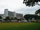 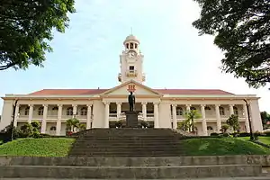  .jpg.webp) From top left to right: National Junior College, Ngee Ann Polytechnic, The Chinese High School Clock Tower Building, Aerial view of the Bukit Timah portion of Holland Village, former Bukit Timah railway station | |
 Location of Bukit Timah in Singapore | |
 Location in Central Region | |
| Coordinates: 1°19′45.88″N 103°48′7.48″E | |
| Country | |
| Region | Central Region
|
| CDCs | |
| Town councils |
|
| Constituencies | |
| Government | |
| • Mayors | Central Singapore CDC
North West CDC South West CDC |
| • Members of Parliament | Bishan-Toa Payoh GRC
Holland-Bukit Timah GRC Jurong GRC Tanjong Pagar GRC |
| Area | |
| • Total | 17.53 km2 (6.77 sq mi) |
| Population | |
| • Total | 77,430 |
| • Density | 4,400/km2 (11,000/sq mi) |
| Demonym(s) | Official
Colloquial
|
| Ethnic groups | |
| • Chinese | 64,150 |
| • Malays | 760 |
| • Indians | 3,650 |
| • Others | 5,910 |
| Postal districts | 10, 11, 21 |
| Dwelling units | 2,423 |
.svg.png.webp)

.svg.png.webp)
Owing to its prime location, Bukit Timah has some of the densest clusters of luxury condominiums and landed property in the city, with very few public housing.
Etymology
The first identification of the area was on the 1828 map by Frankin and Jackson and was noted as Bukit Timah.[4] As the interior of Singapore was not fully explored, it is likely the name came from the Malays.[4]
In Malay, Bukit Timah meant Tin bearing hill.[4] The original Malay name was Bukit Temak, meaning "hill of the temak trees" as the temak trees were abundant in the area.[4][5] It was possible that the British in Singapore had mispronounced or misheard and became Bukit Timah.[4]
History
During World War II, when the British lost Bukit Timah to the Japanese on 11 February 1942,[6] they knew they had little chance of continuing the defence of the island as most of their food and supplies were stored there. On 15 February 1942, the head of the Allied forces, Lieutenant General A.E. Percival surrendered to Lieutenant General Tomoyuki Yamashita at the Ford Factory in Bukit Timah.[6]

During Japanese rule, the Japanese built the Syonan Jinja, a Shinto shrine (Syonan-to was the Occupation name for Singapore), similar to the Yasukuni Shrine in Japan but of a smaller size, at Bukit Timah. Two war memorials dedicated to the Japanese war dead and, surprisingly, to the British and Empire troops who died defending Singapore, were built at the site. Students, Japanese commanders and British POWs' representatives would gather there regularly to commemorate the dead during the Occupation. Syonan Jinja was destroyed by the Japanese before the Japanese surrender.
After World War II, the farms and plantations in Bukit Timah gave way to industrial buildings and high-rise flats. In the 1960s and 1970s, Bukit Timah was a major industrial centre. Today, these have been replaced with luxury bungalows, terraces and condominiums, making Bukit Timah Singapore's premier residential district.[7]
Infrastructure
The Bukit Timah area is a particularly prominent location with high land value.
The Bukit Timah Race Course, a thoroughbred horse racing facility, was opened in 1933 and operated until 1999. The land has since been renovated, and is currently home to The Grandstand, which hosts several food outlets, childcare services and a Giant supermarket.[8]
The nearby area hosts many bungalows, typically expensive in land-scarce Singapore, as well as high rise condominiums. Many expatriates and well-heeled Singaporeans live in this region. Its main attractions include popular eateries at Sixth Avenue, as well as Turf City.
This region was later extended and Upper Bukit Timah (District 21) was formed.
Mass Rapid Transit
There are 6 MRT stations within the planning area, spanning 2 lines, the Downtown Line and Circle Line. Stage 2 of the Downtown MRT Line train service started on 27 December 2015 and parallels the Bukit Timah Road. It connects Bukit Panjang in the North-Western edge of Bukit Timah to the city centre in the South. Both lines have an interchange station at Botanic Gardens MRT station. The 6 stations are:
- DT5 Beauty World
- DT6 King Albert Park
- DT7 Sixth Avenue
- DT8 Tan Kah Kee
- CC20 Farrer Road
- CC21 Holland Village
Education
Bukit Timah is known to having many international schools in the region, due to the high number of expatriates and immigrants living in this region.
Primary schools
- Bukit Timah Primary School
- Henry Park Primary School
- Methodist Girls' School (Primary)
- Nanyang Primary School
- Pei Hwa Presbyterian Primary School
- Raffles Girls' Primary School
Secondary schools
Tertiary Institutions
Other schools
- Chatsworth International School
- DIMENSIONS International College (Bukit Timah Campus)
- German European School
- Hollandse School
- Hwa Chong International School
- St Francis Methodist School
- Singapore Korean International School
- Swiss School in Singapore
See also
- Bukit Timah Monkey Man – cryptid said to be living in the Bukit Timah forest
References
- City Population - statistics, maps and charts | Bukit Timah
- HDB Key Statistics FY 2014/2015 Archived 4 March 2016 at the Wayback Machine
- "Statistics Singapore - Geographic Distribution - 2018 Latest Data". Retrieved 11 February 2019.
- Savage, Victor R. (2013). Singapore street names : a study of toponymics. Brenda S. A. Yeoh. Singapore. pp. 129–130. ISBN 978-981-4484-74-9. OCLC 868957283.
- Loi, Rachel (9 September 2017). "Many Sides of Bukit Timah". The Business Times. Retrieved 21 June 2019.
- Japanese Invasion of Malaysia, accessed October 2009
- "Indonesian maid charged with socialite's murder". The Straits Times. Retrieved 27 December 2014.
- K.C. Vijayan (17 March 2014). "Court battle over handover of Turf City". AsiaOne. Archived from the original on 29 March 2017. Retrieved 29 March 2017.
Sources
- National Heritage Board (2002), Singapore's 100 Historic Places, Archipelago Press, ISBN 981-4068-23-3
External links
| Wikimedia Commons has media related to Bukit Timah. |