Zellenberg
Zellenberg is a communes in the Haut-Rhin department in Grand Est in north-eastern France.
Zellenberg | |
|---|---|
 An aerial view of Zellenberg | |
.svg.png.webp) Coat of arms | |
Location of Zellenberg 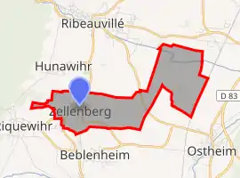 | |
 Zellenberg  Zellenberg | |
| Coordinates: 48°10′18″N 7°19′14″E | |
| Country | France |
| Region | Grand Est |
| Department | Haut-Rhin |
| Arrondissement | Colmar-Ribeauvillé |
| Canton | Sainte-Marie-aux-Mines |
| Intercommunality | Pays de Ribeauvillé |
| Government | |
| • Mayor (2020-2026) | Christian Keller |
| Area 1 | 4.96 km2 (1.92 sq mi) |
| Population | 320 |
| • Density | 65/km2 (170/sq mi) |
| Demonym(s) | Zellenbergeois, Zellenbergeoises |
| Time zone | UTC+01:00 (CET) |
| • Summer (DST) | UTC+02:00 (CEST) |
| INSEE/Postal code | 68383 /68340 |
| Elevation | 183–374 m (600–1,227 ft) |
| 1 French Land Register data, which excludes lakes, ponds, glaciers > 1 km2 (0.386 sq mi or 247 acres) and river estuaries. | |
Population
|
| ||||||||||||||||||||||||||||||||||||||||||||||||||||||||||||||||||||||||||||||||||||||||||||||||||||||||||||||||||||||||||||||||||||||||||||||||||||||
| Source: EHESS (1793-2006)[2] and INSEE[3][4] | |||||||||||||||||||||||||||||||||||||||||||||||||||||||||||||||||||||||||||||||||||||||||||||||||||||||||||||||||||||||||||||||||||||||||||||||||||||||

Company D, 83rd Chemical Bn, in Zellenberg. targeting Germans in nearby Mittelwihr with their 4.2 inch mortars, 9 December 1944.
See also
References
- "Populations légales 2019". The National Institute of Statistics and Economic Studies. 29 December 2021.
- Des villages de Cassini aux communes d'aujourd'hui: Commune data sheet Zellenberg, EHESS. (in French)
- Population en historique depuis 1968, INSEE
- Historique des populations légales
| Wikimedia Commons has media related to Zellenberg. |
This article is issued from Wikipedia. The text is licensed under Creative Commons - Attribution - Sharealike. Additional terms may apply for the media files.