Vihiga County
Vihiga County is an administrative region in the former Western Province of Kenya whose headquarters are in Mbale, the largest town in the county. The county has a population of 554,622[1] (2009 census) and an area of 563 km2.[2] Vihiga County was split from Kakamega County in 1990. In 2019's census, Vihiga was found to have a population of 590, 013, an increase of 35, 391 from the 2009's count.[3]
Vihiga County | |
|---|---|
 Coat of arms | |
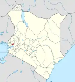 Location in Kenya | |
| Country | |
| Formed | 4 March 2013 |
| Capital | Mbale |
| Government | |
| • Governor | Wilberforce Ottichilo |
| Area | |
| • Total | 531.3 km2 (205.1 sq mi) |
| Population (2019) | |
| • Total | 590,013[1] |
| Time zone | UTC+3 (EAT) |
| Website | vihiga.go.ke |
Local authorities
| Authority | Type | Population* | Urban pop.* |
|---|---|---|---|
| Vihiga | Municipality | 98,189 | 19,067 |
| Luanda | Town | 68,157 | 8,757 |
| Vihiga county | County | 332,537 | 0 |
| * 1999 census. Source: | |||
Administrative divisions
| Division | Population* | Urban pop.* | Headquarters |
|---|---|---|---|
| Emuhaya | 69,250 | 0 | |
| Luanda | 92,462 | 8.016 | Luanda, Kenya |
| Sabatia | 117,863 | 10.135 | |
| Tiriki East | 59,943 | 0 | |
| Tiriki West | 76,370 | 0 | |
| Vihiga | 82,995 | 6.881 | Vihiga |
| * 1999 census. Sources: , , | |||
Constituencies
The district has five constituencies:
- Emuhaya Constituency
- Hamisi Constituency
- Sabatia Constituency
- Vihiga Constituency
- Luanda Constituency
Boyani
References
- https://www.scribd.com/doc/36672705/Kenya-Census-2009
- statoids.com – Districts of Kenya
- "2019 Kenya Population and Housing Census Volume I: Population by County and Sub-County". Kenya National Bureau of Statistics. Retrieved 7 December 2019.
External links
This article is issued from Wikipedia. The text is licensed under Creative Commons - Attribution - Sharealike. Additional terms may apply for the media files.