Victoria Bridge (Stockton-on-Tees)
The Victoria Jubilee Bridge is a road bridge carrying Bridge Road (A1130) east west across the River Tees between Stockton-on-Tees and Thornaby-on-Tees in the borough of Stockton-on-Tees in the north east of England. Commonly referred to as the Victoria Bridge, it is located just south east of Stockton town centre.
Victoria Jubilee Bridge | |
|---|---|
 Victoria Bridge over the river Tees | |
| Coordinates | 54°33′30″N 1°18′25″W |
| Carries | Bridge Road (A1130) |
| Crosses | River Tees |
| Locale | Borough of Stockton-on-Tees, England, United Kingdom |
| Official name | Victoria Jubilee Bridge |
| Heritage status | Grade II listed building (19 February 2010) |
| Preceded by | Surtees Rail Bridge |
| Followed by | Teesquay Millennium Bridge |
| Characteristics | |
| Design | Wrought iron arch |
| Material | Wrought and cast iron, stone and concrete |
| Total length | 341 feet (104 m) |
| Width | 60 feet (18 m) |
| Longest span | 110 feet (34 m) |
| No. of spans | 3 |
| Piers in water | 2 |
| History | |
| Designer | Harrison Haytor and Charles Neate |
| Constructed by | Whitaker Brothers of Leeds |
| Construction start | 1882 |
| Construction end | 1887 |
| Opened | 20 June 1887 |
| Location | |
 | |
Under an 1881 act of Parliament, the bridge was constructed (1882–1887) at a cost of £69,051 by Whitaker Brothers of Leeds,[1][2][3] financed by the local council, a tramway company, North East Railways and the water board,[3] and commemorates the 50th year of the reign of Queen Victoria.[3][4][5]
History
Before the existence of a bridge at this location communication was provided by Bishop's Ferry.[6] The first bridge was a five arch Stockton (stone) Bridge completed in 1771, designed by Joseph Robson of Sunderland.[1][3][4][7] This replaced Yarm Bridge as the lowest bridge point on the River Tees and was toll free by 1820.[8]
Design
The design is a wrought-iron arch bridge by Charles Neate and consulting engineer Harrison Haytor.[1][2][3] The foundations of the abutments and piers are five cylindrical columns, 40 feet (12 m) deep and 14 feet (4.3 m) in diameter.[1] The abutments are faced with granite and sandstone and are filled in with large stone rubble.[7] The bridge has three arches – the centre arch is 110 feet (34 m) wide and the side arches are 85 feet (26 m).[7] The arches each have eight wrought iron ribs[1][7] that vary in thickness from 3 feet (91 cm) at the centre to 4 feet (120 cm) at the bearings.[1] The deck is carried on buckled plates resting on secondary beams.[1] The road is 40 feet (12 m) wide and the pavement 10 feet (3 m) wide.[9] The balustrades are cast iron with an open design of interlocking circles, and on the parapets are ornamental cast-iron lampposts carrying modern lights while the spandrels are open cast-iron work with a design of diminishing interlocking circles.[2]
At either side of the bridge are land-based arches that are currently impassable on the upriver side. These were designed to allow horse-drawn barges to pass under the bridge.
Construction
Whitaker Brothers of Leeds began construction in 1882, and completed the bridge in 1887.[1][3]
Operation
The bridge was opened on 20 June 1887.[4][5][7][9] Shortly after the opening the tram system was extended over the bridge, and the bridge was to be used by trams until 1931.[3] The bridge at this point was the lowest bridge point until the opening of the Transporter Bridge in 1911[6] and the lowest permanent bridge point until the opening of the Newport Bridge in 1934. During the second World War a bomb passed through the roadway without exploding[7] and the bridge still bears shrapnel damage from the time.[10] The bridge used to carry the A66 and A67 until the Surtees Bridge was built in 1981. In 2010 the bridge was made a grade II listed building.[2]
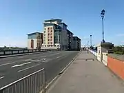 The view over the bridge roadway
 The view from the east bank
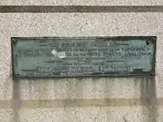 A commemorative plaque on the bridge.
References
- Rennison, Robert William (1996). Civil engineering heritage. ISBN 9780727725189. Retrieved 23 August 2009.
- "Victoria Bridge, Thornaby". British Listed Buildings. Retrieved 25 July 2010.
- "Victoria Bridge, Stockton-on-Tees". Bridges on the Tyne. 2007. Retrieved 23 August 2009.
- Kenyon, Chris. "A Trip up the Tees". Tees Rowing Club. Archived from the original on 12 April 2009. Retrieved 23 August 2009.
- "The Victoria Bridge at Stockton Teesside". marphotographics. Archived from the original on 21 September 2013. Retrieved 23 August 2009.
- Delplanque, Paul (31 August 2009). "Victoria Bridge Stockton...Then and now". Gazette Live. Teesside: Evening Gazette. Archived from the original on 3 October 2011. Retrieved 25 July 2010.
- "SINE Project, Structure Details for Victoria Bridge". Sine – Structural Images of the North East. University of Newcastle-upon-Tyne. Archived from the original on 13 June 2011. Retrieved 23 August 2009.
- Page, William (1928). Parishes: Stockton on Tees. A History of the County of Durham. Vol. 3. Archived from the original on 4 June 2011. Retrieved 25 July 2010.
- Proud, Keith (2 May 2007). "How Thornaby turned into a pottery town". The Northern Echo. NewsBank. Retrieved 3 August 2020.
- Ripley, Roy; Pears, Brian. "Incidents 16th August 1940 to 28th/29th August 1940". NE Diary 1939-45. Archived from the original on 23 September 2010. Retrieved 25 July 2010.
External links
- Webpages: Bridges on the Tyne, Structurae
- Google Books: Civil engineering heritage
- Photographs: Flickr
- Historic photographs: This is Stockton on Tees.
| |||||||||||||||||||||||||||||||||||