Trnavá Hora
Trnavá Hora is a village and municipality in Žiar nad Hronom District in the Banská Bystrica Region of central Slovakia.
Trnavá Hora | |
|---|---|
Village | |
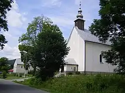 | |
 Trnavá Hora Location of Trnavá Hora in Slovakia | |
| Coordinates: 48°36′N 18°58′E | |
| Country | Slovakia |
| Region | Banská Bystrica |
| District | Žiar nad Hronom |
| Area | |
| • Total | 24.54[1] km2 (9.47[1] sq mi) |
| Elevation | 370[2] m (1,210[2] ft) |
| Population (2021) | |
| • Total | 1,243[3] |
| Population by ethnicity (2011) | |
| • Slovak | 89.4% |
| • Roma | 0.3% |
| • Czech | 0.2% |
| • Others | 0.2% |
| • Unreported | 9.9% |
| Population by religion (2011) | |
| • Roman Catholic | 72.1% |
| • Lutheran | 1.4% |
| • Congregationalist | 0.8% |
| • Mormon | 0.5% |
| • Others | 0.7% |
| • Non-religious | 10.5% |
| • Unreported | 14% |
| Postal code | 966 11[2] |
| Area code(s) | +421 45[2] |
| Car plate | ZH |
References
- "Hustota obyvateľstva - obce [om7014rr_ukaz: Rozloha (Štvorcový meter)]". www.statistics.sk (in Slovak). Statistical Office of the Slovak Republic. 2022-03-31. Retrieved 2022-03-31.
- "Základná charakteristika". www.statistics.sk (in Slovak). Statistical Office of the Slovak Republic. 2015-04-17. Retrieved 2022-03-31.
- "Počet obyvateľov podľa pohlavia - obce (ročne)". www.statistics.sk (in Slovak). Statistical Office of the Slovak Republic. 2022-03-31. Retrieved 2022-03-31.
- SODB - Trnavá Hora, 2011
- SODB - Trnavá Hora, 2011
This article is issued from Wikipedia. The text is licensed under Creative Commons - Attribution - Sharealike. Additional terms may apply for the media files.