Sandu Shui Autonomous County
Sandu Shui Autonomous County (Chinese: 三都水族自治县; pinyin: Sāndū Shuǐzú Zìzhìxiàn; Bouyei: Sanyduy Suijzuf Ziqziqxianq) is an autonomous county in the southeast of Guizhou province, China. It is under the administration of the Qiannan Buyei and Miao Autonomous Prefecture, and the only Shui Autonomous County in China; 63% of Shui in China live in this county, which is the heartland of the Shui people.[3] Sandu has a population of 400,000, 97% of whom belong to ethnic minorities and 67% of the total population are Shui.[4]
Sandu County
三都县 | |
|---|---|
| 三都水族自治县 Sandu Shui Autonomous County | |
 Shui ethnic houses | |
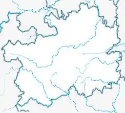 Sandu Location of the seat in Guizhou  Sandu Sandu (Southwest China) | |
| Coordinates (Sandu County government): 25°59′01″N 107°52′10″E | |
| Country | People's Republic of China |
| Province | Guizhou |
| Autonomous prefecture | Qiannan |
| Area | |
| • County | 2,384 km2 (920 sq mi) |
| Elevation | 675 m (2,215 ft) |
| Highest elevation [1] (Gengding Mountain) | 1,665.5 m (5,464.2 ft) |
| Lowest elevation [1] (Duliu River) | 303 m (994 ft) |
| Population (2019) | |
| • County | 400,000 |
| • Density | 170/km2 (430/sq mi) |
| • Urban | 177,882 |
| • Ethnic minorities | 367,100 |
| • Shui people | 261,300 |
| Time zone | UTC+8 (China Standard) |
| Postal code | 558100 |
| Area code(s) | 0854 |
| Website | www |
It is one of the poorest counties of Guizhou. Most of the county is forested and it is noted for its clean air.[4]
Administrative Divisions
Sandu governs 6 towns and 2 subdistricts:[5]
- Sanhe subdistrict
- Fengyu subdistrict
- Dahe town
- Pu'an town
- Dujiang town
- Zhonghe town
- Zhouqin town
- Jiuqian town
Geography
All of Sandu belongs to the watershed of the Liu River which flows into the Pearl River. The Duliu River has its source in Sandu and flows into the Liu River. The county is rather mountainous with Karst landscape resulting in large locale temperature and climate differences. Antimony is mined commercially in Sandu.[1]
Climate
| Climate data for Sandu (1981−2010) | |||||||||||||
|---|---|---|---|---|---|---|---|---|---|---|---|---|---|
| Month | Jan | Feb | Mar | Apr | May | Jun | Jul | Aug | Sep | Oct | Nov | Dec | Year |
| Record high °C (°F) | 25.8 (78.4) |
32.3 (90.1) |
35.6 (96.1) |
37.1 (98.8) |
36.4 (97.5) |
37.5 (99.5) |
39.2 (102.6) |
38.8 (101.8) |
38.4 (101.1) |
35.7 (96.3) |
32.0 (89.6) |
28.1 (82.6) |
39.2 (102.6) |
| Average high °C (°F) | 12.0 (53.6) |
14.4 (57.9) |
18.6 (65.5) |
24.2 (75.6) |
27.9 (82.2) |
30.1 (86.2) |
32.1 (89.8) |
32.7 (90.9) |
30.0 (86.0) |
24.7 (76.5) |
20.3 (68.5) |
15.2 (59.4) |
23.5 (74.3) |
| Daily mean °C (°F) | 7.8 (46.0) |
10.0 (50.0) |
13.7 (56.7) |
18.9 (66.0) |
22.5 (72.5) |
25.1 (77.2) |
26.6 (79.9) |
26.3 (79.3) |
23.6 (74.5) |
19.1 (66.4) |
14.6 (58.3) |
9.7 (49.5) |
18.2 (64.7) |
| Average low °C (°F) | 5.1 (41.2) |
7.2 (45.0) |
10.5 (50.9) |
15.3 (59.5) |
18.8 (65.8) |
21.7 (71.1) |
23.2 (73.8) |
22.6 (72.7) |
19.8 (67.6) |
15.9 (60.6) |
11.3 (52.3) |
6.5 (43.7) |
14.8 (58.7) |
| Record low °C (°F) | −2.9 (26.8) |
−1.9 (28.6) |
−0.5 (31.1) |
5.7 (42.3) |
7.2 (45.0) |
12.5 (54.5) |
15.4 (59.7) |
17.1 (62.8) |
11.9 (53.4) |
6.4 (43.5) |
0.3 (32.5) |
−3.5 (25.7) |
−3.5 (25.7) |
| Average precipitation mm (inches) | 31.6 (1.24) |
40.1 (1.58) |
59.5 (2.34) |
111.6 (4.39) |
205.0 (8.07) |
266.9 (10.51) |
210.9 (8.30) |
156.0 (6.14) |
88.8 (3.50) |
78.6 (3.09) |
51.5 (2.03) |
25.6 (1.01) |
1,326.1 (52.21) |
| Average relative humidity (%) | 78 | 77 | 77 | 79 | 80 | 83 | 82 | 82 | 80 | 81 | 80 | 77 | 80 |
| Source: China Meteorological Data Service Center | |||||||||||||
Transport
Sandu is served by the Guiyang–Guangzhou high-speed railway, with a travel time of 50 minutes to Guiyang.[4] It is also connected by G76 Xiamen–Chengdu Expressway and several provincial expressways.
References
- https://www.neac.gov.cn/seac/ztzl/201207/1067878.shtml.
{{cite web}}: Missing or empty|title=(help) - http://www.sandu.gov.cn/zjsd/czjs/.
{{cite web}}: Missing or empty|title=(help) - "全国唯一的水族自治县——三都宣告脱贫-新华网". www.gz.xinhuanet.com. Retrieved 2021-02-24.
- "三都水族自治县人民政府门户网站-三都简介". www.sandu.gov.cn. Retrieved 2021-02-24.
- "2020年统计用区划代码". www.stats.gov.cn. Retrieved 2021-02-24.