Saint-Pierre-de-l'Isle
Saint-Pierre-de-l'Isle (French pronunciation: [sɛ̃ pjɛʁ də lil]) is a commune in the Charente-Maritime department in southwestern France.[2]
Saint-Pierre-de-l'Isle | |
|---|---|
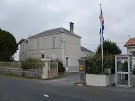 The town hall in Saint-Pierre-de-l'Isle | |
Location of Saint-Pierre-de-l'Isle  | |
 Saint-Pierre-de-l'Isle  Saint-Pierre-de-l'Isle | |
| Coordinates: 46°01′57″N 0°25′49″W | |
| Country | France |
| Region | Nouvelle-Aquitaine |
| Department | Charente-Maritime |
| Arrondissement | Saint-Jean-d'Angély |
| Canton | Matha |
| Government | |
| • Mayor (2020–2026) | Michel Lalaizon |
| Area 1 | 6.43 km2 (2.48 sq mi) |
| Population | 259 |
| • Density | 40/km2 (100/sq mi) |
| Time zone | UTC+01:00 (CET) |
| • Summer (DST) | UTC+02:00 (CEST) |
| INSEE/Postal code | 17384 /17330 |
| Elevation | 23–52 m (75–171 ft) (avg. 29 m or 95 ft) |
| 1 French Land Register data, which excludes lakes, ponds, glaciers > 1 km2 (0.386 sq mi or 247 acres) and river estuaries. | |
Population
| Year | Pop. | ±% |
|---|---|---|
| 1962 | 260 | — |
| 1968 | 350 | +34.6% |
| 1975 | 277 | −20.9% |
| 1982 | 311 | +12.3% |
| 1990 | 293 | −5.8% |
| 1999 | 262 | −10.6% |
| 2008 | 258 | −1.5% |
Geography
The commune is traversed by the river Boutonne.
References
| Wikimedia Commons has media related to Saint-Pierre-de-l'Isle. |
This article is issued from Wikipedia. The text is licensed under Creative Commons - Attribution - Sharealike. Additional terms may apply for the media files.