Boutonne
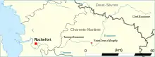
The Boutonne (French pronunciation: [butɔn]) is a 98.8 km (61.4 mi) long river in the Deux-Sèvres and Charente-Maritime departments in western France.[1] Its source is in the village of Chef-Boutonne (French: head of the Boutonne). It flows generally southwest. It is a right tributary of the Charente into which it flows near Cabariot.[1]
| Boutonne | |
|---|---|
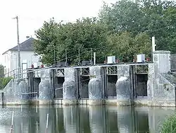 The Boutonne at Saint-Jean-d'Angély | |
 | |
| Location | |
| Country | France |
| Physical characteristics | |
| Source | |
| • location | Chef-Boutonne |
| • coordinates | 46°06′46″N 00°03′57″W |
| • elevation | 85 m (279 ft) |
| Mouth | |
• location | Charente |
• coordinates | 45°54′32″N 00°49′35″W |
• elevation | 4 m (13 ft) |
| Length | 98.8 km (61.4 mi) |
| Basin size | 1,320 km2 (510 sq mi) |
| Discharge | |
| • average | 13 m3/s (460 cu ft/s) |
| Basin features | |
| Progression | Charente→ Atlantic Ocean |
Departments and communes along its course
This list is ordered from source to mouth:
- Deux-Sèvres: Chef-Boutonne, Fontenille-Saint-Martin-d'Entraigues, Chérigné, Lusseray, Brioux-sur-Boutonne, Vernoux-sur-Boutonne, Séligné, Brieuil-sur-Chizé, Villefollet, Villiers-sur-Chizé, Chizé, Le Vert
- Charente-Maritime: Dampierre-sur-Boutonne, Saint-Séverin-sur-Boutonne, Coivert, Blanzay-sur-Boutonne, Saint-Georges-de-Longuepierre, Saint-Martial, Saint-Pierre-de-l'Isle, Nuaillé-sur-Boutonne, Saint-Pardoult, Les Églises-d'Argenteuil, Antezant-la-Chapelle, Vervant, Poursay-Garnaud, Courcelles, Saint-Julien-de-l'Escap, Saint-Jean-d'Angély, Ternant, La Vergne, Voissay, Torxé, Les Nouillers, Tonnay-Boutonne, Puy-du-Lac, Archingeay, Saint-Coutant-le-Grand, Champdolent, Lussant, Cabariot,
This article is issued from Wikipedia. The text is licensed under Creative Commons - Attribution - Sharealike. Additional terms may apply for the media files.