Riverway
Riverway, also referred to as "the Riverway," is a parkway in Boston, Massachusetts. The parkway is a link in the Emerald Necklace system of parks and parkways designed by Frederick Law Olmsted in the 1890s.[2] Starting at the Landmark Center end of the Back Bay Fens, the parkway follows the path of the Muddy River south to Olmsted Park across a stone bridge over Route 9 near Brookline Village. The road and its associated park form Boston's western border with neighboring Brookline and is popular with local nearby residents in both municipalities.
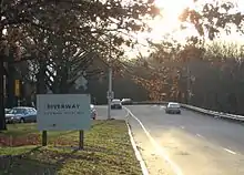 Northerly end of the Riverway near Park Drive. | |||
| Maintained by | Department of Conservation and Recreation | ||
|---|---|---|---|
| Length | 1.1 mi[1] (1.8 km) | ||
| Location | Emerald Necklace, Boston, Massachusetts | ||
| South end |
| ||
| North end | Park Drive in Fenway-Kenmore | ||
| Other | |||
| Designer | Frederick Law Olmsted | ||
Major intersections
The entire route is in Boston, Suffolk County.
| Location | mi[1] | km | Destinations | Notes | |
|---|---|---|---|---|---|
| Mission Hill | 0.0 | 0.0 | Grade-separated interchange; northern terminus of Jamaicaway | ||
| 0.4 | 0.64 | Brookline Avenue – Longwood | Left turn restrictions in both directions | ||
| Fenway–Kenmore | 1.0 | 1.6 | Fenway east | Western terminus of Fenway; one-way eastbound | |
| 1.1 | 1.8 | Park Drive | |||
| 1.000 mi = 1.609 km; 1.000 km = 0.621 mi | |||||
Notes
- Google (May 25, 2019). "Riverway" (Map). Google Maps. Google. Retrieved May 25, 2019.
- Bilis, Madeline (15 May 2018). "The History Behind Boston's Treasured Emerald Necklace".
External links
| Wikimedia Commons has media related to Riverway. |
 | ||

This article is issued from Wikipedia. The text is licensed under Creative Commons - Attribution - Sharealike. Additional terms may apply for the media files.