Quebec Route 195
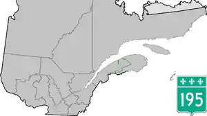
Route 195 is an 87 km two-lane north/south highway in Quebec, Canada, which starts in Matane at the junction of Route 132 and ends in Saint-Zénon-du-Lac-Humqui. The highway acts mainly as a shortcut between Matane and the southern section of Route 132 which leads to the Matapédia River Valley and the southern part of the Gaspé Peninsula.
 | ||||
|---|---|---|---|---|
 | ||||
| Route information | ||||
| Maintained by Transports Québec | ||||
| Length | 87.1 km[1] (54.1 mi) | |||
| Major junctions | ||||
| South end | Route-des-Étangs in Saint-Zénon-du-Lac-Humqui | |||
| North end | ||||
| Location | ||||
| Country | Canada | |||
| Province | Quebec | |||
| Major cities | Amqui, Matane | |||
| Highway system | ||||
| ||||
Municipalities along Route 195
See also
References
- Ministère des transports, "Distances routières", page 76-77, Les Publications du Québec, 2005
External links
- Interactive Provincial Route Map (Quebec Ministry of Transportation) (in French)
- Route 195 on Google Maps
This article is issued from Wikipedia. The text is licensed under Creative Commons - Attribution - Sharealike. Additional terms may apply for the media files.