Qatana District
Qatana District (Arabic: منطقة قطنا, romanized: minṭaqat Qaṭana) is a district of the Rif Dimashq Governorate in southern Syria.
Qatana District
منطقة قطنا | |
|---|---|
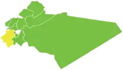 Map of Qatana District within Rif Dimashq Governorate | |
| Coordinates (Qatana): 33.43°N 36.08°E | |
| Country | |
| Governorate | Rif Dimashq |
| Seat | Qatana |
| Subdistricts | 3 nawāḥī |
| Area | |
| • Total | 995.48 km2 (384.36 sq mi) |
| Population (2004)[1] | |
| • Total | 207,245 |
| • Density | 210/km2 (540/sq mi) |
| Geocode | SY0308 |
The district is located just to the east of Mount Hermon. Administrative centre is the city of Qatana. At the 2004 census, the district had a population of 207,245.[1]
Sub-districts
The district of Qatana is divided into three sub-districts or nawāḥī (population as of 2004[1]):
| Code | Name | Area | Population |
|---|---|---|---|
| SY030800 | Qatana Subdistrict | 506.56 km² | 146,344 |
| SY030801 | Beit Jen Subdistrict | 159.84 km² | 15,668 |
| SY030802 | Sa'sa' Subdistrict | 329.08 km² | 45,233 |
Localities in Qatana District
According to the Central Bureau of Statistics (CBS), the following villages, towns and cities make up the district of Qatana:[1]
| English Name | Arabic Name | Population | Subdistrict |
|---|---|---|---|
| Jdeidat Artouz | جديدة عرطوز | 45,000 | Qatana |
| Qatana | قطنا | 33,996 | Qatana |
| Artouz | عرطوز | 16,199 | Qatana |
| Kanaker | كناكر | 13,950 | Sa'sa' |
| Khan al-Shih | خان الشيح | 12,148 | Qatana |
| al-Sabboura | الصبورة | 10,969 | Qatana |
| Sa'sa' | سعسع | 9,945 | Sa'sa' |
| Drousha | دروشه | 6,091 | Qatana |
| Mazraat Beit Jen | مزرعة بيت جن | 5,073 | Beit Jen |
| Yaafour | يعفور | 4,638 | Qatana |
| Beitima | بيتيما | 3,366 | Sa'sa' |
| Qalaat al-Jandal | قلعة الجندل | 3,251 | Qatana |
| Deir Maker | دير ماكر | 3,228 | Sa'sa' |
| Arnah | عرنة | 3,146 | Qatana |
| Beit Saber | بيت سابر | 3,021 | Sa'sa' |
| Kafr Hawr | كفر حور | 2,957 | Sa'sa' |
| Beit Jen | بيت جن | 2,846 | Beit Jen |
| Harfa | حرفا | 2,362 | Beit Jen |
| Beqaasem | بقعسم | 2,268 | Qatana |
| Manshiyat Khan al-Shih | منشية خان الشيح | 2,146 | Qatana |
| Darbal | دربل | 2,049 | Beit Jen |
| Hinah | حينة | 1,524 | Beit Jen |
| al-Nufour | النفور | 1,203 | Sa'sa' |
| Kawkab | كوكب | 1,188 | Qatana |
| Rima | ريمه | 1,132 | Qatana |
| al-Bejaa | البجاع | 1,058 | Qatana |
| Kafr Qouq | كفرقوق | 1,015 | Qatana |
| Denaji | دناجي | 933 | Sa'sa' |
| Ras al-Ayn | رأس العين | 892 | Qatana |
| al-Shawkatliyah | الشوكتلية | 775 | Sa'sa' |
| Dourin | دورين | 750 | Sa'sa' |
| Hamrit | حمريت | 737 | Sa'sa' |
| Maas | ماعص | 719 | Sa'sa' |
| al-Hubariyah | الهباريـة | 711 | Sa'sa' |
| Jisr al-Safra | جسر الصفراء | 704 | Sa'sa' |
| Ain al-Shaara | عين الشعره | 659 | Beit Jen |
| Abou Qawouq | أبو قاووق | 645 | Sa'sa' |
| Maghar al-Mir | مغرالمير | 588 | Beit Jen |
| al-Qleiaah | القليعة | 533 | Sa'sa' |
| Rasem al-Tahin | رسم الطحين | 455 | Sa'sa' |
| al-Maqrousa | المقروصه | 443 | Beit Jen |
| al-Aamrat | العمرات | 427 | Qatana |
| Ambiya | أمبيا | 412 | Qatana |
| Rakhlah | رخلة | 368 | Qatana |
| Hosh al-Nufour | حوش النفور | 363 | Sa'sa' |
| al-Adnaniyah | العدنانية | 238 | Sa'sa' |
| Kherbet al-Sawda | خربة السودا | 124 | Beit Jen |
References
- "2004 Census Data" (PDF) (in Arabic). Syrian Central Bureau of Statistics. Archived from the original (PDF) on 8 December 2015. Retrieved 15 October 2015.
Also available in English: "2004 Census Data". UN OCHA. Retrieved 15 October 2015.
|  | ||||||||||||||||||
|
| |||||||||||||||||||
| |||||||||||||||||||
| |||||||||||||||||||
| |||||||||||||||||||
| |||||||||||||||||||
| |||||||||||||||||||
| |||||||||||||||||||
| |||||||||||||||||||
This article is issued from Wikipedia. The text is licensed under Creative Commons - Attribution - Sharealike. Additional terms may apply for the media files.