North–South Expressway (Malaysia)
The North–South Expressway is a network of tolled controlled-access highways running through the west coast of Peninsular Malaysia. The expressway network consists of the northern route and southern route, having a total length of 772 kilometres (480 miles). Running through seven states and connecting the Thailand and Singapore borders, the North–South Expressway is an important thoroughfare for local, interstate and international traffic. The expressway is part of route AH2, a designation of the Asian Highway Network.[3]
  | |
|---|---|
| Lebuhraya Utara–Selatan | |
| North–South Expressway | |
 North–South Expressway (Malaysia) (Peninsular Malaysia) Route of the North–South Expressway | |
| Route information | |
| Part of | |
| Maintained by PLUS Expressways | |
| Length | 772 km (480 mi) |
| Existed | 1981[1]–present |
| History | Completed in 1994[2] |
| Component highways | |
| Major junctions | |
| North end | Bukit Kayu Hitam, Kedah |
| See individual expressway articles for details | |
| South end | Johor Bahru, Johor |
| Location | |
| Country | Malaysia |
| Major cities | Alor Setar, Seberang Perai, Ipoh, Greater Kuala Lumpur, Seremban, Johor Bahru |
| Highway system | |
The expressways were first conceived in 1977 due to increasing congestion on federal route 1, which was the main north–south thoroughfare at the time. However, economic uncertainties and the large cost meant that construction did not begin until 1981. The expressway began opening in stages from 1982, but the economic downturn at the time meant that construction had stalled and the work had to be fully privatised. The expressways were finally completed in 1994, with the tolls collected from the opened sections funding the remainder of the construction work.
Overview
The North–South Expressway is divided into 2 main routes – the northern route (route E1) and the southern route (route E2). Both routes run in parallel to the federal route 1 from Johor Bahru to Bukit Kayu Hitam. Each component expressway begins at the furthest end of the expressway from Kuala Lumpur. While the E2 terminates at the Selangor–Kuala Lumpur border, the E1 ends at Bukit Lanjan before proceeding to the city via the New Klang Valley Expressway, which is also gazetted as route E1. The E1 and E2 expressways are linked together via the North–South Expressway Central Link.[4][5]
While most of the expressway was construction according to JKR R6 design standards being defined in the Arahan Teknik 8/86: A Guide on Geometric Design of Roads (controlled-access expressway with design speed limit of 120 km/h and lane width of 3.5 m), the Jitra–Bukit Kayu Hitam section does not adhere to the JKR R6 standards and was grandfathered as part of the E1 expressway, as the section was constructed before the Arahan Teknik 8/86 was published by the Malaysian Public Works Department in 1986.[6]
 |
 South section of North–South Expressway, facing towards Kuala Lumpur, near Ayer Keroh, Malacca |
 Signs in the expressway |
|
History
The North–South Expressway was constructed due to the congestion along the federal route 1 as a result of increasing traffic. In 1977, the government proposed to build a new north–south divided highway as an alternative to the federal route 1.[1] The proposal to build the new highway was mooted as a result of the severe congestion along the Federal Route 1.[6] Because of the large cost of the project, the highway was planned to be privatised and tolled, but none of the constructors being invited by the government were willing to do the job due to economic uncertainties at that time and the plan could not be materialised.[1][6] It was only after Mahathir Mohamad became the Prime Minister that the North–South Expressway project was revived. The project was launched in 1981.[1]
The Malaysian Highway Authority was established on 24 October 1980 to supervise and execute the design, construction, regulation, operation and maintenance of inter-urban highways, to impose and collect tolls, to enter into contracts and to provide for matters connected therewith.[7] At that time, all construction works of the expressway between 1982 and 1988 was solely administered by Malaysian Highway Authority before being transferred to Projek Lebuhraya Utara-Selatan Berhad on 13 May 1988.
The construction of the expressway was done in stages. As the construction works continued, segments of the highway were opened to traffic as they were finished to help fund the construction works. The Jitra–Bukit Kayu Hitam section was constructed as an upgrade of the existing Federal Route 1 section into a divided highway with partial access control and at-grade intersections.[6] At that time, the construction of the Kuala Lumpur–Seremban Expressway was ongoing, and therefore the expressway would later form the pioneer route for the southern route. The Kuala Lumpur–Seremban Expressway, which was opened on 16 June 1982, was the first completed section of the North–South Expressway project and became the first expressway to implement the ticket system (closed toll system),[8] then followed by the Jitra–Bukit Kayu Hitam section in 1985.[6] Unlike the other sections of the North–South Expressway, the Jitra–Bukit Kayu Hitam section did not comply with the expressway standards defined by the Arahan Teknik 8/86: A Guide on Geometric Design of Roads which was only published by the Malaysian Public Works Department (JKR) later in 1986, resulting the section to be grandfathered as a part of the North–South Expressway E1.[6]
The third section being opened to motorists was the Seberang Jaya–Perai section. The section was constructed as a part of the Penang Bridge project; hence, the section forms the pioneer route for the Penang section of the North–South Expressway.[6] The Seberang Jaya–Perai section, together with the Penang Bridge, was opened on 14 September 1985.[9]
Meanwhile, the 27.3-km Skudai Highway was constructed in Johor Bahru as another upgrade of route 1 in the south. The toll road had two toll plazas at the Senai and at the Johor Causeway.[6] It was constructed by the Malaysian Public Works Department (JKR) before being handed over to Malaysian Highway Authority (LLM) in November 1985.[10] The extensive urbanisation of Johor Bahru however had rendered the Skudai Highway FT1 to be unsuitable to become a part of the North–South Expressway E2, as the Skudai Highway FT1 is not a controlled-access highway. Nevertheless, the toll road and the North–South Expressway were acquired by Projek Lebuhraya Utara-Selatan Berhad.[6] However, various parties especially residents of Senai and political parties urged that the toll collection be abolished due to the lack of toll-free alternative. As a result, the toll collection at Senai toll plaza was abolished on 1 March 2004.[11] After the toll collection at Senai was abolished, the highway had been maintained by the Malaysian Public Works Department.[12] The Johor Causeway toll plaza remained in operation until 2008,[6] when the former Johor Bahru CIQ Complex was closed and replaced by the Sultan Iskandar CIQ Complex, and the access to the new CIQ complex and the Johor–Singapore Causeway is provided by the Johor Bahru Eastern Dispersal Link Expressway.
The next completed sections were the Ipoh–Changkat Jering and Senawang–Ayer Keroh sections in 1987.[13][6] The Senawang–Ayer Keroh section was built as an extension of the Kuala Lumpur–Seremban Expressway. The toll collection of the Kuala Lumpur–Seremban Expressway was from Sungai Besi to Labu. As a result of the completion of the Senawang–Ayer Keroh section, the old Labu Toll Plaza was demolished and was replaced by three toll plaza interchanges at Exit 218 Seremban Interchange, Exit 219 Port Dickson Interchange and Exit 220 Senawang Interchange; the Senawang Interchange was constructed by rerouting the through traffic to Ayer Keroh and southwards.[6]
During the initial phases, the North–South Expressway project was criticized for its sluggish progress pace. As of 1986, only about 350 km (or two-thirds of the entire length) of the expressway was completed.[1] The work progress became worse due to the nationwide economic setback caused by the falling prices of commodities like rubber and tin.[6] As a result, the government had to revise its initial policy of having the Malaysian Highway Authority (LLM) to execute the entire construction job and decided to have the expressway project to be privatised, citing the success of the privatisation of the North Klang Straits Bypass in 1985 by Shapadu[1] A letter of intention was sent to United Engineers (Malaysia) Sdn. Bhd. (now UEM Group) on 29 December 1986 before being finalised in 1988.[14] The privatisation agreement had led to the formation of Highway Concessionaires Berhad which would later become Projek Lebuhraya Utara-Selatan Berhad (PLUS). PLUS took over the construction, operation and maintenance jobs of the North–South Expressway from LLM starting from March 1998, together with the Skudai Highway FT1.[15]
After the North–South Expressway project was privatised in 1988, the construction work progress continued at a faster pace. The first section completed by PLUS was the Ayer Keroh–Pagoh section on 5 April 1989.[16] Meanwhile, the 31-km New Klang Valley Expressway (NKVE) E1 was opened on 11 January 1993, connecting major cities in the Klang Valley with the North–South Expressway northern route.[17] The remaining sections were opened gradually until the entire expressway was fully completed in 1994.
The expressway was officially opened on 8 September 1994 by Malaysian prime minister at that time, Tun Dr. Mahathir bin Mohamad. After the North–South Expressway was completed in 1994, the expressway took the role of the Federal Route 1 as the main backbone route in Peninsular Malaysia.[2]
Monuments
The North–South Expressway Monument was erected at Rawang Rest and Service Area (R&R) (North bound) near Rawang, Selangor on 8 September 1994. A capsule was put in place that contains documents that have been cultivated by the fourth prime minister of Malaysia, Tun Dr Mahathir Mohammad in conjunction with the official opening of the North–South Expressway on 8 September 1994. The capsule will be released after the expiry of the concession of the North–South Expressway by PLUS Expressways on 31 Dec 2038.[18]
The monument is inscribed on Malay and English. The English version rewards:
"This monument symbolizes the pinnacle of successful for the construction of the North–South Expressway that connects Bukit Kayu Hitam bordering with Thailand in the North to Johor Bahru in the Causeway bordering with Singapore in the South. The construction of the 848km expressway, across the peat swamps and forests and hill untapped granite hills, is an amazing achievement. Also impressive is the pragmatic way in which the combined efforts between the public and private sectors has resulted in this achievement. The expressways is the result of joint efforts of the Malaysian Highway Authority, a statutory body, which has been planned early and begin construction, with the Projek Lebuhraya Utara-Selatan Berhad (PLUS) (North–South Expressway Project), a private company that was awarded concessions to finance, design, construct, operate and maintain the expressways. Such efforts shows an improvement visions into a reality after across a variety of challenges that threaten to stop. It acknowledged the success of the Government and represents a national effort funded and operated successfully by Malaysians. This monument also commemorates the efforts of leaders of the Government, public services, businesses, financial institutions, consultants, engineers and consultants, as well as contractors and labours, which has played an important role in facing their challenges and bring this project to a level of success. Those who use this expressway will be expected not only to enjoy the various parties in the construction efforts, but also can even appreciate this expressway contribution towards national development."
Improvements
Six-lane widening works
Plans to upgrade the stretches from Slim River to Tanjung Malim, Tanjung Malim to Rawang (Northern route), Seremban to Senawang, and Senawang to Ayer Keroh (Southern route) was approved by the government for better traffic flow. It was completed in 2007.
Kuala Lumpur–Penang through traffic (Ipoh North (Jelapang)–Ipoh South)
The Jelapang and Ipoh South toll plazas were demolished in 2009 to make a non-stop route across Ipoh. This is achieved through the construction of two local-express lanes for each side, which are only accessible via Exit 138 Ipoh South Exit (for northbound traffic) and Exit 141 Ipoh North Exit (for southbound traffic). The toll plazas in Ipoh are therefore relocated at each ends of the local-express lanes.
The decision to demolish both toll plazas was made as a result of accidents which happened at Jelapang toll plaza. Since the toll plaza was opened on 28 September 1987, there were many accident cases which involved brake failure in heavy vehicles due to hard braking when proceeding downhill to the toll plaza. On 7 June 2008, the new Ipoh North toll plaza (South bound) replacing old Jelapang toll plaza opened to traffic, followed by north bound on 15 August 2008. Beginning 11:00 am on 14 July 2009, the Kuala Lumpur–Penang through traffic is now opened to traffic. With the opening of the 14.7-kilometre (9.1 mi) between Ipoh North (Jelapang) and Ipoh South stretch, highway users are no longer required to stop for toll transactions at the Ipoh North and Ipoh South Toll Plazas.
Fourth lane additions
In July 2010, the operator PLUS Expressways Berhad announced that the government has awarded contracts to build a fourth lane on certain stretches of the highway, namely from Shah Alam to Jalan Duta, from Shah Alam to Rawang and from Nilai (North) to Port Dickson. In October 2012, the upgrading works for this project began.
LED Light Upgrades
Plus Expressways Berhad changes older Sodium-vapor lamp lighting to a new LED lamp lighting when needed frequently. The North–South Expressway southern route from Sungai Besi Toll Plaza to Nilai Utara exit and most of North–South Expressway Central Link lighting was changed. In the North–South Expressway northern route, lighting was added to sharp turns and hazardous sections. (Gua Tempurung stretch and Kuala Kangsar–Jelapang stretch which are both highland roads with dangerous corners)
RFID Tag Addition
On 16th December 2021, the North-South Expressway completes its RFID Tag MyRFID network thus making all tolled roads on the west coast of Peninsular Malaysia have a MyRFID toll booth.
Carriageways
Generally the expressway consists of four lanes, two for each direction.
There are some exceptions to this; the following are stretches with six lanes or eight lanes (three or four each way)
Six-lane carriageways
| Highways | Stretches |
|---|---|
| North–South Expressway southern route | Sungai Besi to Ayer Keroh (except Nilai North to Port Dickson stretches) |
| New Klang Valley Expressway | Bukit Raja to Shah Alam |
| North–South Expressway northern route | Rawang to Slim River |
| North–South Expressway northern route | Sungai Dua to Juru located at Penang |
| North–South Expressway Central Link | Shah Alam to Nilai North |
| Second Link Expressway | Pulai to Ayer Rajah Expressway (Tuas, Singapore) |
| Penang Bridge | Prai to Gelugor |
Eight-lane carriageways
| Highways | Stretches |
|---|---|
| North–South Expressway southern route | Nilai North to Port Dickson |
| New Klang Valley Expressway | Shah Alam to Jalan Duta |
| North–South Expressway northern route | Bukit Lanjan to Rawang |
Speed limit
North–South Expressway is designed as a high-speed long distance expressway therefore the default speed limit on the expressway is 110 km/h (68 mph), but there are some exceptions in some places for several reasons, including:-
- 1 km before every toll plaza: 60 km/h (to help the traffic to slow down)
- Bukit Kayu Hitam–Jitra stretch: 90 km/h (expressway section with at-grade junctions) (Kedah)
- Sungai Dua–Juru: 90 km/h (due to heavy traffic at Penang Bridge) (Penang)
- Kuala Kangsar–Jelapang stretch: 80 km/h (highland stretch with dangerous corners) (Perak)
- Jelapang–Ipoh South stretch: 90 km/h for main carriageways; 70 km/h for toll-free local-express lanes (to control the traffic flow of the non-stop main carriageways and the toll-free local-express lanes) (Perak)
- Gua Tempurung stretch: 90 km/h (highland stretch) (Perak)
- Bukit Lanjan Interchange: 80 km/h (to control traffic flow of NKVE and the main link of northern route to avoid accidents) (Selangor)
- Bukit Lanjan–Jalan Duta stretch: 90 km/h (steep uphill/downhill stretch) (Kuala Lumpur)
- Sungai Besi–Bangi stretch: 90 km/h (due to high traffic capacity) (Kuala Lumpur-Selangor)
Notable accidents
- On 6 January 1996, a landslide at km 303.8 resulted in a lorry driver being killed. The old route section where the landslide occurred was abandoned and a new route constructed near Gopeng, Perak.[19]
- On 13 August 2007, 20 people were killed in a bus crash near Changkat Jering, Perak.
- On 27 March 2008, a Singaporean family of 4 were killed in an accident along North–South Expressway near Tangkak, Johor, leaving behind a 2-month-old baby.
- On 7 December 2008, 10 passengers were killed in a bus crash at km 146.8 between Tangkak and Pagoh, Johor.
- On 13 April 2009, six people were killed in double decker express bus crash at km 443 near Rawang, Selangor.
- On 26 December 2009, ten passengers were killed and two injured after a northbound double-decker express bus skidded and hit the road divider at km 272.8 about 8 km from the Ipoh South toll plaza near Ipoh, Perak.
- On 10 October 2010, twelve people were killed and more than 50 others injured in a highway crash involving two buses, three cars and a van at km 223, near the Simpang Ampat interchange, Malacca.
Measures taken to reduce accidents

Most heavy vehicles are only allowed to travel 80–90 km/h by law. Considering that two lanes are inadequate for smooth traffic flow, the expressway is being widened as a result of the increasing number of fatal accidents along this highway.
It has been recently decided that the two-lane 110 km/h highway will be upgraded to a three-lane 110 km/h highway to prevent accidents, however another lane was being added on the selected stretches to increase it to four lanes.
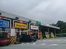
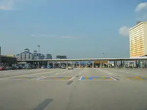
Toll system

The North–South Expressway is a toll expressway. Since 26 April 2017, all toll plazas are fully electronic with cash no longer being accepted. Payment is done by the Touch 'n Go electronic payment system through the use of Touch 'n Go cards, PLUSMiles Touch 'n Go cards, SmartTAG and Touch 'n Go RFID.
The North–South Expressway uses two toll systems:-
- Ticket system or closed system – Users enter the expressway via an entry toll plaza where the entry is recorded, and pay a distance-based toll at the exit toll plaza. Users must use the same Touch 'n Go card or the same type of electronic payment method to enter and exit the expressway. The majority of the North-South Expressway is covered under the closed system:
- Hutan Kampung (Kedah) to Sungai Dua, Butterworth (Penang) on the northern route;
- Juru (Penang) to Bukit Lanjan (Selangor) on the northern route, where the expressway and toll system continue onto the NKVE;
- Sungai Besi (Selangor) to Skudai (Johor) on the southern route.
- The section between Sungai Dua and Juru is toll-free due to heavy usage by local commuters to access Penang Bridge. The section between Jelapang (Ipoh North) and Ipoh South was previously toll-free as well with a break in the closed system, however, in 2009 the section was converted to a local-express lane system with through traffic on the express lane remaining within the closed system.
- In addition, the closed toll systems of the New Klang Valley Expressway and the North-South Expressway Central Link are integrated with the North-South Expressway closed system. Therefore, it is possible to travel between Juru and Skudai without leaving the toll system.
- Barrier system or open system – Users pay a fixed rate depending on vehicle type when passing through the toll plaza. There are two toll plazas using the open system:
Records
.jpg.webp)

- North–South Expressway is Malaysia's first long-distance expressway as well as Malaysia's longest expressway.
- Menora Tunnel, an 800 m (2,600 ft) tunnel on the North–South Expressway northern route near Jelapang, was once Malaysia's longest highway tunnel at the time of its construction.
- The largest toll plaza in Malaysia is Bandar Cassia-PLUS Toll Plaza (Gateway Arch Toll Plaza) in Penang Second Bridge E28 with over 28 lanes (excluding additional motorcycle toll plaza). The second largest toll plaza is Sungai Besi Toll Plaza in North–South Expressway southern route E2 with over 18 lanes (excluding additional toll booths).
- The longest bridge along the expressway is Sungai Perak Bridge (Jambatan Sultan Azlan Shah) with the length of 300 m (980 ft).
- The first rest and service area on the North–South Expressway is the Ayer Keroh Rest and Service Area in the North–South Expressway southern route opened in 1987.
- North–South Expressway is the first expressway in Malaysia that provides overhead bridge restaurants.
- The longest flyover bridge along the NSE network is Batu Tiga flyover in the North–South Expressway Central Link.
- The most expensive section of the expressway is the Gopeng–Tapah section. At RM200 million, it costed any average of RM 20 million per kilometre. Embankment strengthening is the major contributor for this escalating cost.
- The longest stretch of the North–South Expressway network is the Pagoh–Yong Peng (North) section. This 47-kilometre stretch passing Mount Maokil and the plains of Seri Medan and Sungai Sarang Buaya.
- The PLUS Speedway (formerly ELITE Speedway) in USJ Rest and Service Area on North–South Expressway Central Link is the first highway go-kart circuit in Malaysia.
- North–South Expressway forms 80% of Malaysian part of the Asian Highway Network, specifically Asian Highway Network 2
 AH2. The other expressways in Malaysia included in the route are Johor Bahru Eastern Dispersal Link Expressway and Johor Causeway.
 - The Nilai Memorial Park near Nilai Layby on North–South Expressway southern route is the first closed tolled expressway public memorial park in Malaysia.
- The PLUS Art Gallery in Ayer Keroh Overhead Bridge Restaurant (OBR) is the first highway art gallery in Malaysia.
- Kempas Highway (Johor State Route J3) is the only state route ever built by an expressway concessionaire company (PLUS Expressway Berhad).
- The Machap Rest and Service Area (northbound) at the North–South Expressway southern route is the first fully air-conditioned rest area in Malaysia, after it was renovated during mid-2008.
- The Sungai Perak Rest and Service Area (southbound) at the North–South Expressway northern route E1 in Perak is the first rest and service area in the Malaysian expressway to have an eco-management theme known as "The Green Trail" (Malay: "Jejak Hijau").
- PLUSMiles is the first and only toll rebate loyalty programme in the Malaysian expressways.
- The longest closed toll collection system coverage in Malaysia is from Juru toll plaza to Skudai toll plaza (previously Ipoh South toll plaza to Skudai toll plaza), which runs through the North–South Expressway northern route E1, New Klang Valley Expressway E1, North–South Expressway Central Link E6 and North–South Expressway southern route E2.
- The North–South Expressway northern route E1 is the only expressway in Malaysia to have a runaway truck ramp near Jelapang, Ipoh.
Junction list
| State | District | km | Exit | Name | Destinations | No. of lanes |
Speed limit |
Notes |
|---|---|---|---|---|---|---|---|---|
| Malaysia-Thailand border Through to | ||||||||
| Kedah | Kubang Pasu | 0.0 | Bukit Kayu Hitam Duty Free Complex | Four | 60 km/h | 3-way at-grade intersection Northern terminus of concurrency with | ||
| T/P | Bukit Kayu Hitam Toll Plaza Bukit Kayu Hitam Checkpoint |
Toll operation discontinued | ||||||
| EXIT 185 | Bukit Kayu Hitam I/S | Bukit Kayu Hitam town center | 90 km/h | 4-way intersection | ||||
| Padang Donan I/S | 3-way intersection | |||||||
| EXIT 183 | Changlun I/C | |||||||
| Titi Kerbau I/S | 3-way intersection | |||||||
| Changlun Town I/S | 4-way intersection | |||||||
| Asun I/S | 3-way intersection | |||||||
| EXIT 182B | Jitra North I/C | Southern terminus of concurrency with | ||||||
| EXIT 182B | Jitra North I/C | 110 km/h | ||||||
| BR | Sungai Ibor bridge | |||||||
| T/P | Jitra Toll Plaza | Touch 'n Go Touch 'n Go SmartTAG MyRFID SmartTAG Touch 'n Go Touch 'n Go | 60 km/h | Accepts contactless payments only (Touch 'n Go, MyRFID and SmartTAG) | ||||
| 30.5 | L/B | Kepala Batas L/B | 110 km/h | Northbound | ||||
| EXIT 181 | Jitra South I/C (Bandar Darul Aman I/C) |
|||||||
| Kota Setar | EXIT 180 | Kepala Batas I/C | ||||||
| 38.8 | L/B | Hutan Kampung L/B | Southbound | |||||
| T/P | Hutan Kampung Toll Plaza | Touch 'n Go SmartTAGMyRFID SmartTAG Touch 'n Go | 60 km/h | |||||
| EXIT 178 | Alor Setar North I/C | No Limit (110 Advisory) | ||||||
| BR | Sungai Kedah bridge | |||||||
| EXIT 177 | Alor Setar South I/C | |||||||
| Pendang | EXIT 175 | Pendang I/C | ||||||
| 65.0 | L/B | Bukit Ko'bah L/B | Southbound | |||||
| Kuala Muda | 80.6 | RSA | Gurun RSA | Southbound | ||||
| 81.1 | RSA | Gurun RSA | Northbound | |||||
| EXIT 173 | Gurun I/C | |||||||
| BR | Sungai Bongkok bridge | |||||||
| BR | Sungai Tok Pawang bridge | |||||||
| BR | Sungai Getah bridge | |||||||
| BR | Sungai Lalang bridge | |||||||
| EXIT 170 | Sungai Petani North I/C | |||||||
| BR | Sungai Petani bridge | |||||||
| EXIT 168 | Sungai Petani South I/C | |||||||
| 113.5 | L/B | Tikam Batu L/B | Southbound | |||||
| Penang | Seberang Perai Utara | BR | Sungai Muda bridge | Kedah - Penang | ||||
| 116.0 | L/B | Sungai Muda L/B | Northbound | |||||
| EXIT 166 | Bertam I/C | |||||||
| T/P | Sungai Dua Toll Plaza | Touch 'n Go SmartTAG MyRFID SmartTAG Touch 'n Go | 60 km/h | |||||
| EXIT 165 | Sungai Dua I/C | Six | 90 km/h | |||||
| Seberang Perai Tengah | BR | Sungai Perai bridge | ||||||
| BR | Sungai Sama Gagah bridge | |||||||
| EXIT 164 | Permatang Pauh I/C | |||||||
| EXIT 163 | Seberang Jaya I/C | |||||||
| BR | Sungai Kubang Semang bridge | |||||||
| EXIT 162 | Perai I/C | |||||||
| EXIT 161A | Penang Bridge I/C | |||||||
| EXIT 161B | Jalan Perusahaan I/C | |||||||
| 141.6 | L/B | Juru L/B | Northbound | |||||
| 141.8 | L/B | Juru L/B | Southbound | |||||
| EXIT 160 | Juru I/C | Jalan Kebun Nenas – Juru, Bukit Mertajam | Four | |||||
| T/P | Juru Toll Plaza | Touch 'n Go SmartTAG MyRFID SmartTAG Touch 'n Go | 60 km/h | |||||
| BR | Sungai Bukit Minyak bridge | No Limit (110 Advisory) | ||||||
| Seberang Perai Selatan | BR | Sungai Junjung bridge | ||||||
| EXIT 158 | Bukit Tambun I/C | |||||||
| 154.0 | EXIT 157 | Bandar Cassia-NSE I/C | ||||||
| 158.0 | L/B | Sungai Bakap L/B | Southbound | |||||
| 158.2 | L/B | Sungai Bakap L/B | Northbound | |||||
| BR | Sungai Bakap bridge | |||||||
| BR | Sungai Jawi bridge | |||||||
| EXIT 156 | Jawi I/C | |||||||
| Kedah | Bandar Baharu | EXIT 153 | Bandar Baharu I/C | |||||
| Perak | Kerian | BR | Sungai Kerian bridge | Perak - Penang border | ||||
| BR | Sungai Sama Gagah bridge | |||||||
| 179.6 | L/B | Alor Pongsu L/B | Southbound | |||||
| 179.9 | L/B | Alor Pongsu L/B | Northbound | |||||
| 181.0 | EXIT 151 | Alor Pongsu I/C | ||||||
| BR | Sungai Kurau bridge | |||||||
| EXIT 150 | Bukit Merah I/C | |||||||
| 194.6 | RSA | Gunung Semanggol RSA | Southbound | |||||
| 196.0 | RSA | Gunung Semanggol RSA | Northbound | |||||
| Larut, Matang dan Selama | BR | Sungai Sepetang bridge | ||||||
| EXIT 148 | Taiping North I/C | |||||||
| BR | Sungai Jebong Kanan bridge | |||||||
| 212.6 | L/B | Taiping L/B | Southbound | |||||
| 213.0 | L/B | Taiping L/B | Northbound | |||||
| BR | Sungai Larut bridge | |||||||
| EXIT 146 | Changkat Jering I/C | |||||||
| 224.8 | RSA | Bukit Gantang RSA | Southbound | |||||
| 226.0 | RSA | Bukit Gantang RSA | Northbound | |||||
| Kuala Kangsar | ||||||||
| BR | Sungai Dal bridge | |||||||
| 241.4 | EXIT 143 | Kuala Kangsar I/C | ||||||
| 249.0 | BR | Sungai Perak bridge Jambatan Sultan Azlan Shah |
Length: 360 m | |||||
| 249.3 | RSA | Sungai Perak RSA | Both bounds | |||||
| Runaway truck ramp | Five | 80 km/h | Northbound 3 lanes southbound | |||||
| Kinta | TN | Menora Tunnel | Four | Length: 800 m Maximum clearance: 4.75 m Both bounds | ||||
| 263.0 | V/P | Ipoh V/P | VMenora Vista Point - |
Five | Northbound 3 lanes northbound | |||
| 268.0 | Runaway truck ramp | Southbound 3 lanes northbound | ||||||
| EXIT 141 | Ipoh North collector-express system | Eight (4 collector, 4 express) |
90 km/h (70 km/h on collector lanes) |
Northern terminus of collector-express lane system | ||||
| T/P | Jelapang Toll Plaza | Access to interchanges only possible via collector lanes | ||||||
| EXIT 4(EXIT 141) | Meru Raya I/C (Jelapang I/C) |
East West | ||||||
| 268.7
271.0 |
EXIT 3(EXIT 140) | Ipoh North I/C | ||||||
| 273.0 | BR | Sungai Kinta bridge | ||||||
| 276.0 | EXIT 2(EXIT 139) | Ipoh South I/C | ||||||
| 276.2 | EXIT 1(EXIT 138) | Tambun I/C | ||||||
| T/P | Ipoh South Toll Plaza | |||||||
| EXIT 138 | Ipoh South collector-express system | Southern terminus of collector-express lane system | ||||||
| 286.9 | EXIT 137 | Simpang Pulai I/C | Four | 130 km/h | ||||
| BR | Sungai Raya bridge | |||||||
| 290.4 | L/B RSA |
Simpang Pulai L/B Gopeng Rural Transformation Centre (RTC) RSA |
Northbound | |||||
| 290.4 | L/B | Simpang Pulai L/B | Southbound | |||||
| Kampar | EXIT 135 | Gopeng I/C | ||||||
| BR | Sungai Kampar bridge | Five | 90 km/h | 3 lanes southbound | ||||
| 301.4 | L/B | Gua Tempurung L/B | Southbound | |||||
| BR | Gua Tempurung viaduct | Six | ||||||
| BR | Gua Tempurung viaduct | No Limit (110 Advisory) | ||||||
| BR | Sungai Dipang bridge | |||||||
| BR | Sungai Lah bridge | |||||||
| Batang Padang | EXIT 132 | Tapah I/C | ||||||
| BR | Sungai Cherok bridge | |||||||
| BR | Sungai Batang Padang bridge | |||||||
| 331.2 | RSA | Tapah RSA | Southbound | |||||
| 332.3 | RSA | Tapah RSA | Northbound | |||||
| BR | Sungai Gempa bridge | |||||||
| BR | Sungai Gedong bridge | |||||||
| EXIT 130 | Bidor I/C | |||||||
| BR | Sungai Bidor bridge | |||||||
| BR | Sungai Kelau bridge | |||||||
| 347.4 | L/B | Ladang Bikam L/B | Northbound | |||||
| 347.4 | L/B | Ladang Bikam L/B | Southbound | |||||
| BR | Sungai Sungkai bridge | |||||||
| EXIT 128 | Sungkai I/C | |||||||
| BR | Sungai Trolak bridge | |||||||
| EXIT 126 | Slim River I/C | |||||||
| BR | Sungai Slim bridge | |||||||
| 382.8 | L/B | Behrang L/B | Southbound | |||||
| 383.2 | L/B | Behrang L/B | Northbound | |||||
| BR | Sungai Behrang bridge | |||||||
| 390.0 | EXIT 124 | Behrang I/C | ||||||
| Selangor | Hulu Selangor | BR | Sungai Bernam bridge | Perak - Selangor border | ||||
| 396.4 | L/B | Tanjung Malim L/B | Northbound | |||||
| 398.8 | RSA | Ulu Bernam RSA | Southbound | |||||
| 399.8 | EXIT 121 | Tanjung Malim I/C | 120 km/h | |||||
| BR | Sungai Beletak bridge | |||||||
| BR | Sungai Jerneh bridge | |||||||
| EXIT 120 | Lembah Beringin I/C | |||||||
| EXIT 119 | Bukit Tagar I/C | |||||||
| BR | Sungai Selangor bridge | |||||||
| 428.0 | EXIT 118 | Bukit Beruntung I/C | ||||||
| BR | Sungai Guntong bridge | |||||||
| 436.0 | EXIT 117 | Sungai Buaya I/C | ||||||
| 436.4 | L/B | Rawang L/B | Southbound | |||||
| BR | Sungai Serendah bridge | |||||||
| Gombak | BR | Sungai Rawang bridge | ||||||
| 440.0 | RSA | Rawang RSA | Northbound | |||||
| RSA | The TWO | Planned | ||||||
| EXIT 116 | Rawang I/C | Eight | 110 km/h | |||||
| 444.0 | EXIT 115 | Rawang South I/C | ||||||
| 452.7 | EXIT 114 | Sungai Buloh North I/C (Hospital Sungai Buloh I/C) |
Jalan Hospital – Hospital Sungai Buloh, Sungai Buloh, Kepong, Selayang | |||||
| 452.8 | L/B | Sungai Buloh Truck L/B | Southbound | |||||
| BR | Sungai Cheumbong bridge | |||||||
| Petaling | BR | Sungai Buloh viaduct Sungai Gasi bridge |
||||||
| 456.0 | EXIT 113 | Sungai Buloh I/C | ||||||
| BR | Sungai Hampar bridge | |||||||
| OBR | Sungai Buloh Overhead Bridge Restaurant | Both bounds | ||||||
PLUS Expressway border limit | ||||||||
PLUS Expressway border limit | ||||||||
| 20.1 | 107 | Kota Damansara | Persiaran Kenanga – Kota Damansara, Sunway Damansara, Mutiara Damansara | after the said IC, there is a climbing lane for northeast-bound | ||||
| 17.0 | 106 | Damansara | ||||||
| Damansara layby (northeast-bound) | ||||||||
| The carriageway is expanded temporarily to 5 lanes per direction (Subang-Damansara) | ||||||||
| Petaling Jaya | 13.9 | 104 | Subang | |||||
PLUS Expressway border limit | ||||||||
PLUS Expressway border limit | ||||||||
| | Damansara River bridge | |||||||
| Subang Jaya | 4.3 | 602 | Ebor | Northwest-bound exit, and southeast-bound entrance from north only | ||||
| 5.4 | 603 | Seafield | ||||||
| 8.4 | USJ rest and service area (both directions; vehicles separated) | |||||||
| 9.0 | 604 | USJ | ||||||
| Putra Heights | 13.2 | 605 | Putra Heights | Persiaran Putra Indah – Putra Heights | ||||
| Petaling–Kuala Langat boundary | | Klang River bridge | ||||||
| Kuala Langat | Bandar Saujana Putra | 17.0 | 606 | Saujana Putra | Persiaran Saujana Putra – Bandar Saujana Putra | |||
| Cyberjaya | 21.2 | 607 | Putrajaya | |||||
| 22.9– 23.6 | Dengkil rest and service area (both directions; separated) | |||||||
| 26.7 | 607A | Gamuda Cove | Unnamed road – Gamuda Cove, Cyberjaya | |||||
| Sepang | Dengkil | 31.6 | 608 | KLIA | ||||
| | Langat River bridge | |||||||
| 35.0 | 609 | Bandar Serenia | ||||||
PLUS Expressway border limit | ||||||||
PLUS Expressway border limit | ||||||||
| 215 | Nilai I/C | |||||||
| 274.4 | RSA | Seremban RSA | Southbound | |||||
| 272.2 | RSA | Seremban RSA | Northbound | |||||
| L/B | Petron L/B | Northbound | ||||||
| 269.7 | 217 | Bandar Ainsdale I/C | ||||||
| BR | Railway crossing bridge | |||||||
| 267.5 | 218 | Seremban I/C | ||||||
| BR | Sungai Linggi bridge | Seven | 3 lanes northbound, 4 lanes southbound | |||||
| 260.0 | 219 | Port Dickson I/C | ||||||
| 256.1 | 220 | Senawang I/C | Six | |||||
| BR | Sungai Simin bridge | |||||||
| 249.9 | L/B | Senawang L/B | Southbound | |||||
| 248.2 | L/B | Senawang L/B | Northbound | |||||
| BR | Sungai Ibor bridge | |||||||
| Rembau | 240.0 | 223 | Pedas Linggi I/C | |||||
| BR | Sungai Pedas bridge | |||||||
| 237.0 | V/P | Pedas Linggi V/P | Southbound | |||||
| BR | Sungai Keling bridge | |||||||
| 230.3 | L/B | Pedas Linggi L/B | Southbound | |||||
| BR | Sungai Rembau bridge | |||||||
| 225.5 | L/B | Pedas Linggi L/B | Northbound | |||||
| 224.0 | V/P | Pedas Linggi V/P | Northbound | |||||
| Melaka | Alor Gajah | BR | Sungai Simpang Ampat bridge | |||||
| 217.0 | 227 | Simpang Ampat I/C (Alor Gajah I/C) |
||||||
| 209.9 | OBR | Ayer Keroh OBR | Both bounds | |||||
| 209.9 | RSA | Ayer Keroh RSA | Southbound | |||||
| 207.9 | BR | Sungai Melaka bridge | ||||||
| 205.1 | RSA | Ayer Keroh RSA | Northbound | |||||
| Jasin | BR | Sungai Durian Tunggal bridge | ||||||
| 195.5 | 231 | Ayer Keroh I/C | ||||||
| BR | Sungai Ayer Panas bridge | Four | ||||||
| 185.3 | L/B | Kampung Bemban L/B | Northbound | |||||
| 184.3 | L/B | Kampung Bemban L/B | Southbound | |||||
| 183.6 | BR | Sungai Ayer Merbau bridge | ||||||
| 180.4 | 233 | Jasin I/C | ||||||
| BR | Sungai Chin Chin bridge | |||||||
| Johor | Tangkak | BR | Sungai Kesang bridge | |||||
| BR | Sungai Tangkak bridge | |||||||
| 169.6 | 235 | Tangkak I/C | ||||||
| 165.0 | L/B | Tangkak L/B | Southbound | |||||
| 161.6 | L/B | Tangkak L/B | Northbound | |||||
| BR | Sungai Belemang Besar bridge | |||||||
| 156.7 | 236 | Bukit Gambir I/C | ||||||
| Muar | BR | Sungai Muar bridge | ||||||
| 146.6 | RSA | Pagoh RSA | Northbound | |||||
| BR | Parit Lundang Gajah bridge | |||||||
| 141.1 | 238 | Pagoh I/C | ||||||
| BR | Sungai Pagoh bridge | |||||||
| 135.5 | RSA | Pagoh RSA | Southbound | |||||
| BR | Sungai Pendendam bridge | |||||||
| BR | Sungai Pagoh bridge | |||||||
| Batu Pahat | BR | Sungai Ayer Puteh bridge | ||||||
| BR | Sungai Pancho bridge | |||||||
| BR | Sungai Pancho bridge | |||||||
| BR | Sungai Simpang Kiri bridge | |||||||
| 108.8 | L/B | Yong Peng L/B | Northbound | |||||
| 105.3 | L/B | Yong Peng L/B | Southbound | |||||
| 99.9 | 242 | Yong Peng North I/C | ||||||
| BR | Sungai Bekok bridge | |||||||
| BR | Sungai Sedi bridge | |||||||
| 95.0 | 243 | Yong Peng South I/C | Access from / to south only | |||||
| BR | Sungai Semberong bridge | |||||||
| 80.0 | 244 | Ayer Hitam I/C | ||||||
| Kluang | 74.7 | RSA | Machap RSA | Northbound | ||||
| 74.6 | RSA | Machap RSA | Southbound | |||||
| 73.0 | 245 | Machap I/C | ||||||
| BR | Sungai Machap bridge | |||||||
| BR | Sungai Benut bridge | |||||||
| 58.6 | 247 | Simpang Renggam I/C | ||||||
| 54.3 | L/B | Simpang Renggam L/B | Southbound | |||||
| 54.2 | L/B | Simpang Renggam L/B | Northbound | |||||
| Kulai | 40.9 | 250 | Sedenak I/C | |||||
| BR | Sungai Ulu Pontian bridge | |||||||
| BR | Sungai Pontian bridge | |||||||
| 33.2 | L/B | Kulai L/B | Southbound | |||||
| 33.1 | L/B | Kulai L/B | Northbound | |||||
| 27.5 | 252 | Kulai I/C | ||||||
| 18.0 | 253 | Senai North I/C | ||||||
| 15.0 | T/P | Skudai Toll Plaza | Touch 'n Go Touch 'n Go SmartTAG SmartTAG MyRFID SmartTAG SmartTAG Touch 'n Go Touch 'n Go | 60 km/h | ||||
| 14.3 | L/B | Petronas and Petron L/B | 110 km/h | Northbound | ||||
| 13.1 | 254 | Skudai I/C | ||||||
| BR | Sungai Skudai bridge | |||||||
| BR | Railway crossing bridge | |||||||
| Johor Bahru | 11.0 | 254A | Bukit Amber I/C | Jalan Bukit Impian – Seelong, Senai Airport City |
Opened 2016[20] | |||
| L/B | Kempas L/B | 60 km/h | ||||||
| T/P | Kempas Toll Plaza | TnG POS TnG POS Touch 'n Go Touch 'n Go SmartTAG SmartTAG MyRFID Touch 'n Go Touch 'n Go SmartTAG SmartTAG MyRFID Touch 'n Go Touch 'n Go TnG POS TnG POS | Accepts electronic toll payment (Touch 'n Go and SmartTAG) only | |||||
| 6.5 | 255 | Kempas I/C | 110 km/h | |||||
| 255B | Setia Tropika I/C | Jalan Setia Tropika – Setia Tropika | Northbound direction only | |||||
| 255A | Desa Palma I/C | Persiaran Desa Palma - Desa Palma, Taman Bukit Mutiara | Southbound direction only | |||||
| 3.5 | 255C | Bandar Dato' Onn I/C | Persiaran Dato' Onn – Bandar Dato' Onn, Adda Heights, Seri Austin, Taman Daya | |||||
| BR | Railway crossing bridge | |||||||
| 0.7 | 256 | Pasir Gudang I/C | Access from / to Pasir Gudang only | |||||
| BR | Sungai Bala bridge | |||||||
| 0.0 | 257 | Pandan I/C | ||||||
| Through to | ||||||||
1.000 km = 0.621 mi; 1.000 mi = 1.609 km
| ||||||||
Commemorative events
The North–South Expressway commemorative postage stamps
The commemorative postage stamps to mark the opening of the North–South Expressway in 1994 were issued by Pos Malaysia on 10 September 1994. The denominations for these stamps were 30 sen, 50 sen, and RM1.00.
References
- Roads in Malaysia. Kuala Lumpur: Malaysian Ministry of Works. 2011. p. 204. ISBN 978-967-5399-17-6.
- "Perasmian Penyempurnaan Lebuhraya Utara-Selatan". Hari Ini Dalam Sejarah. National Archives of Malaysia. 8 October 1994. Archived from the original on 19 January 2016. Retrieved 31 May 2015.
- "Asian Highway Database: AH Network in Member Countries". United Nations Economic and Social Commission for Asia and the Pacific. Archived from the original on 25 January 2013. Retrieved 19 September 2015.
- Inventori Rangkaian Jalan Utama Persekutuan Semenanjung Malaysia. Kuala Lumpur: Malaysian Ministry of Works. 2009. pp. 58–64. ISBN 978-983-44278-2-5.
- "Our Expressways: North–South Expressway (NSE)". PLUS Malaysia Berhad. Archived from the original on 26 September 2015. Retrieved 19 September 2015.
- "Sejarah lengkap Lebuhraya Utara-Selatan E1 dan E2". Blog Jalan Raya Malaysia (in Malay). 20 April 2015. Retrieved 31 May 2015.
- "Corporate Info: Background". Malaysian Highway Authority. Archived from the original on 31 August 2015. Retrieved 19 September 2015.
- "Pembukaan Plaza Tol Lebuhraya Kuala Lumpur-Seremban". Hari Ini Dalam Sejarah. National Archives of Malaysia. 16 June 1982. Archived from the original on 14 July 2014. Retrieved 31 May 2015.
- "Jambatan Pulau Pinang Dirasmikan". Hari Ini Dalam Sejarah. National Archives of Malaysia. 14 September 1985. Retrieved 31 May 2015.
{{cite web}}: CS1 maint: url-status (link) - "Perasmian Penutupan Plaza Tol Senai, Lebuh Raya Senai-Tampoi". Hari Ini Dalam Sejarah. National Archives of Malaysia. 1 March 2004. Archived from the original on 19 January 2016. Retrieved 31 May 2015.
- "Plaza tol Senai akhiri operasi". Utusan Malaysia (in Malay). 1 March 2004. Retrieved 20 September 2015.
- "Penduduk gembira Tol Senai ditutup". Utusan Malaysia (in Malay). 2 March 2004. Retrieved 20 September 2015.
- "Pembukaan Rasmi Lebuh Raya Ipoh-Changkat Jering". Hari Ini Dalam Sejarah. National Archives of Malaysia. 28 September 1987. Retrieved 31 May 2015.
- "UEM Tandatangani Perjanjian Dengan JKR Untuk Pembinaan Lebuhraya Utara-Selatan". Hari Ini Dalam Sejarah. National Archives of Malaysia. 29 December 1986. Archived from the original on 25 September 2015. Retrieved 31 May 2015.
- "Subsidiaries: Projek Lebuhraya Utara-Selatan Berhad". PLUS Malaysia Berhad. Retrieved 19 September 2015.
- "Perasmian Lebuhraya Ayer Keroh-Pagoh". Hari Ini Dalam Sejarah. National Archives of Malaysia. 5 April 1989. Archived from the original on 25 September 2015. Retrieved 24 September 2015.
- "Perasmian Lebuhraya Baru Lembah Klang". Hari Ini Dalam Sejarah. National Archives of Malaysia. 11 January 1993. Archived from the original on 25 September 2015. Retrieved 24 September 2015.
- "PLUS: Federal Highway concession period only ends in 2038 | The Star".
- Detik Tragik | Episod 7, retrieved 30 May 2021
- "往马新第二通道只需25分钟‧武吉安柏新出口通车". sinchew.com.my. 9 October 2016. Archived from the original on 15 November 2017. Retrieved 24 April 2018.
External links
| Interstate | ||
|---|---|---|
| Interstate (East Malaysia (Sabah, Sarawak and Labuan)) | ||
| Greater Kuala Lumpur/ Klang Valley and Selangor |
| |
| Greater Penang | ||
| Johor | ||
| Elsewhere | ||
| ||