Mottereau
Mottereau (French pronunciation: [mɔtʁo]) is a commune in the Eure-et-Loir department in northern France.
Mottereau | |
|---|---|
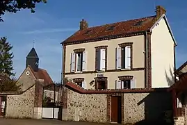 The town hall in Mottereau | |
Location of Mottereau  | |
 Mottereau  Mottereau | |
| Coordinates: 48°15′21″N 1°10′43″E | |
| Country | France |
| Region | Centre-Val de Loire |
| Department | Eure-et-Loir |
| Arrondissement | Châteaudun |
| Canton | Brou |
| Government | |
| • Mayor (2020–2026) | Patrick Martin[1] |
| Area 1 | 8.79 km2 (3.39 sq mi) |
| Population | 159 |
| • Density | 18/km2 (47/sq mi) |
| Time zone | UTC+01:00 (CET) |
| • Summer (DST) | UTC+02:00 (CEST) |
| INSEE/Postal code | 28272 /28160 |
| Elevation | 157–202 m (515–663 ft) (avg. 166 m or 545 ft) |
| 1 French Land Register data, which excludes lakes, ponds, glaciers > 1 km2 (0.386 sq mi or 247 acres) and river estuaries. | |
Population
| Year | Pop. | ±% |
|---|---|---|
| 1962 | 152 | — |
| 1968 | 161 | +5.9% |
| 1975 | 111 | −31.1% |
| 1982 | 118 | +6.3% |
| 1990 | 140 | +18.6% |
| 1999 | 142 | +1.4% |
| 2008 | 159 | +12.0% |
References
- "Répertoire national des élus: les maires". data.gouv.fr, Plateforme ouverte des données publiques françaises (in French). 2 December 2020.
- "Populations légales 2019". The National Institute of Statistics and Economic Studies. 29 December 2021.
| Wikimedia Commons has media related to Mottereau. |
This article is issued from Wikipedia. The text is licensed under Creative Commons - Attribution - Sharealike. Additional terms may apply for the media files.