Main Brook
Main Brook is a town in the Canadian province of Newfoundland and Labrador. The town had a population of 246 in the Canada 2021 Census.
Main Brook | |
|---|---|
Town | |
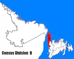
 Main Brook Location of Main Brook in Newfoundland | |
| Coordinates: 51°09′55″N 55°59′15″W[1] | |
| Country | Canada |
| Province | Newfoundland and Labrador |
| Population (2021) | |
| • Total | 246 |
| Time zone | UTC−03:30 (NST) |
| • Summer (DST) | UTC−02:30 (NDT) |
| Area code(s) | 709 |
| Highways | |
Climate
| Climate data for Main Brook Climate ID:: 840KE88; coordinates 51°11′N 56°01′W; elevation: 14 m (46 ft); 1981-2010 normals | |||||||||||||
|---|---|---|---|---|---|---|---|---|---|---|---|---|---|
| Month | Jan | Feb | Mar | Apr | May | Jun | Jul | Aug | Sep | Oct | Nov | Dec | Year |
| Record high °C (°F) | 11.0 (51.8) |
9.0 (48.2) |
11.0 (51.8) |
15.0 (59.0) |
25.0 (77.0) |
30.0 (86.0) |
31.0 (87.8) |
30.5 (86.9) |
28.0 (82.4) |
23.5 (74.3) |
18.5 (65.3) |
13.5 (56.3) |
31.0 (87.8) |
| Average high °C (°F) | −6.3 (20.7) |
−6.0 (21.2) |
−1.7 (28.9) |
3.6 (38.5) |
9.6 (49.3) |
15.0 (59.0) |
19.2 (66.6) |
19.5 (67.1) |
15.2 (59.4) |
8.5 (47.3) |
2.5 (36.5) |
−2.6 (27.3) |
6.4 (43.5) |
| Daily mean °C (°F) | −11.0 (12.2) |
−11.0 (12.2) |
−6.4 (20.5) |
−0.3 (31.5) |
5.1 (41.2) |
10.0 (50.0) |
14.2 (57.6) |
14.7 (58.5) |
10.7 (51.3) |
5.0 (41.0) |
−0.7 (30.7) |
−6.4 (20.5) |
2.0 (35.6) |
| Average low °C (°F) | −15.7 (3.7) |
−16.0 (3.2) |
−11.1 (12.0) |
−4.2 (24.4) |
0.5 (32.9) |
4.9 (40.8) |
9.1 (48.4) |
9.9 (49.8) |
6.2 (43.2) |
1.5 (34.7) |
−3.8 (25.2) |
−10.1 (13.8) |
−2.4 (27.7) |
| Record low °C (°F) | −34.0 (−29.2) |
−35.0 (−31.0) |
−34.0 (−29.2) |
−22.0 (−7.6) |
−10.0 (14.0) |
−2.0 (28.4) |
0.0 (32.0) |
1.0 (33.8) |
−3.0 (26.6) |
−9.0 (15.8) |
−22.5 (−8.5) |
−31.0 (−23.8) |
−35.0 (−31.0) |
| Average precipitation mm (inches) | 129.8 (5.11) |
137.8 (5.43) |
88.4 (3.48) |
69.9 (2.75) |
73.6 (2.90) |
99.0 (3.90) |
108.8 (4.28) |
100.1 (3.94) |
89.6 (3.53) |
105.8 (4.17) |
92.1 (3.63) |
129.0 (5.08) |
1,223.9 (48.2) |
| Average rainfall mm (inches) | 9.5 (0.37) |
12.7 (0.50) |
15.2 (0.60) |
33.6 (1.32) |
60.8 (2.39) |
97.9 (3.85) |
108.8 (4.28) |
100.1 (3.94) |
89.6 (3.53) |
102.9 (4.05) |
52.5 (2.07) |
25.3 (1.00) |
708.8 (27.91) |
| Average snowfall cm (inches) | 120.2 (47.3) |
125.1 (49.3) |
73.2 (28.8) |
36.3 (14.3) |
12.8 (5.0) |
1.1 (0.4) |
0.0 (0.0) |
0.0 (0.0) |
0.0 (0.0) |
2.9 (1.1) |
39.7 (15.6) |
103.8 (40.9) |
515.0 (202.8) |
| Average precipitation days (≥ 0.2 mm) | 12.3 | 10.9 | 9.5 | 8.5 | 10.7 | 11.9 | 13.4 | 11.9 | 11.7 | 14.7 | 12.1 | 13.0 | 140.5 |
| Average rainy days (≥ 0.2 mm) | 1.5 | 1.3 | 2.1 | 4.6 | 9.5 | 11.9 | 13.4 | 11.9 | 11.7 | 14.4 | 7.7 | 3.3 | 93.2 |
| Average snowy days (≥ 0.2 cm) | 11.1 | 9.9 | 7.6 | 4.5 | 1.2 | 0.14 | 0.0 | 0.0 | 0.0 | 0.67 | 5.1 | 10.4 | 50.7 |
| Source: Environment and Climate Change Canada[3] | |||||||||||||
Demographics
In the 2021 Census of Population conducted by Statistics Canada, Main Brook had a population of 246 living in 118 of its 180 total private dwellings, a change of 1.2% from its 2016 population of 243. With a land area of 28 km2 (11 sq mi), it had a population density of 8.8/km2 (22.8/sq mi) in 2021.[4]
References
- "Main Brook". Geographical Names Data Base. Natural Resources Canada.
- "Main Brook". Geographical Names Data Base. Natural Resources Canada.
- "Main Brook". Canadian Climate Normals 1981–2010. 25 November 2021. Retrieved 16 February 2022.
- "Population and dwelling counts: Canada, provinces and territories, census divisions and census subdivisions (municipalities), Newfoundland and Labrador". Statistics Canada. February 9, 2022. Retrieved March 15, 2022.
See also
This article is issued from Wikipedia. The text is licensed under Creative Commons - Attribution - Sharealike. Additional terms may apply for the media files.