Lukovany
Lukovany is a municipality and village in Brno-Country District in the South Moravian Region of the Czech Republic. It has about 600 inhabitants.
Lukovany | |
|---|---|
.jpg.webp) View towards the Church of Saint Wenceslaus | |
 Flag  Coat of arms | |
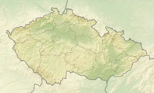 Lukovany Location in the Czech Republic | |
| Coordinates: 49°9′45″N 16°17′52″E | |
| Country | |
| Region | South Moravian |
| District | Brno-Country |
| First mentioned | 1269 |
| Area | |
| • Total | 9.07 km2 (3.50 sq mi) |
| Elevation | 415 m (1,362 ft) |
| Population (2021-01-01)[1] | |
| • Total | 630 |
| • Density | 69/km2 (180/sq mi) |
| Time zone | UTC+1 (CET) |
| • Summer (DST) | UTC+2 (CEST) |
| Postal code | 664 84 |
| Website | www |
Lukovany lies approximately 24 kilometres (15 mi) west of Brno and 170 kilometres (110 mi) south-east of Prague.
This article is issued from Wikipedia. The text is licensed under Creative Commons - Attribution - Sharealike. Additional terms may apply for the media files.