Hatsukaichi
Hatsukaichi (廿日市市, Hatsukaichi-shi) is a city located in Hiroshima Prefecture, Japan. The name derives from a market traditionally held on the 20th of each month with hatsuka (廿日) meaning "20th day" and ichi (市) translating to "market". The market continues to this day on a small scale featuring fresh, locally grown vegetables and foodstuffs. Following the absorption of the nearby towns of Ōno and Miyajima on November 3, 2005 (as of September 1, 2016), Hatsukaichi has a population of 117,106 and a population density of 239.36 persons per km². The total land area stands at 489.36 km².
Hatsukaichi
廿日市市 | |
|---|---|
 Top:Hayatani Shrine, Itsukushima Shrine, Bottom:Mount Aki Kanmuri, Memorial sourse in Yuhama Spa, Oze River Dam (all item of left to right) | |
 Flag  Emblem | |
 Location of Hatsukaichi in Hiroshima Prefecture | |
 Hatsukaichi Location in Japan | |
| Coordinates: 34°21′N 132°20′E | |
| Country | Japan |
| Region | Chūgoku (San'yō) |
| Prefecture | Hiroshima Prefecture |
| First official recorded | middle 5th century |
| City Settled | April 1, 1988 |
| Government | |
| • Mayor | Katsuhiro Shinno |
| Area | |
| • Total | 489.36 km2 (188.94 sq mi) |
| Population (September 1, 2016) | |
| • Total | 117,106 |
| • Density | 239.36/km2 (619.9/sq mi) |
| Time zone | UTC+09:00 (JST) |
| City hall address | 1-11-1 Shimohera, Hatsukaichi-shi, Hiroshima-ken. 738-8501 |
| Climate | Cfa |
| Website | www |
| Symbols | |
| Flower | Satsuki azalea |
| Tree | Sakura |
History
- The name "Hatsuka-ichi" was from the ichi on the 20th of every month from Kamakura Period.
- "Hatsukaichi-machi", Saeki District, Hiroshima was founded on April 1, 1889.
- The city "Hatsukaichi" was founded on April 1, 1988.
- On March 1, 2003, the town of Saeki and the village of Yoshiwa, both from Saeki District, merged into the expanded city of Hatsukaichi.
- On November 3, 2005, the towns of Miyajima and Ōno (both from Saeki District) were merged into Hatsukaichi. Therefore, Saeki District was dissolved as a result of this merger.
Climate
| Climate data for Hatsukaichi (1991−2020 normals, extremes 1978−present) | |||||||||||||
|---|---|---|---|---|---|---|---|---|---|---|---|---|---|
| Month | Jan | Feb | Mar | Apr | May | Jun | Jul | Aug | Sep | Oct | Nov | Dec | Year |
| Record high °C (°F) | 17.2 (63.0) |
19.8 (67.6) |
22.8 (73.0) |
29.1 (84.4) |
31.5 (88.7) |
33.0 (91.4) |
37.4 (99.3) |
36.7 (98.1) |
35.0 (95.0) |
29.4 (84.9) |
23.9 (75.0) |
19.5 (67.1) |
37.4 (99.3) |
| Average high °C (°F) | 6.7 (44.1) |
8.1 (46.6) |
12.2 (54.0) |
18.1 (64.6) |
23.1 (73.6) |
25.8 (78.4) |
29.3 (84.7) |
30.7 (87.3) |
26.9 (80.4) |
21.3 (70.3) |
15.3 (59.5) |
9.2 (48.6) |
18.9 (66.0) |
| Daily mean °C (°F) | 1.5 (34.7) |
2.4 (36.3) |
5.9 (42.6) |
11.4 (52.5) |
16.5 (61.7) |
20.3 (68.5) |
24.2 (75.6) |
25.0 (77.0) |
21.0 (69.8) |
14.8 (58.6) |
8.8 (47.8) |
3.5 (38.3) |
12.9 (55.3) |
| Average low °C (°F) | −2.9 (26.8) |
−2.6 (27.3) |
−0.1 (31.8) |
4.6 (40.3) |
9.9 (49.8) |
15.4 (59.7) |
20.1 (68.2) |
20.6 (69.1) |
16.2 (61.2) |
9.2 (48.6) |
3.2 (37.8) |
−1.2 (29.8) |
7.7 (45.9) |
| Record low °C (°F) | −11.7 (10.9) |
−13.7 (7.3) |
−8.4 (16.9) |
−4.8 (23.4) |
−0.7 (30.7) |
5.8 (42.4) |
10.5 (50.9) |
12.5 (54.5) |
3.3 (37.9) |
−2.2 (28.0) |
−4.6 (23.7) |
−10.6 (12.9) |
−13.7 (7.3) |
| Average precipitation mm (inches) | 64.5 (2.54) |
80.4 (3.17) |
144.6 (5.69) |
180.0 (7.09) |
212.1 (8.35) |
270.0 (10.63) |
343.0 (13.50) |
189.8 (7.47) |
210.9 (8.30) |
116.7 (4.59) |
82.0 (3.23) |
69.8 (2.75) |
1,963.8 (77.31) |
| Average rainy days | 8.6 | 9.6 | 11.0 | 10.0 | 9.4 | 12.6 | 12.3 | 10.0 | 10.0 | 7.2 | 7.7 | 8.9 | 117.3 |
| Mean monthly sunshine hours | 116.9 | 127.6 | 165.0 | 189.2 | 210.0 | 143.3 | 149.8 | 183.3 | 151.9 | 167.6 | 142.2 | 124.5 | 1,871.3 |
| Source: JMA[1][2] | |||||||||||||
Points of interest

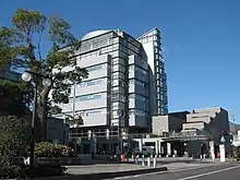
Hatsukaichi City hall
- Itsukushima Shrine - an UNESCO World Heritage Site on the island of Itsukushima (also known as Miyajima) - one of the three most beautiful sites in Japan.
- Marine Plaza Miyajima - an aquarium on Miyajima
- Miyajima Natural Botanical Garden
- Miyao Castle ruins, site of the Battle of Miyajima (1555)
- Miyajima Underwater Firework Festival, held in mid-August[3]

Torii Gate in Itsukushima Shrine
- Hatsukaichi City is considered to be the birthplace of kendama, a traditional Japanese toy.

Miyajima
Transportation
- Hatsukaichi can be accessed from Hiroshima city via the JR West Sanyo Line; on the Hiroden streetcar services' Miyajima Line; as well as by buses and boats.
- JR Miyajima Ferry and Miyajima Matsudai Kisen connect between Miyajimaguchi and Miyajima.
Sister cities
Hatsukaichi has Sister City relationships with:
 Masterton, New Zealand
 Mont Saint-Michel, France
See also
References
- 観測史上1~10位の値(年間を通じての値). JMA. Retrieved February 17, 2022.
- 気象庁 / 平年値(年・月ごとの値). JMA. Retrieved February 17, 2022.
- "Miyajima Water Fireworks Display". Retrieved July 20, 2012.
External links
| Wikimedia Commons has media related to Hatsukaichi, Hiroshima. |
- Hatsukaichi city official website (in Japanese)
- Le Mont Saint-Michel (in French)
- The 150 year anniversary of France and Japan in 2008 (in French)
 Geographic data related to Hatsukaichi at OpenStreetMap
This article is issued from Wikipedia. The text is licensed under Creative Commons - Attribution - Sharealike. Additional terms may apply for the media files.