Garyp
Garyp (Dutch: Garijp[3]) is a village in Tytsjerksteradiel municipality in the province of Friesland, the Netherlands. It had a population of around 1,894 in January 2017.[4]
Garyp
Garijp | |
|---|---|
Village | |
 St Peter's Church | |
 Coat of arms | |
 Location of the village in Tytsjerksteradiel | |
 Garyp Location in the Netherlands  Garyp Garyp (Netherlands) | |
| Coordinates: | |
| Country | |
| Province | |
| Municipality | |
| Area | |
| • Total | 18.26 km2 (7.05 sq mi) |
| Elevation | −0.1 m (−0.3 ft) |
| Population (2021)[1] | |
| • Total | 1,895 |
| • Density | 100/km2 (270/sq mi) |
| Postal code | 9263[1] |
| Dialing code | 0511 |
History
The village was first mentioned between 1325 to 1336 as Garipe, and means "village of the river bank".[5] Garyp developed into a stretched out village on a sandy ridge. The current Dutch Reformed church dates from 1838, however the first church was built around 1100.[6] Around 1930, the peat in the region was excavated.[7]
Garyp was home to 620 people in 1840.[7]
Gallery
 Village view
 Farm Binnenrust
- House in Garyp
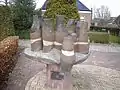 Village community statue
References
- "Kerncijfers wijken en buurten 2021". Central Bureau of Statistics. Retrieved 5 April 2022.
two entries
- "Postcodetool for 9263AA". Actueel Hoogtebestand Nederland (in Dutch). Het Waterschapshuis. Retrieved 5 April 2022.
- Taalunie (2019). "Friese namen" (in Dutch). Retrieved 18 November 2019.
- Overzicht inwonersaantal Tytsjerksteradiel - Tytsjerksteradiel
- "Garyp - (geografische naam)". Etymologiebank (in Dutch). Retrieved 5 April 2022.
- Ronald Stenvert & Sabine Broekhoven (2000). "Garyp" (in Dutch). Zwolle: Waanders. ISBN 90 400 9476 4. Retrieved 5 April 2022.
- "Garyp". Plaatsengids (in Dutch). Retrieved 5 April 2022.
| Wikimedia Commons has media related to Garyp. |
| Administrative Centre |  | |
|---|---|---|
| Villages |
| |
| Hamlets |
| |
| Landmarks | ||
| Lakes |
| |
This article is issued from Wikipedia. The text is licensed under Creative Commons - Attribution - Sharealike. Additional terms may apply for the media files.