Diepenheim
Diepenheim is a small city in the Dutch province of Overijssel. It is located in the municipality of Hof van Twente, about 5 km southwest of Goor. Diepenheim was a separate municipality until 2001, when it became a part of Hof van Twente.[3]
Diepenheim | |
|---|---|
Small city | |
 Huize Diepenheim, manor house | |
 Flag  Coat of arms | |
 Diepenheim Location in province of Overijssel in the Netherlands  Diepenheim Diepenheim (Netherlands) | |
| Coordinates: 52°12′0″N 6°33′0″E | |
| Country | Netherlands |
| Province | Overijssel |
| Municipality | Hof van Twente |
| Area | |
| • Total | 26.58 km2 (10.26 sq mi) |
| Elevation | 13 m (43 ft) |
| Population (2021)[1] | |
| • Total | 2,615 |
| • Density | 98/km2 (250/sq mi) |
| Time zone | UTC+1 (CET) |
| • Summer (DST) | UTC+2 (CEST) |
| Postal code | 7478[1] |
| Dialing code | 0547 |
History
It was first mentioned in 1150 as de Dipenhem. The name probably means "settlement near low lying land".[4] Diepenheim developed next to Huize Diepenheim.[5] The original manor house was destroyed in 1177 by the Prince-Bishop of Münster who built a castle in its place.[6] The castle was partially demolished after a 1536 siege. The current manor house dates from 1648, but has been extensively modified and altered.[6]
In 1224, a parish church was built in Diepenheim. The city rights are from 1422,[5] however it probably had become a city prior to 1379, but the archives were destroyed in a fire in 1597.[7] The Dutch Reformed Church dates from 1679 and has a bell dating from 1366.[5] Warmelo is a havezate surrounded by a moat from the 17th century and is located to the west of Diepenheim.[5]
Diepenheim remained a small city, and is nicknamed "Stedeke" (little city) by its inhabitants. In 1840, it was home to 666 people. In 2001, it was merged into Hof van Twente.[7]
Gallery
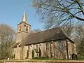 Diepenheim, church (Johanneskerk)
 Diepenheim, country-house (Huize Diepenheim)
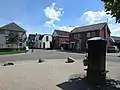 Water pump
 Path along the Regge
References
- "Kerncijfers wijken en buurten 2021". Central Bureau of Statistics. Retrieved 16 March 2022.
- "Postcodetool for 7478AA". Actueel Hoogtebestand Nederland (in Dutch). Het Waterschapshuis. Retrieved 16 March 2022.
- Ad van der Meer and Onno Boonstra, Repertorium van Nederlandse gemeenten, KNAW, 2011.
- "Diepenheim - (geografische naam)". Etymologiebank (in Dutch). Retrieved 16 March 2022.
1105 reference is a forgery
- Ronald Stenvert & Jan ten Hove (1998). "Diepenheim" (in Dutch). Zwolle: Waanders. p. 127. ISBN 90 400 9200 1. Retrieved 15 March 2022.
- "Huis Diepenheim". Landgoeden in Overijssel (in Dutch). Retrieved 16 March 2022.
- "Diepenheim". Plaatsengids (in Dutch). Retrieved 16 March 2022.
| Wikimedia Commons has media related to Diepenheim. |