Del Gallego
Del Gallego, officially the Municipality of Del Gallego (Central Bikol: Banwaan kan Del Gallego; Tagalog: Bayan ng Del Gallego), is a 4th class municipality in the province of Camarines Sur, Philippines. According to the 2020 census, it has a population of 26,403 people. [3]
Del Gallego | |
|---|---|
| Municipality of Del Gallego | |
 Seal | |
| Motto(s): Sulong Del Gallego! | |
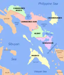
 Map of Camarines Sur with Del Gallego highlighted | |
OpenStreetMap  | |
.svg.png.webp) Del Gallego Location within the Philippines | |
| Coordinates: 13°55′24″N 122°35′46″E | |
| Country | Philippines |
| Region | Bicol Region |
| Province | Camarines Sur |
| District | 1st district |
| Founded | 1937 |
| Barangays | 32 (see Barangays) |
| Government | |
| • Type | Sangguniang Bayan |
| • Mayor | Melanie B. Abarientos-Garcia |
| • Vice Mayor | Cleto R. Suarilla |
| • Representative | Vacant |
| • Municipal Council | Members |
| • Electorate | 16,633 voters (2019) |
| Area | |
| • Total | 208.31 km2 (80.43 sq mi) |
| Highest elevation | 1,499 m (4,918 ft) |
| Lowest elevation | 0 m (0 ft) |
| Population | |
| • Total | 26,403 |
| • Density | 130/km2 (330/sq mi) |
| • Households | 5,243 |
| Economy | |
| • Income class | 4th municipal income class |
| • Poverty incidence | 30.59% (2018)[4] |
| • Revenue | ₱128,356,034.71 (2020) |
| • Assets | ₱638,842,820.57 (2020) |
| • Expenditure | ₱105,765,874.24 (2020) |
| • Liabilities | ₱154,436,485.15 (2020) |
| Service provider | |
| • Electricity | Quezon 1 Electric Cooperative (QUEZELCO 1) |
| Time zone | UTC+8 (PST) |
| ZIP code | 4411 |
| PSGC | |
| IDD : area code | +63 (0)54 |
| Native languages | Central Bikol Tagalog |
| Website | www |
It used to be called Danawin and is located along Kilbay River. It was established through Executive Order No. 56 Series of 1936 signed by then President Manuel L. Quezon.
The municipality celebrated its 80th foundation anniversary on October 5, 2017.
Del Gallego is the last town in the northern part of Camarines Sur. This is where the Quirino Highway (Andaya Highway) road meets with the first town of Quezon province, Tagkawayan.
According to the town's socio-economic profile in the year 1998, agricultural workers are greater in number reaching about 70% of the whole working force while the remaining 30% are engaged in non-agricultural occupations.
History
In 1959, the following sitios were converted into barrios: Sinuknipan, Sabang, Pasay and Bajo (renamed to San Juan).[5]
Geography
Barangays

Del Gallego is politically subdivided into 32 barangays.
- Bagong Silang
- Bucal
- Cabasag
- Comadaycaday
- Domagondong
- Kinalangan
- Comadogcadog
- Mabini
- Magais I
- Magais II
- Mansalaya
- Nagkalit
- Palaspas
- Pamplona
- Pasay
- Pinagdapian
- Pinugusan
- Zone I Fatima (Poblacion)
- Zone II San Antonio (Poblacion)
- Poblacion Zone III
- Sabang
- Salvacion
- San Juan
- San Pablo
- Santa Rita I
- Santa Rita II
- Peñafrancia (Sinagawsawan)
- Sinuknipan I
- Sinuknipan II
- Sugsugin
- Tabion
- Tomagoktok
Climate
| Climate data for Del Gallego, Camarines Sur | |||||||||||||
|---|---|---|---|---|---|---|---|---|---|---|---|---|---|
| Month | Jan | Feb | Mar | Apr | May | Jun | Jul | Aug | Sep | Oct | Nov | Dec | Year |
| Average high °C (°F) | 32 (90) |
31 (88) |
35 (95) |
37 (99) |
37 (99) |
35 (95) |
34 (93) |
34 (93) |
34 (93) |
33 (91) |
32 (90) |
31 (88) |
34 (93) |
| Average low °C (°F) | 26 (79) |
26 (79) |
28 (82) |
30 (86) |
31 (88) |
30 (86) |
29 (84) |
29 (84) |
29 (84) |
29 (84) |
28 (82) |
27 (81) |
29 (83) |
| Average precipitation mm (inches) | 104.02 (4.10) |
52.53 (2.07) |
60.67 (2.39) |
95.79 (3.77) |
337.51 (13.29) |
344.38 (13.56) |
258.12 (10.16) |
169.08 (6.66) |
242.35 (9.54) |
268.86 (10.59) |
113.40 (4.46) |
303.9 (11.96) |
2,350.61 (92.55) |
| Average rainy days | 24 | 24 | 23 | 24 | 26 | 30 | 31 | 28 | 28 | 28 | 28 | 30 | 324 |
| Source: World Weather Online (modeled/calculated data, not measured locally)[6] | |||||||||||||
Demographics
| Year | Pop. | ±% p.a. |
|---|---|---|
| 1939 | 4,883 | — |
| 1948 | 9,915 | +8.19% |
| 1960 | 11,820 | +1.48% |
| 1970 | 12,664 | +0.69% |
| 1975 | 13,754 | +1.67% |
| 1980 | 13,476 | −0.41% |
| 1990 | 17,047 | +2.38% |
| 1995 | 18,760 | +1.81% |
| 2000 | 20,456 | +1.87% |
| 2007 | 21,272 | +0.54% |
| 2010 | 23,064 | +2.99% |
| 2015 | 25,397 | +1.85% |
| 2020 | 26,403 | +0.77% |
| Source: Philippine Statistics Authority [7] [8] [9][10] | ||
In the 2020 census, the population of Del Gallego was 26,403 people, [3] with a density of 130 inhabitants per square kilometre or 340 inhabitants per square mile.
Economy
| Poverty Incidence of Del Gallego | |
| Source: Philippine Statistics Authority[11][12][13][14][15][16][17] | |
Transportation

The municipality is connected with Manila by the Andaya Highway and daily rail services to and from Naga & Legazpi are provided by the Philippine National Railways.
In order to spur development in the municipality, The Toll Regulatory Board declared Toll Road 5 the extension of South Luzon Expressway.[18] A 420-kilometer, four lane expressway starting from the terminal point of the now under construction SLEX Toll Road 4 at Barangay Mayao, Lucena City in Quezon to Matnog, Sorsogon, near the Matnog Ferry Terminal. On August 25, 2020, San Miguel Corporation announced that they will invest the project which will reduce travel time from Lucena to Matnog from 9 hours to 5.5 hours.[19]
Another expressway that will serve Del Gallego is the Quezon-Bicol Expressway (QuBEx), which will link between Lucena and San Fernando, Camarines Sur.[20]
Education
Public and private schools:
- Del Gallego Central School
- Alfelor Sr. Memorial College
- Magais Elementary School
- Del Gallego High School
- Mansalaya National High School
- Mansalaya Elementary School
- Sinuknipan National High School
- Colegio de Santa Rita Foundation, Inc.
References
- Municipality of Del Gallego | (DILG)
- "2015 Census of Population, Report No. 3 – Population, Land Area, and Population Density" (PDF). Philippine Statistics Authority. Quezon City, Philippines. August 2016. ISSN 0117-1453. Archived (PDF) from the original on May 25, 2021. Retrieved July 16, 2021.
- Census of Population (2020). "Region V (Bicol Region)". Total Population by Province, City, Municipality and Barangay. PSA. Retrieved July 8, 2021.
- "PSA Releases the 2018 Municipal and City Level Poverty Estimates". Philippine Statistics Authority. December 15, 2021. Retrieved January 22, 2022.
- "R.A. No. 2108, An Act Creating Certain Barrios in the Municipality of Del Gallego, Province of Camarines Sur". LawPH.com. Archived from the original on July 10, 2012. Retrieved April 13, 2011.
- "Del Gallego, Camarines Sur: Average Temperatures and Rainfall". World Weather Online. Retrieved October 29, 2017.
- Census of Population (2015). "Region V (Bicol Region)". Total Population by Province, City, Municipality and Barangay. PSA. Retrieved June 20, 2016.
- Census of Population and Housing (2010). "Region V (Bicol Region)". Total Population by Province, City, Municipality and Barangay. NSO. Retrieved June 29, 2016.
- Censuses of Population (1903–2007). "Region V (Bicol Region)". Table 1. Population Enumerated in Various Censuses by Province/Highly Urbanized City: 1903 to 2007. NSO.
- "Province of Camarines Sur". Municipality Population Data. Local Water Utilities Administration Research Division. Retrieved December 17, 2016.
- "Poverty incidence (PI):". Philippine Statistics Authority. Retrieved December 28, 2020.
- https://psa.gov.ph/sites/default/files/NSCB_LocalPovertyPhilippines_0.pdf; publication date: 29 November 2005; publisher: Philippine Statistics Authority.
- https://psa.gov.ph/sites/default/files/2003%20SAE%20of%20poverty%20%28Full%20Report%29_1.pdf; publication date: 23 March 2009; publisher: Philippine Statistics Authority.
- https://psa.gov.ph/sites/default/files/2006%20and%202009%20City%20and%20Municipal%20Level%20Poverty%20Estimates_0_1.pdf; publication date: 3 August 2012; publisher: Philippine Statistics Authority.
- https://psa.gov.ph/sites/default/files/2012%20Municipal%20and%20City%20Level%20Poverty%20Estima7tes%20Publication%20%281%29.pdf; publication date: 31 May 2016; publisher: Philippine Statistics Authority.
- https://psa.gov.ph/sites/default/files/City%20and%20Municipal-level%20Small%20Area%20Poverty%20Estimates_%202009%2C%202012%20and%202015_0.xlsx; publication date: 10 July 2019; publisher: Philippine Statistics Authority.
- "PSA Releases the 2018 Municipal and City Level Poverty Estimates". Philippine Statistics Authority. December 15, 2021. Retrieved January 22, 2022.
- "SLEX Toll Road 5 to connect Quezon province to Sorsogon". YugaTech. August 18, 2020. Retrieved January 14, 2021.
- "San Miguel investing P122B for SLEX Toll Road 5, Pasig River Expressway projects". GMA News Online. August 25, 2020. Retrieved January 14, 2021.
- "QUEZON–BICOL EXPRESSWAY | Department of Public Works and Highways". www.dpwh.gov.ph. Archived from the original on February 6, 2017. Retrieved February 6, 2017.
External links
- Philippine Standard Geographic Code
- Philippine Census Information
- Official Site of the Province of Camarines Sur
Places adjacent to Del Gallego | |
|---|---|
Pili (capital) | |
| Municipalities | |
| Component city | |
| Independent component city |
|