Borujen
Boroujen (Persian: بروجن, also Romanized as Borojen, Borūjen, Boroojen; also known as Urjen, or Oorjen)[3] is a city and capital of Borujen County, Chaharmahal and Bakhtiari Province, Iran. At the 2006 census, its population was 49,077, in 12,828 families.[4]
Boroujen
بروجن Borojen | |
|---|---|
City | |
 Siasard Touristic Area (at Sunset, Summer time) | |
 Boroujen Location in Iran | |
| Coordinates: 31°57′55″N 51°17′14″E | |
| Country | |
| Province | Chaharmahal and Bakhtiari Province |
| County | Borujen County |
| Bakhsh | Central |
| Government | |
| • Mayor | Mohammadali Shafi'zadeh |
| Elevation | 2,197 m (7,208 ft) |
| Population (2016 Census) | |
| • Total | 57,071 [2] |
| Time zone | UTC+3:30 (IRST) |
| • Summer (DST) | UTC+4:30 (IRDT) |
| Area code(s) | 382 |
| Website | https://web.archive.org/web/20110712025929/http://broujencity.ir/ |
The city is populated by Persians with a minority of Lurs and Turkic peoples.[5][6]
Weather and Climate
Boroujen is well known by its extremely cold weather, usually mentioned as one of the coldest Iran cities in national weather forecasts. It is located on an altitude of about 2197 m from sea levels. Its climate is usually combined of moderate summer climates as well as very cold winters. Snow days are normally 122 days per year, and the temperature could reach -27 °C. The maximum observed temperature has been 36 °C. Average annular precipitation is 243 mm (24% in the spring, 1% in the summer, 33% in the fall, and 44% in the winter).
Boroujen has one of the highest elevation among all Iran cities, making it rich and fruitful in terms of vegetable and animal environment.
| Climate data for Boroujen | |||||||||||||
|---|---|---|---|---|---|---|---|---|---|---|---|---|---|
| Month | Jan | Feb | Mar | Apr | May | Jun | Jul | Aug | Sep | Oct | Nov | Dec | Year |
| Average high °C (°F) | 2 (36) |
4 (39) |
14 (57) |
20 (68) |
26 (79) |
29 (84) |
31 (88) |
30 (86) |
27 (81) |
24 (75) |
15 (59) |
6 (43) |
19.9 (67.8) |
| Average low °C (°F) | −14 (7) |
−12 (10) |
−7 (19) |
−3 (27) |
2 (36) |
5 (41) |
11 (52) |
7 (45) |
2 (36) |
1 (34) |
−6 (21) |
−15 (5) |
1.1 (34.0) |
| Source: chaharmahalmet.ir [7] | |||||||||||||
The city is located in a valley with the same name which has a total area of 580 m² in the eastern part of Chahar Mahaal and Bakhtiari province.
Gallery
_square%252C_Borujen%252C_Iran.jpg.webp) Moallem (Teacher) Square, Buali Boulevard
Moallem (Teacher) Square, Buali Boulevard Elahieh District
 Mosalla Bridge (A Historical Bridge)
 Inverted Tulips, Siasard Area
 Mosalla Bridge
 Boroujen-Isfahan Road
 A Park in the City
Colleges and universities
Borujen hosts several higher education institutes:
- Payam-e-Noor University of Boroujen (in Persian)
- Islamic Azad University of Boroujen (in Persian)
- Nursing Faculty of Boroujen (in Persian)
- Boroujen Technical School (in Persian)
References
- "ايستگاه ها - اداره کل هواشناسي استان چهارمحال و بختياري". Archived from the original on 2004-10-19.
- "Statistical Center of Iran > Home".
- Borujen can be found at GEOnet Names Server, at this link, by opening the Advanced Search box, entering "-3056915" in the "Unique Feature Id" form, and clicking on "Search Database".
- "Census of the Islamic Republic of Iran, 1385 (2006)" (Excel). Statistical Center of Iran. Archived from the original on 2011-11-11.
- "Language distribution: Chahar Mahal va Bakhtiari Province". Iran Atlas. Archived from the original on 2017-12-04. Retrieved 25 March 2021.
- Anonby, Erik. "Atlas of the Languages of Iran: A working classification". Iran Atlas. Archived from the original on 2019-12-29. Retrieved 27 March 2021.
- "Regional Weather Forecast".
External links
| Wikimedia Commons has media related to Borujen. |
| Capital | 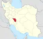 | ||||||||||||||||||||
|---|---|---|---|---|---|---|---|---|---|---|---|---|---|---|---|---|---|---|---|---|---|
| Counties and cities |
| ||||||||||||||||||||
| Landmarks |
| ||||||||||||||||||||
| populated places | |||||||||||||||||||||
| Capital | |||||||||||||||||||||||||||||
|---|---|---|---|---|---|---|---|---|---|---|---|---|---|---|---|---|---|---|---|---|---|---|---|---|---|---|---|---|---|
| Districts |
| ||||||||||||||||||||||||||||