Bhaderwah
Bhaderwah (also Bhadarwah Valley) is a town, tehsil and sub-division (sub-district) in the district Doda of Jammu Division of the Indian union territory of Jammu and Kashmir.[2][3]
Bhaderwah
Bhadlayi Bhaderkashi (ancient name in princely state) | |
|---|---|
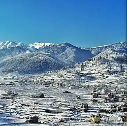 Bhaderwah in Snow | |
 Bhaderwah Location in Jammu and Kashmir, India  Bhaderwah Bhaderwah (India) | |
| Coordinates: 32.980033°N 75.713706°E | |
| Country | |
| Union Territory | Jammu and Kashmir |
| Division | Jammu |
| Region | Chenab Valley |
| District | Doda |
| Area | |
| • Total | 112.17 km2 (43.31 sq mi) |
| Elevation | 1,613 m (5,292 ft) |
| Population (2011)[1] | |
| • Total | 75,376 |
| • Density | 670/km2 (1,700/sq mi) |
| Demonym(s) | Bhaderwahi |
| Languages | |
| • Official | Urdu |
| • Other Spoken languages | Kashmiri Bhaderwahi, Urdu, Dogri |
| Time zone | UTC +05:30 (Indian Standard Time) |
| ADC Bhaderwah | Dilmeer Choudhary |
Etymology
The word Bhaderwah is derived from the Hindu Goddess Bhadrakali and the place was formerly known as Bhaderkashi. Later, the name of this place was modified to Bhadarwah,[4] which is now common and official name of this place.[5]
History
In 1841, Bhadarwah became part of J&K state. When Maharaja Partap Singh was crowned as king of Jammu and Kashmir, he gifted Bhadarwah to his younger brother Raja Amar Singh as “Jagir”. The Jagir comprised Bhadarwah , Bhalessa and the vast area left of river Chenab from Thathri up to Khellani (Doda).[6]
| Year | Pop. | ±% p.a. |
|---|---|---|
| 1911 | 2,563 | — |
| 1921 | 2,603 | +0.15% |
| 1931 | 2,895 | +1.07% |
| 1941 | 2,989 | +0.32% |
| 1951 | 3,559 | +1.76% |
| 1961 | 4,129 | +1.50% |
| 1971 | 5,211 | +2.35% |
| 1981 | 6,075 | +1.55% |
| 2001 | 10,516 | +2.78% |
| 2011 | 11,084 | +0.53% |
| Source: [1] | ||
Demography
Climate
| Climate data for Bhaderwah (1981–2010 normals, extremes 1977–2012) | |||||||||||||
|---|---|---|---|---|---|---|---|---|---|---|---|---|---|
| Month | Jan | Feb | Mar | Apr | May | Jun | Jul | Aug | Sep | Oct | Nov | Dec | Year |
| Record high °C (°F) | 21.8 (71.2) |
24.8 (76.6) |
29.6 (85.3) |
32.6 (90.7) |
38.4 (101.1) |
39.3 (102.7) |
39.4 (102.9) |
37.2 (99.0) |
35.1 (95.2) |
32.4 (90.3) |
28.7 (83.7) |
22.9 (73.2) |
39.4 (102.9) |
| Average high °C (°F) | 12.1 (53.8) |
13.1 (55.6) |
18.2 (64.8) |
23.4 (74.1) |
27.3 (81.1) |
30.5 (86.9) |
30.5 (86.9) |
29.8 (85.6) |
28.4 (83.1) |
24.6 (76.3) |
20.1 (68.2) |
14.8 (58.6) |
22.7 (72.9) |
| Average low °C (°F) | −1.0 (30.2) |
0.2 (32.4) |
3.5 (38.3) |
7.2 (45.0) |
10.1 (50.2) |
13.9 (57.0) |
16.9 (62.4) |
16.5 (61.7) |
12.4 (54.3) |
6.6 (43.9) |
3.0 (37.4) |
0.4 (32.7) |
7.5 (45.5) |
| Record low °C (°F) | −10.8 (12.6) |
−9.2 (15.4) |
−6.5 (20.3) |
−2.5 (27.5) |
0.2 (32.4) |
5.2 (41.4) |
7.0 (44.6) |
8.1 (46.6) |
2.5 (36.5) |
−3.0 (26.6) |
−2.5 (27.5) |
−6.5 (20.3) |
−10.8 (12.6) |
| Average rainfall mm (inches) | 125.3 (4.93) |
170.9 (6.73) |
171.5 (6.75) |
123.8 (4.87) |
94.1 (3.70) |
74.8 (2.94) |
141.0 (5.55) |
121.0 (4.76) |
92.2 (3.63) |
38.8 (1.53) |
35.9 (1.41) |
72.5 (2.85) |
1,262.6 (49.71) |
| Average rainy days | 6.8 | 8.5 | 8.6 | 7.5 | 7.4 | 7.1 | 9.8 | 9.3 | 4.9 | 2.6 | 2.4 | 3.9 | 78.5 |
| Average relative humidity (%) (at 17:30 IST) | 63 | 64 | 57 | 51 | 51 | 51 | 64 | 68 | 60 | 51 | 54 | 58 | 58 |
| Source: India Meteorological Department[8][9] | |||||||||||||
References
- A-4 Towns And Urban Agglomerations Classified By Population Size Class In 2011 With Variation Since 1901. Office of the Registrar General & Census Commissioner, Ministry of Home Affairs, Government of India (Report).
Class - IV Population of 10,000 and 19,999 (Report). - Bhaderwah Town, Department of Tourism, Jammu and Kashmir
- "Administrative Setup | District Doda | India". Retrieved 7 February 2022.
- Excelsior, Daily (26 July 2012). "Bhaderwah beckons you". Retrieved 14 June 2021.
- "Administrative Setup of Doda district". doda.nic.in. Retrieved 7 September 2021.
- Excelsior, Daily (6 February 2016). "Past, present of Doda". Retrieved 14 June 2021.
- C-16 Population By Mother Tongue – Jammu & Kashmir (Report). Office of the Registrar General & Census Commissioner, India. Retrieved 18 July 2020.
- "Station: Badarwah Climatological Table 1981–2010" (PDF). Climatological Normals 1981–2010. India Meteorological Department. January 2015. pp. 57–58. Archived from the original (PDF) on 5 February 2020. Retrieved 5 March 2021.
- "Extremes of Temperature & Rainfall for Indian Stations (Up to 2012)" (PDF). India Meteorological Department. December 2016. p. M75. Archived from the original (PDF) on 5 February 2020. Retrieved 29 March 2020.
This article is issued from Wikipedia. The text is licensed under Creative Commons - Attribution - Sharealike. Additional terms may apply for the media files.