Bantaeng Regency
Bantaeng Regency (Kabupaten Bantaeng; ᨀᨅᨘᨄᨈᨙ ᨅᨈᨕᨙᨂ) is a regency of South Sulawesi Province in Indonesia. It covers an area of 395.83 km2 and had a population of 176,984 at the 2010 Census,[2] rising to 196,716 at the 2020 Census.[3] The administrative centre is the town of Bantaeng (historically, Bonthain), which lies on the south coast of the southern peninsula of Sulawesi island.
Bantaeng Regency
Kabupaten Bantaeng ᨀᨅᨘᨄᨈᨙ ᨅᨈᨕᨙᨂ | |
|---|---|
|
Seal | |
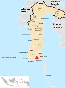 Location within South Sulawesi | |
| Country | Indonesia |
| Province | South Sulawesi |
| Capital | Bantaeng |
| Government | |
| • Regent | Dr.HM. Nurdin Abdullah M.Agr |
| Area | |
| • Total | 395.83 km2 (152.83 sq mi) |
| Population (2020 Census)[1] | |
| • Total | 196,716 |
| • Density | 500/km2 (1,300/sq mi) |
| Time zone | UTC+8 (WITA) |
| Website | http://www.bantaeng.go.id |
Administration
Bantaeng Regency is divided into eight Districts (Kecamatan), tabulated below with their areas and their populations at the 2010 Census[4] and the 2020 Census.[5]
| Name | Area in km2 | Population Census 2010 | Population Census 2020 |
|---|---|---|---|
| Bissappu | 32.84 | 30,931 | 35,356 |
| Uluere | 67.29 | 10,814 | 11,563 |
| Sinoa | 43.00 | 11,827 | 13,031 |
| Bantaeng | 28.85 | 36,718 | 39,597 |
| Eremerasa | 45.01 | 18,614 | 21,284 |
| Tompobulu | 76.99 | 22,913 | 24,857 |
| Pa'jukukang | 48.90 | 29,017 | 32,331 |
| Gantarangkeke | 52.95 | 15,865 | 18,697 |
| Totals | 395.83 | 176,984 | 196,716 |
Climate
Bantaeng has a tropical savanna climate (Aw) with moderate to little rainfall from July to November and heavy rainfall from December to June.
| Climate data for Bantaeng | |||||||||||||
|---|---|---|---|---|---|---|---|---|---|---|---|---|---|
| Month | Jan | Feb | Mar | Apr | May | Jun | Jul | Aug | Sep | Oct | Nov | Dec | Year |
| Average high °C (°F) | 29.8 (85.6) |
29.8 (85.6) |
30.3 (86.5) |
31.0 (87.8) |
31.2 (88.2) |
30.9 (87.6) |
31.0 (87.8) |
31.6 (88.9) |
32.0 (89.6) |
32.2 (90.0) |
31.3 (88.3) |
30.1 (86.2) |
30.9 (87.7) |
| Daily mean °C (°F) | 26.3 (79.3) |
26.3 (79.3) |
26.5 (79.7) |
26.8 (80.2) |
26.9 (80.4) |
26.3 (79.3) |
25.8 (78.4) |
26.0 (78.8) |
26.4 (79.5) |
27.0 (80.6) |
27.0 (80.6) |
26.5 (79.7) |
26.5 (79.7) |
| Average low °C (°F) | 22.8 (73.0) |
22.9 (73.2) |
22.8 (73.0) |
22.7 (72.9) |
22.6 (72.7) |
21.7 (71.1) |
20.7 (69.3) |
20.4 (68.7) |
20.9 (69.6) |
21.8 (71.2) |
22.8 (73.0) |
22.9 (73.2) |
22.1 (71.7) |
| Average rainfall mm (inches) | 181 (7.1) |
149 (5.9) |
128 (5.0) |
130 (5.1) |
194 (7.6) |
185 (7.3) |
106 (4.2) |
41 (1.6) |
20 (0.8) |
46 (1.8) |
80 (3.1) |
144 (5.7) |
1,404 (55.2) |
| Source: Climate-Data.org[6] | |||||||||||||
Beaches
Bantaeng Regency has 3 beaches:[7]
- Lamalaka Beach
- Seruni Beach
- Marina Beach and Resort
The previous 2 beaches is near the administrative centre, Bantaeng, and the last beach is 18 kilometers southeast of Lamalaka Beach.
References
- Badan Pusat Statistik, Jakarta, 2021.
- Biro Pusat Statistik, Jakarta, 2011.
- Badan Pusat Statistik, Jakarta, 2021.
- Biro Pusat Statistik, Jakarta, 2011.
- Badan Pusat Statistik, Jakarta, 2021.
- "Climate: Bantaeng". Climate-Data.org. Retrieved 18 November 2020.
- "Bantaeng". July 1, 2012. Archived from the original on 2012-10-05.
Regencies and cities of South Sulawesi | ||
|---|---|---|
Capital: Makassar | ||
| Regencies |  | |
| Cities | ||