Amethi
Amethi is a town and tehsil in the Indian state of Uttar Pradesh. It is a major town of the Amethi district, in the Faizabad division. The Hanumangarhi temple is located in the heart of the town.
Amethi | |
|---|---|
Town | |
 Amethi Railway Station in Amethi, U.P. | |
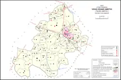 Map of Amethi CD block, U.P | |
 Amethi Location in Uttar Pradesh, India  Amethi Amethi (India) | |
| Coordinates: 26.155°N 81.809°E | |
| Country | |
| State | Uttar Pradesh |
| District | Amethi |
| Government | |
| • MP | Smriti Irani ( BJP) |
| Area | |
| • Total | 0.72 km2 (0.28 sq mi) |
| Elevation | 100 m (300 ft) |
| Population (2011)[1] | |
| • Total | 13,849 |
| • Density | 19,000/km2 (50,000/sq mi) |
| Language | |
| • Official | Hindi[2] |
| • Additional official | Urdu[2] |
| • Regional | Awadhi |
| Time zone | UTC+5:30 (IST) |
| Telephone code | +915368 |
| Vehicle registration | UP-36 |
| Sex ratio | 908 females per 1000 males ♂/♀ |
| Literacy (2011) | 59.14 |
| Website | amethi |
The town is part of the Amethi Lok Sabha constituency and Amethi Assembly constituency, which became reputed as a stronghold of the Indian National Congress party. The Congress leaders belonging to Nehru-Gandhi family won several elections from Amethi during 1980-2014.
History
In the past, Amethi used to be called Raipur-Amethi.[3] When the train station was built here, it took the name of Amethi, but before then there had been no settlement with that exact name.[4] There had been a mahal or pargana of Amethi since at least the time of Akbar: it is mentioned in the Ain-i-Akbari as belonging to the sarkar of Lucknow, with a brick fort at headquarters and was held by Rajputs called "Bahmangoti"s, who are probably the same as the Bandhalgotis from whom the Rajas of Amethis originated.[4] Later on, the pargana was transferred to Manikpur.[4]
The Rajas of Amethi
The Bandhalgoti Rajas of Amethi originally resided at Raipur Phulwari, which along with Sarwanpur and Katra Himmat Singh was one of the three villages that would later be amalgamated into the modern town of Raipur-Amethi.[4] The old fort at Raipur Phulwari was destroyed by Safdar Jang c. 1743; its ruins are still visible today.[4] The story behind its destruction is as follows: the Bandhalgoti leader Gurdatt Singh (who alternately bore the titles of Babu and Raja) had defied Safdar Jang's authority so conspicuously that Safdar Jang personally led an army to Raipur to besiege the fort.[4] After a siege of 18 days, Gurdatt Singh fled into the neighbouring jungle of Ramnagar (which became the rajas' main residence), and the fort was destroyed and his estate (then known as Udiawan, until the British annexation of Awadh) put under Safdar Jang's direct control.[4]
Gurdatt Singh's son Drigpal Singh was able to recover his father's estate.[4] While Gurdatt Singh had been known by various titles, all his successors beginning with Drigpal Singh were unequivocally styled Raja.[4] Because of the prevalence of barren usar land in the pargana, there was a popular saying "gar na hota Amethi úsar, Rája hota deoti dusar", meaning "if there had been no usar in Amethi, the Raja would be a second deity".[4]
The taluqa was then divided between Drigpal Singh's two sons, with Har Chand Singh receiving the bulk of the inheritance and Jai Chand Singh founding the junior branch of Kannu Kasrawan.[4] Har Chand Singh had originally inherited 153 villages but in 1804 was permitted to engage for the entire pargana of Amethi (except for the village of Raghipur).[4] In 1810, this arrangement was changed by Saadat Ali Khan II, leaving Har Chand Singh with just 43 rent-free villages; he abdicated in favour of his son Dalpat Sah, who in 1813 was able to restore the taluqa to its original extent.[4] Dalpat Sah died in 1815 and was succeeded by his son Bisheshar Singh, who then died childless in 1842.[4]
At this point, the taluqa was inherited by Bisheshar Singh's cousin Madho Singh, whose father Arjun Singh (Dalpat's brother) had held the independent Gangoli estate as a junior branch.[4] Under Madho Singh, these two branches became united.[4] Madho Singh clashed with the nazim of Sultanpur, Maharaja Man Singh, in 1845; when this proved indecisive, the two parties turned to negotiations.[4] The resulting agreement in 1846 ended up leasing the entire pargana to Madho Singh except for a few villages that would be directly retained by the nazim.[4] This lease included Kannu Kasrawan, still held by Jai Chand Singh's descendants, but the proprietors ignored the terms and Madho Singh ended up getting a decree of confiscation from the Nawab of Awadh himself.[4] After protracted fighting the proprietors finally submitted in 1853.[4]
The Udiawan taluqa was almost completely broken up upon the British annexation in 1856, but reconstituted after the 1857 uprising.[4] Madho Singh supported the rebellion but the British were still willing to give him a sanad for the estate; they also formally acknowledged his title of Raja (he had never really sought formal recognition beforehand).[4] Madho Singh died in August 1891, shortly after the death of his only son, and was succeeded by a more distant relative who was adopted as his heir.[4] At the turn of the 20th century, the Amethi estate consitsed of 314 villages and 4 pattis, all in the pargana of Amethi.[4]
Growth of the modern town
Amethi's development as a major town is because of the coming of the railway.[4] As late as 1897, a British settlement officer wrote "Raipur is a collection of small unimportant hamlets, with positively no attempt at trade."[4] That changed when the Oudh and Rohilkhand Railway came to town with a station in 1898.[4] The town then rapidly grew in size and commercial importance, and as early as 1903 it was already described as "a flourishing town" and the previous description was described as "already ancient history".[4]
As of 1901 the population was 3,688 including 1,127 Muslims which was an especially large proportion for the area.[4] It contained the tehsil headquarters, a school, a police station, a pound, and a dispensary.[4]
Raipur is the place where the first fort of Raja of Bachhalgoti Rajputs was located. His ancestors used to reside in Raipur which is now Raipur Phulwari. New fort was built in Ram Nagar about 6 Kms north of present Amethi which had been Center of Political activities during freedom movement. It is inhabited by Ex MP Sanjaya Sinh and present MLA Garima Singh. Amethi became known worldwide with Sanjay Gandhi contesting Parliamentary Election on the behest of Raja Rannjay Singh who had close relationship with Nehru family. It is also famous for the Hanuman temple called [Hanumangarhi] and a mosque both built about hundred years ago. About 7 kilometres north of Amethi there is a tomb of famous Poet Malik Mohammad Jayasi at Magravan which is near Ram Nagar, where he died. Present fort was built by Bachalgoti Rajput Rajas.[3]
Demographics
| Year | Pop. | ±% |
|---|---|---|
| 1981 | 7,132 | — |
| 1991 | 10,661 | +49.5% |
| 2001 | 12,836 | +20.4% |
| 2011 | 13,849 | +7.9% |
| Source: 2011 Census of India[1] | ||
According to the 2011 census, Amethi has a population of 13,849 people, in 2,262 households.[1] The town's sex ratio is 965 females to every 1000 males; 7,049 of Amethi's residents are male (50.9%) and 6,800 are female (49.1%).[1] The 0-6 age group numbered 1,731, or about 12.5% of the town's population; the sex ratio for this group was 987.[1] Members of Scheduled Castes make up 12.87% of the town's population, while no members of Scheduled Tribes were recorded.[1] Amethi's literacy rate was 78.3% (counting only people age 7 and up); literacy was higher among men and boys (86.01%) than among women and girls (70.27%).[1] The scheduled castes literacy rate is 60.73% (71.95% among men and boys, and 48.25% among women and girls).[1]
In terms of employment, 21.29% of Amethi residents were classified as main workers (i.e. people employed for at least 6 months per year) in 2011.[1] Marginal workers (i.e. people employed for less than 6 months per year) made up 6.27%, and the remaining 72.44% were non-workers.[1] Employment status varied significantly according to gender, with 44.76% of men being either main or marginal workers, compared to only 9.74% of women.[1]
As per the 2001 Census of India, Amethi had a population of 12,808. Males constitute 52% of the population and females 48%. Amethi has an average literacy rate of 59%, lower than the national average of 59.5%; with 59% of the males and 41% of females literate. 17% of the population is under 6 years of age.[5]
Transport
Amethi is connected to the major cities in Uttar Pradesh and North-Eastern India via Indian Railways and roads. Amethi railway station has direct trains connecting with major cities like Jammu, Amritsar, Ambala, Delhi, Lucknow, Kanpur, Dehradun, Haridwar, Jaipur, Allahabad, Varanasi, Patna, Kolkata, Puri, Bhopal, Mumbai and Bangalore.
A number of Uttar Pradesh State Road Transport Corporation buses play from Amethi.
Allahabad Airport (104 km) and Ayodhya Airport (91 km) are the nearby airports from Amethi.
Institutions, industries and organisations
- Rajiv Gandhi Institute of Petroleum Technology
- HAL School Korwa
- Mahatma Shiv Kumar Inter College[6]
Raja Rananjay Singh did much in the educational field.Beginning from Anand Pathashala to Ranvir Inter college and first ever Degree College-Ranvir Ranjay Degree College at Amethi- then only a Tehsil of District Sultanpur was established in 1959.Its first Convocation was addressed by the then Governor of Uttar Pradesh V. V. Giri.
A few public sector units were established in Amethi in the 1970s however not much has occurred in the town for the past two decades, leading to youngsters leaving the town in search of jobs.[7] Rajiv Gandhi Charitable Trust is one of the NGOs in Amethi district.
- Amethi has the Avionics Division of Hindustan Aeronautics Limited, the organization responsible for manufacture of Aircraft for Indian Airforce. One Ordnance Factory has been established in 2009 by Congress Government to manufacture small arms and weapons.
A joint venture between Kalashnikov Concern and the Ordnance Factory Board to establish a rifle factory in Amethi is being negotiated between India and Russia, and is planned to be launched by October 2020.[8][9]
Villages
Amethi CD block has the following 86 villages:[1]
| Village name | Total land area (hectares) | Population (in 2011) |
|---|---|---|
| Trilokpur | 167.3 | 2,062 |
| Teri | 162 | 832 |
| Katra Maharani | 134.4 | 1,236 |
| Lokipur | 52.7 | 623 |
| Matyar Baghaura | 49.5 | 481 |
| Dandupur | 134.4 | 1,001 |
| Bhupatipur | 85.7 | 629 |
| Ramdaypur | 130.2 | 1,441 |
| Naugawa | 125.6 | 647 |
| Banhapur | 86.3 | 978 |
| Jangal Ramnagar | 1,198.2 | 10,843 |
| Saray Khema | 557 | 4,489 |
| Ramnagar Mafi | 78.7 | 233 |
| Mahmoodpur | 226.9 | 3,154 |
| Marfapur | 38.1 | 303 |
| Balipur | 34.5 | 329 |
| Benipur | 128.3 | 1,438 |
| Ramnathpur | 24.4 | 367 |
| Parsanwa | 301.7 | 1,622 |
| Bhaganpur | 151 | 981 |
| Jangal Tikari | 68.9 | 581 |
| Tala | 181.4 | 1,626 |
| Loharta | 51.2 | 776 |
| Ahirawal | 67.8 | 406 |
| Sonpur Mankhanth | 79.9 | 855 |
| Darkha | 277.8 | 1,735 |
| Sundar Pur | 107.5 | 725 |
| Haripur | 51.6 | 233 |
| Kushitali | 127.3 | 1,342 |
| Umapur Gana Patti | 382.7 | 2,258 |
| Katra Hulasi | 55.7 | 517 |
| Nuwanwa | 456.9 | 2,861 |
| Mangal Pur | 62.2 | 304 |
| Bariya Pur | 274.1 | 1,336 |
| Korari Girdhar Shah | 386.3 | 2,603 |
| Mochwa | 166.1 | 982 |
| Saraiheermati | 98 | 569 |
| Chaturbhuj Pur | 119.4 | 1,400 |
| Ghawnie | 43.4 | 627 |
| Sultanpur | 112.2 | 617 |
| Pithi Pur | 147 | 746 |
| Ghaghu Ghar | 133.6 | 632 |
| Raipur Phulwari | 278.5 | 2,208 |
| Loniyapur | 110.5 | 1,339 |
| Bharti Pur | 38.1 | 382 |
| Katra Raja Himmat Singh | 80 | 0 |
| Ray Day Pur | 105.8 | 859 |
| Sarvan Pur | 123.3 | 2,344 |
| Sarai Rajshah | 68.3 | 268 |
| Parsauli | 134.1 | 964 |
| Katra Phool Kunwar | 175.1 | 1,524 |
| Jagi Patti | 118.7 | 322 |
| Hathkila | 216.7 | 1,907 |
| Baghvariya | 87.2 | 306 |
| Kherauna | 169.5 | 1,870 |
| Chachka Pur | 59.5 | 819 |
| Birahim Pur | 71.2 | 490 |
| Rebha | 99.6 | 642 |
| Manipur Raghau | 57.7 | 141 |
| Mandhar Patti | 22.6 | 171 |
| Gyan Chandra Pur | 60.1 | 555 |
| Mahson | 86.1 | 1,020 |
| Jairam Pur | 108.9 | 801 |
| Jamal Patti | 104.6 | 483 |
| Deohapsaar | 314.4 | 2,544 |
| Gareri | 268.8 | 3,146 |
| Gangauli | 375 | 2,072 |
| Bhushari | 235.1 | 1,638 |
| Himmatgarh | 390.9 | 1,715 |
| Ramgarh | 685.2 | 3,877 |
| Nainha | 182.4 | 1,290 |
| Bartali | 93.3 | 640 |
| Rajapur Kohra | 153.5 | 1,226 |
| Kudwan Mahmadpur | 66.5 | 611 |
| Dehra | 233.6 | 2,488 |
| Saidpur | 100.4 | 1,103 |
| Aghar | 213.3 | 1,495 |
| Maharajpur | 164.4 | 1,276 |
| Biyasiya | 200.6 | 1,536 |
| Kakwa | 367.9 | 3,044 |
| Dalashah Pur | 81.4 | 518 |
| Kohra | 577.1 | 4,407 |
| Mahmad Pur | 447.8 | 3,665 |
| Saraiya Duban | 301.9 | 1,823 |
| Naraini | 584.6 | 5,082 |
| Purabgaon | 222.2 | 1,546 |
| Block total | 123,577 | 15,954.3 |
| Village name | Total land area (hectares) | Population (in 2011) |
Notable people
- Rajiv Gandhi (former Prime Minister of India)
- Rahul Gandhi (MP)
- Rakesh Pandey (Writer & Author)
- Sanjay Gandhi (MP)
- Smriti Irani (MP and cabinet minister)
- Manoj Muntashir (lyricist)
- Jagdish Piyush (Writer, educationist, Indian National Congress politician)
- Ameeta Singh
- Deepak Singh (MLC)
- Garima Singh (MLA)
References
- "Census of India 2011: Uttar Pradesh District Census Handbook - Sultanpur, Part A (Village and Town Directory)" (PDF). Census 2011 India. pp. 35–66, 199–215, 758–73. Retrieved 13 November 2021.
- "52nd Report of the Commissioner for Linguistic Minorities in India" (PDF). nclm.nic.in. Ministry of Minority Affairs. Archived from the original (PDF) on 25 May 2017. Retrieved 20 December 2018.
- "About Amethi". amethi.in. Retrieved 16 December 2021.
- Nevill, H.R. (1903). Sultanpur: A Gazetteer, Being Volume XLVI Of The District Gazetteers Of The United Provinces Of Agra And Oudh. Allahabad: Government Press. p. 95-7, 136, 156-8, 202-3. Retrieved 1 December 2021.
- "Census of India 2001: Data from the 2001 Census, including cities, villages and towns (Provisional)". Census Commission of India. Archived from the original on 16 June 2004. Retrieved 1 November 2008.
- "MAHATMA SHIV KUMAR I C DHARAIMAFI - Dharaimafi, District Amethi Csm Nagar (Uttar Pradesh)". schools.org.in. Retrieved 21 March 2022.
- Dutta, Sanjay (22 October 2016). "BJP goes to Amethi with populist plans". The Times of India. Retrieved 8 December 2016.
- Pubby, Manu (6 February 2020). "Indo-Russian joint venture for Amethi rifles factory hits hurdle". The Economic Times. Retrieved 18 August 2020.
- Pubby, Manu (25 June 2020). "India requests quick delivery of missiles, ammo from Russia; Amethi factory to launch before summit". The Economic Times. Archived from the original on 6 July 2020. Retrieved 18 August 2020.
Sources said that the two sides also discussed the project to manufacture Kalashnikov rifles at a factory in Amethi under a joint venture approach with OFB and it has been agreed that the facility would be launched by the time Prime Minister Narendra Modi and President Vladimir Putin meet for a summit tentatively planned for October this year.