Woodbridge, Connecticut
Woodbridge is a town in New Haven County, Connecticut, United States. The population was 9,087 at the 2020 census.[1] The town center is listed on the National Register of Historic Places as Woodbridge Green Historic District. Woodbridge is part of the Amity Regional School District #5, rated the #1 school district in New Haven County and the 10th best school district in CT by Niche in 2021.[2] As of 2019 Woodbridge has the 7th highest median household income in CT.[3]
Woodbridge, Connecticut | |
|---|---|
 Seal | |
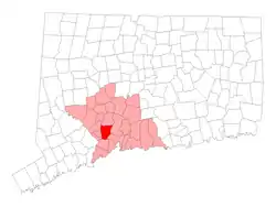 Location in New Haven County, Connecticut | |
| Coordinates: 41°21′15″N 73°00′41″W | |
| Country | |
| U.S. state | |
| County | New Haven |
| Metropolitan area | New Haven |
| Incorporated | 1784 |
| Government | |
| • Type | Selectman-town meeting |
| • First Selectman | Beth Heller (D) |
| • Board of Selectmen |
|
| Area | |
| • Total | 19.2 sq mi (49.7 km2) |
| • Land | 18.8 sq mi (48.8 km2) |
| • Water | 0.4 sq mi (1.0 km2) |
| Elevation | 348 ft (106 m) |
| Population (2020) | |
| • Total | 9,087 |
| • Density | 470/sq mi (180/km2) |
| Time zone | UTC-5 (Eastern) |
| • Summer (DST) | UTC-4 (Eastern) |
| ZIP code | 06525 |
| Area code(s) | 203/475 |
| FIPS code | 09-87700 |
| GNIS feature ID | 0213539 |
| Website | www |
Due to restrictive zoning regulations, 99.8% of the town's area only permits single-family housing.[4]
In the Fall of 2021 the Woodbridge Town Planning and Zoning Commission changed town regulations and now allow applications for two family or multi family housing on all lots in Woodbridge.[5]
History
Woodbridge was originally called "Amity", having been carved out of land originally belonging to New Haven and Milford as an independent parish in 1739. In 1742, the Rev. Benjamin Woodbridge was ordained in Amity, and it is after him that the modern town was named. Woodbridge was incorporated in 1784.[6]
In 1661, the town was the location of one of the hideouts of the "Regicides" — three of the judges who signed the death warrant for King Charles I of England. The ruins of their hideout can be found on the nearby West Rock ridge, which runs along the town's eastern border.
Thomas Darling (1720–1789), a tutor at Yale College and later an entrepreneur in New Haven, moved to town in 1774. His home is now the Darling House Museum, operated by the Amity & Woodbridge Historical Society.[7] The original farms of Woodbridge were located in the area of the West River Valley known as The Flats.
In the modern era, Woodbridge has undergone significant suburbanization.
Government
Woodbridge is governed by a 6-member Board of Selectmen.
In April 2006, Edward Maum Sheehy (Democrat) became First Selectman. Since 2017, Beth Heller is the First Selectwoman in Woodbridge (Democrat). Sheehy served on the Board of Selectmen for 27 years as a regular selectman. The Board of Selectmen elected Sheehy First Selectman by a 3 to 2 vote, along party lines, to replace Amey Marella (Republican), who stepped down to accept a job as Deputy Commissioner of the Connecticut Department of Environmental Protection. Before becoming First Selectwoman in 2001, Marella was an attorney with the United States Environmental Protection Agency. Edward Sheehy was reelected in May 2009 to another two-year term.
On April 22, 2013, Sheehy died suddenly at the age of 73 while still holding the First Selectman's office. He was actively seeking re-election in May. He was laid to rest on April 27, 2013.[8] On April 25, 2013, the Board of Selectman unanimously selected Deputy First Selectman Beth Heller to serve as First Selectmen for the remainder of Sheehy's term. The Woodbridge Democratic Town Committee selected Ellen Scalettar to replace Sheehy as their nominee for First Selectman. Scalettar was elected on May 6, 2013, and sworn in as First Selectman on June 28, 2013. Scalettar served as the First Selectman for 2 terms (four years) and choose not to seek reelection in 2017. Beth Heller was elected as the First Selectman in 2017 and was reelected in 2019.
Recent First Selectmen elections
2021: Beth Heller (Democrat) runs unopposed
2019: Beth Heller (Democrat) defeated Ed Weinberg (Republican);
2017: Beth Heller (Democrat) defeated Anthony Anastasio (Republican);
2015: Ellen Scalettar (Democrat) defeated Catherine Wick (Republican);
2013: Ellen Scalettar (Democrat) defeated Catherine Wick (Republican);
2013: Beth Heller (Democrat) elected by Board of Selectmen, 5 to 0;
Education
Elementary school
Beecher Road School is the town's pre Kindergarten-Grade 6 school.[9]
Middle school
As part of the Amity school system, Woodbridge shares a middle school with the town of Bethany, which is located north of Woodbridge.
High school
Woodbridge also shares the Amity Regional High School with the neighboring towns of Bethany and Orange. The high school is located in Woodbridge's town center area.
Woodbridge is home to Ezra Academy, a regional Jewish day school whose students reside in 21 towns throughout New Haven and Fairfield counties.[10]
Geography
According to the United States Census Bureau, the town has a total area of 19.2 square miles (50 km2), of which 18.8 square miles (49 km2) is land and 0.4 square miles (1.0 km2) is water. The total area is 2.03% water.
Woodbridge is informally divided into two distinct parts: central Woodbridge, which occupies the western hilly side of town; and the area known as The Flats, which occupies the eastern slice of town, bordering West Rock and the New Haven neighborhood of Westville.
Neighboring towns are Bethany to the north, Hamden to the east, New Haven to the southeast, Orange to the south, and Derby, Ansonia, and Seymour to the west.
Parks and hiking trails

Woodbridge is home to several organizations that protect undeveloped land and historic sites, including the Woodbridge Land Trust and the Woodbridge Park Association.[11] The town has an extensive system of preserved hiking trails open to the public, notably the 93-acre (380,000 m2) Alice Newton Street Memorial Park and the 22-acre (89,000 m2) Wepawaug Falls area. Some of the land has been donated by residents.[12]
Demographics
| Historical population | |||
|---|---|---|---|
| Census | Pop. | %± | |
| 1820 | 1,988 | — | |
| 1850 | 912 | — | |
| 1860 | 872 | −4.4% | |
| 1870 | 829 | −4.9% | |
| 1880 | 926 | 11.7% | |
| 1890 | 926 | 0.0% | |
| 1900 | 852 | −8.0% | |
| 1910 | 878 | 3.1% | |
| 1920 | 1,170 | 33.3% | |
| 1930 | 1,630 | 39.3% | |
| 1940 | 2,262 | 38.8% | |
| 1950 | 2,822 | 24.8% | |
| 1960 | 5,182 | 83.6% | |
| 1970 | 7,673 | 48.1% | |
| 1980 | 7,761 | 1.1% | |
| 1990 | 7,924 | 2.1% | |
| 2000 | 8,983 | 13.4% | |
| 2010 | 8,990 | 0.1% | |
| 2020 | 9,087 | 1.1% | |
| U.S. Decennial Census[13] | |||
As of the census[14] of 2020, there were 9,087 people, 2,897 households, and 2,353 families in the town. The population density was 477.0 people per square mile (184.2/km2). There were 3,476 housing units at an average density of 169.3 per square mile (65.4/km2). The racial makeup of the town was 74.5% White, 3.07% African American, 0.17% Native American, 13.3% Asian, 0.033% Pacific Islander, 1.91% from other races, and 6.99% from two or more races. 6.02% of the population were Hispanic or Latino of any race.
Out of 2,897 households, there were 2,353 families in which 70% were married couple family households, 13.9% female householder with no spouse present, and 10.5% male householder with no spouse present. 36% of households have one or more person under the age of 18. 61.1% of the population is actively married. 13.7% of all households were made up of individuals, and 9.1% had someone living alone who was 65 years of age or older. The average family size was 3.31. 5.8% of the population was under the age of 5, 23.2% of the population was under the age of 18, 76.8% of the population was 18 years and over, and 24.8% were 65 years of age or older. The median age was 49.3 years. For every 100 females, there were 100.7 males.
The median income for a household in the town was $157,610, and the median income for a family was $166,546. As of 2010, males had a median income of $105,632 versus $70,286 for females. The per capita income for the town was $69,179.[15] 3.5% of the population and 1.4% of families were below the poverty line. 3.3% of those under the age of 18 and 4% of those 65 and older were living below the poverty line.
| Voter registration and party enrollment as of October 27, 2020[16] | ||||
|---|---|---|---|---|
| Party | Active voters | Inactive voters | Total voters | |
| Republican | 1,305 | 119 | 1,424 | |
| Democratic | 2,645 | 243 | 2,888 | |
| Unaffiliated | 2,627 | 431 | 3,058 | |
| Minor Parties | 95 | 9 | 104 | |
| Total | 6,672 | 802 | 7,474 | |
Other
- The sulfur match was invented in Woodbridge by Samuel Beecher and Thomas Sanford in 1835.
- Woodbridge is often mentioned on the CW show Gilmore Girls as a rival of Stars Hollow, a fictional Connecticut town. Per the show, Woodbridge is to the east of Stars Hollow.
- Because of its proximity to Yale and its good school district, Woodbridge is considered one of the most educated towns in Connecticut. In 2011, Woodbridge had the highest percentage of residents with graduate or professional degrees in Connecticut.[17]
Notable people
- Guido Calabresi, U.S. Court of Appeals for the Second Circuit judge and Yale Law School professor.
- Charles Edward Clark, jurist and politician.
- David Gelernter, author and Yale University professor of computer science.
- Suzanne Greco, businesswoman.
- Boone Guyton, businessman, author, and WWII test pilot.
- John Hollander, poet and literary critic.
- David Aaron Kessler, physician and former FDA commissioner.
- Bun Lai, author, and creator the first sustainable sushi in the world, Miya's.
- Jeremy Leven, Hollywood screenwriter, director, producer, and novelist.
- Jonathan Mostow, film director, producer, screenwriter.
- Paul Roessler, musician, composer, and producer.
- Tarek Saleh, NFL linebacker.
- Louise Shaffer, actress, scriptwriter, and author.
- Bernie S. Siegel, author and pediatric surgeon.
- Maury Yeston, Tony Award-winning Broadway composer and lyricist.
- Josh Zeid, American-Israeli baseball player.
Notable locations
On the National Register of Historic Places
- Darling House Museum - added to the National Register of Historic Places in 1979
- Dr. Andrew Castle House - added to the National Register of Historic Places in 2000
- New England Cement Company Kiln and Quarry - added to the National Register of Historic Places in 2001
- Woodbridge Green Historic District - added to the National Register of Historic Places in 2003
- Chatfield Farmstead - added to the National Register of Historic Places in 2010
- James Alexis Darling House - added to the National Register of Historic Places in 2020
References
- "Census - Geography Profile: Woodbridge town, New Haven County, Connecticut". United States Census Bureau. Retrieved December 23, 2021.
- "Amity Regional School District No. 5". Niche.
- "Census data: What's the median household income in your Connecticut town?". Hartford Courant.
- Prevost, Lisa (February 26, 2021). "A Push for Zoning Reform in Connecticut". The New York Times. ISSN 0362-4331. Retrieved March 1, 2021.
- "Zoning Opens Door to Affordability Concept". Woodbridge Town News. June 24, 2021. Retrieved October 12, 2021.
- The Connecticut Magazine: An Illustrated Monthly. Connecticut Magazine Company. 1903. p. 335.
- "History" web page, Amity & Woodbridge Historical Association website, retrieved February 6, 2008,
- "Obituary: Woodbridge First Selectman Edward Maum Sheehy, 73". Bethwood, Connecticut Patch. April 24, 2013.
- "Woodbridge School District".
- Spring 2005 Ezra Academy pamphlet
- "Archived copy". Archived from the original on January 29, 2009. Retrieved February 17, 2009.
{{cite web}}: CS1 maint: archived copy as title (link) - "Archived copy" (PDF). Archived from the original (PDF) on May 11, 2008. Retrieved February 17, 2009.
{{cite web}}: CS1 maint: archived copy as title (link) - "Census of Population and Housing". Census.gov. Retrieved June 4, 2015.
- "Woodbridge town, New Haven County, Connecticut". United States Census Bureau. Retrieved February 1, 2022.
{{cite web}}: CS1 maint: url-status (link) - "Profile of General Population and Housing Characteristics: 2010 Demographic Profile Data (DP-1): Woodbridge town, New Haven County, Connecticut". United States Census Bureau. Retrieved October 1, 2012.
- "Registration and Party Enrollment Statistics as of October 27, 2020" (PDF). Connecticut Secretary of State. Retrieved February 1, 2022.
{{cite web}}: CS1 maint: url-status (link) - LEE, MARA. "Woodbridge Leads State In Advanced Degrees". courant.com. Retrieved May 25, 2020.
External links
| Wikimedia Commons has media related to Woodbridge, Connecticut. |

Municipalities and communities of New Haven County, Connecticut, United States | ||
|---|---|---|
| Cities |  | |
| Towns | ||
| Boroughs | ||
| CDPs | ||
| Other communities |
| |
| ||