Silghat
Silghat is a town located on the southern banks of the Brahmaputra, in Nagaon district, Assam. It is 48 km northeast of Nagaon. With river and hills, the scenic beauty of Silghat attracts local as well as foreign tourists throughout the year. Silghat is a place of great archaeological and historical value as it has Kamakhya Temple, Trishuldhari (religious cum picnic spot), Samantagiri, Simala Garh, Manuh Kata Tumoni, some heritage Bungalows of British era, Gandhi Asthidham, Sudhakantha Sammanoi Khetra etc. Every year in the month of March or April ( Chot/ Bohag), Ashokastami mela is held at the holy river bank of Silghat. The Assam Cooperative Jute Mill Ltd. is a leading jute textile industry of Assam also present here in Silghat.
Silghat | |
|---|---|
city | |
 Silghat Location in Assam, India  Silghat Silghat (India) | |
| Coordinates: 26°37′N 92°56′E | |
| Country | |
| State | Assam |
| District | Nagaon |
| Languages | |
| • Official | Assamese |
| Time zone | UTC+5:30 (IST) |
| Vehicle registration | AS |
Jute Mill
The Assam Co-operative Jute Mills Ltd. is situated at Silghat. The mill commenced its commercial production in 1970. This jute mill is a major producer of jute in Assam. This is the only Jute Mill in the Country in Co-operative Sector. It was registered in the year 1959 under the Assam Co-operative Societies Act.[1]
Transportation
The nearest airport is at Saloni, 10 km from Tezpur. Silghat Town Railway Station is the nearby railway station. Alipurduar–Silghat Town Rajya Rani Express, Nagaon Express, Kolkata–Silghat Town Kaziranga Express and Guwahati - Silghat Town DEMU are the trains originating from this station. National Highway 52 passes through the town.
Kamakhya temple
Silghat Kamakhya Temple is a famous temple along with an ancient temple for lord Shiva. The Shiva temple is on the banks of River Brahamputra.
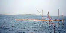
Silghat multimodal waterways terminal
Silghat multimodal waterways terminal on Brahmaputra National Waterway 2 in Sissiborgaon tehsil is part of Bharatmala and Sagarmala projects.[2] There are 19 National Waterways for the Northeast connectivity.
References
- "The Assam Co-operative Jute Mills Ltd". Retrieved 18 September 2020.
- Bharatmala presentation