McGinty Mountain
McGinty Mountain is a mountain located in San Diego County.
| McGinty Mountain | |
|---|---|
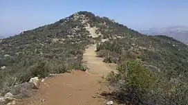 Top of McGinty Mountain | |
| Highest point | |
| Elevation | 2,185 ft (666 m) NAVD 88[1] |
| Prominence | 223 ft (68 m)[1] |
| Isolation | 1.39 mi (2.24 km)[1] |
| Coordinates | 32°44′27″N 116°50′18″W[2] |
| Geography | |
 McGinty Mountain | |
| Location | San Diego County, California, U.S. |
| Topo map | USGS Dulzura |
| Climbing | |
| Easiest route | Trail Hike class 1[3] |
The chaparral covered mountain is part of the Cleveland National Forest and accessible through a hiking trail.[3]
References
- "McGinty Mountain, California". Peakbagger.com. Retrieved 2021-09-19.
- "McGinty Mountain". Geographic Names Information System. United States Geological Survey. Retrieved 2021-09-19.
- "McGinty Mountain". SummitPost.org. Retrieved 2021-09-19.
This article is issued from Wikipedia. The text is licensed under Creative Commons - Attribution - Sharealike. Additional terms may apply for the media files.