Lumberton, North Carolina
Lumberton is a city in Robeson County, North Carolina, United States. It is the county seat of Robeson County, which is the largest county in the state by land area.[5]
Lumberton, North Carolina | |
|---|---|
City | |
 A view down Elm Street in Lumberton | |
 Lumberton Location within the state of North Carolina  Lumberton Lumberton (the United States) | |
| Coordinates: 34°37′38″N 79°0′43″W | |
| Country | United States |
| State | North Carolina |
| County | Robeson |
| Government | |
| Area | |
| • Total | 17.81 sq mi (46.14 km2) |
| • Land | 17.73 sq mi (45.93 km2) |
| • Water | 0.08 sq mi (0.20 km2) |
| Elevation | 131 ft (40 m) |
| Population (2010) | |
| • Total | 21,542 |
| • Estimate (2019)[2] | 20,484 |
| • Density | 1,155.00/sq mi (445.94/km2) |
| Time zone | UTC−5 (Eastern (EST)) |
| • Summer (DST) | UTC−4 (EDT) |
| ZIP codes | 28358-28360 |
| Area code(s) | 910 |
| FIPS code | 37-39700[3] |
| GNIS feature ID | 0989128[4] |
| Website | www.ci.lumberton.nc.us |
Located in southern North Carolina's Inner Banks region, Lumberton is located on the Lumber River. It was founded in 1787 by John Willis, an officer in the American Revolution. This was developed as a shipping point for lumber used by the Navy, and logs were guided downriver to Georgetown, South Carolina. Most of the town's growth took place after World War II.
History
The City of Lumberton was created by an Act of the North Carolina General Assembly in 1787 and it was named the county seat of Robeson County. Lumberton was incorporated in 1859.
Robeson County is located in the Coastal Plains region of southeastern North Carolina. The county was created from Bladen County in 1786 by two American Revolutionary War heroes and residents of the area, General John Willis and Colonel Thomas Robeson. The county was named after Colonel Robeson and the land for the county seat was donated by General Willis, who is credited with naming the county seat as Lumberton.
The area was a frontier destination for both white and numerous free families of color from Virginia in the late eighteenth and early nineteenth centuries. Many free blacks were descendants of white women (who were free) and African men, whether slave, free or indentured, from the colonial years, when working classes lived and worked near each other.[6] The county has a high proportion of residents who identify as Lumbee: they have been recognized as a Native American tribe both by the state of North Carolina and the Federal government; however, they do not receive federal benefits (money) because no known treaty (contract) exists between Lumbee Indians and the US government that would entitle them to federal benefits according to Dr. Ben Chavis. In short, the Lumbee Indians were never defeated in a war or removed from their land by the United States government.

For four seasons, 1947–50, Lumberton fielded a professional minor league baseball team in the Tobacco State League. Affiliated with the Chicago Cubs, the team was known as the Lumberton Cubs in 1947 and '48, and the Lumberton Auctioneers in 1949 and '50.[7]
Established in 1912, the Robeson County Health Department is recognized as the oldest rural health department in the nation. Its current headquarters is on the outskirts of Lumberton.[8] In 1970, Lumberton was named an All-American City, presented by the National Civic League. It became a two-time winner in 1995 of this award which recognizes those whose citizens work together to identify and tackle community-wide challenges and achieve uncommon results.
In 2010, the North Carolina Legislature designated Lumberton as the first "Certified Retirement Community" in North Carolina. This certification signals that Lumberton offers an unprecedented quality of living and range of amenities, services and opportunities which make it desirable to retirees. This program captured the Governor's Innovative Small Business Community Award in 2011.[9]
The Baker Sanatorium, Luther Henry Caldwell House, Carolina Theatre, Humphrey-Williams Plantation, Lumberton Commercial Historic District, Planters Building, Robeson County Agricultural Building, Alfred Rowland House, and US Post Office-Lumberton are listed on the National Register of Historic Places.[10][11]
Geography
Lumberton is located at 34°37′38″N 79°00′43″W.[12]
According to the United States Census Bureau, the city has a total area of 15.8 square miles (40.9 km2), of which 15.7 square miles (40.7 km2) are land and 0.1 square mile (0.2 km2) (0.44%) is water.
Lumberton is located on the Lumber River in the state's Coastal Plains region. The Lumber River State Park, 115 miles (185 km) of natural and scenic waterway, flows through Lumberton.
Lumberton is served by Interstate 95 and Interstate 74.
Climate
Lumberton experiences a humid subtropical climate with hot, humid summers and cool winters.
| Climate data for LUMBERTON MUNI AP, NC, 1991-2020 normals, extremes 1903-present | |||||||||||||
|---|---|---|---|---|---|---|---|---|---|---|---|---|---|
| Month | Jan | Feb | Mar | Apr | May | Jun | Jul | Aug | Sep | Oct | Nov | Dec | Year |
| Record high °F (°C) | 82 (28) |
84 (29) |
96 (36) |
96 (36) |
101 (38) |
104 (40) |
108 (42) |
106 (41) |
104 (40) |
99 (37) |
87 (31) |
83 (28) |
108 (42) |
| Average high °F (°C) | 54.6 (12.6) |
58.6 (14.8) |
65.8 (18.8) |
74.7 (23.7) |
82.5 (28.1) |
88.8 (31.6) |
91.0 (32.8) |
89.1 (31.7) |
84.2 (29.0) |
75.9 (24.4) |
65.9 (18.8) |
57.5 (14.2) |
74.1 (23.4) |
| Daily mean °F (°C) | 44.9 (7.2) |
48.0 (8.9) |
54.5 (12.5) |
62.7 (17.1) |
71.0 (21.7) |
78.8 (26.0) |
81.6 (27.6) |
80.0 (26.7) |
74.5 (23.6) |
64.2 (17.9) |
54.1 (12.3) |
47.5 (8.6) |
63.5 (17.5) |
| Average low °F (°C) | 35.3 (1.8) |
37.4 (3.0) |
43.1 (6.2) |
50.7 (10.4) |
59.5 (15.3) |
68.7 (20.4) |
72.3 (22.4) |
70.9 (21.6) |
64.8 (18.2) |
52.5 (11.4) |
42.4 (5.8) |
37.5 (3.1) |
52.9 (11.6) |
| Record low °F (°C) | −1 (−18) |
3 (−16) |
9 (−13) |
22 (−6) |
29 (−2) |
40 (4) |
50 (10) |
44 (7) |
35 (2) |
20 (−7) |
12 (−11) |
−2 (−19) |
−2 (−19) |
| Average precipitation inches (mm) | 2.55 (65) |
2.77 (70) |
3.26 (83) |
2.85 (72) |
3.41 (87) |
4.92 (125) |
4.61 (117) |
4.77 (121) |
4.93 (125) |
2.29 (58) |
2.95 (75) |
3.31 (84) |
42.62 (1,083) |
| Average precipitation days (≥ 0.01 in) | 9.1 | 8.7 | 9.6 | 8.3 | 10.0 | 11.5 | 12.2 | 13.4 | 10.3 | 7.8 | 7.9 | 9.3 | 118.1 |
| Source: NOAA[13][14] | |||||||||||||
Demographics
| Historical population | |||
|---|---|---|---|
| Census | Pop. | %± | |
| 1870 | 615 | — | |
| 1880 | 533 | −13.3% | |
| 1890 | 584 | 9.6% | |
| 1900 | 849 | 45.4% | |
| 1910 | 2,230 | 162.7% | |
| 1920 | 2,691 | 20.7% | |
| 1930 | 4,140 | 53.8% | |
| 1940 | 5,803 | 40.2% | |
| 1950 | 9,186 | 58.3% | |
| 1960 | 15,305 | 66.6% | |
| 1970 | 16,961 | 10.8% | |
| 1980 | 18,241 | 7.5% | |
| 1990 | 18,601 | 2.0% | |
| 2000 | 20,795 | 11.8% | |
| 2010 | 21,542 | 3.6% | |
| 2019 (est.) | 20,484 | [2] | −4.9% |
| U.S. Decennial Census[15] | |||

Lumberton is the larger principal city of the Lumberton-Laurinburg CSA, a Combined Statistical Area that includes the Lumberton (Robeson County) and Laurinburg (Scotland County) micropolitan areas,[16][17] which had a combined population of 159,337 at the 2000 census.[3]
2020 census
| Race | Num. | Perc. |
|---|---|---|
| White (non-Hispanic) | 6,657 | 34.99% |
| Black or African American (non-Hispanic) | 6,764 | 35.55% |
| Native American | 2,500 | 13.14% |
| Asian | 379 | 1.99% |
| Pacific Islander | 23 | 0.12% |
| Other/Mixed | 814 | 4.28% |
| Hispanic or Latino | 1,888 | 9.92% |
As of the 2020 United States census, there were 19,025 people, 7,142 households, and 4,536 families residing in the city.
2010 census
As of the 2010 United States Census, there were 21,542 people living in the city. The racial makeup of the city was 39.0% White, 36.7% Black, 12.7% Native American, 2.4% Asian, 0.1% Pacific Islander, 0.1% from some other race and 2.2% from two or more races. 6.7% were Hispanic or Latino of any race.
2000 census
As of the census[3] of 2000, there were 20,795 people, 7,827 households and 5,165 families residing in Lumberton. The population density was 1,322.4 people per square mile (510.8/km2). There were 8,800 housing units at an average density of 559.6 per square mile (216.1/km2). The racial makeup of the city was 48.54% White, 35.44% African American, 12.79% Native American, 0.91% Asian, 0.03% Pacific Islander, 1.18% from other races and 1.11% from two or more races. Hispanics or Latinos of any race were 3.30% of the population.
Of the 7,827 households, 32.2% had children under the age of 18 living with them; 38.8% were married couples living together; 23.0% had a female householder with no husband present, and 34.0% were non-families. 29.9% of all households were made up of individuals, and 12.6% had someone living alone who was 65 years of age or older. The average household size was 2.44 and the average family size was 3.01. Children of high school age (grades 9-12) attend Lumberton High School, which is run by the Public Schools of Robeson County,[19] as it is in Robeson County.
The city's population was spread out, with 26.3% under the age of 18; 9.3% from 18 to 24; 28.2% from 25 to 44; 21.3% from 45 to 64; and 14.8% who were 65 years of age or older. The median age was 35 years. For every 100 females, there were 89.1 males. For every 100 females age 18 and over, there were 85.8 males.
The median income for a household in Lumberton was $26,782, and the median income for a family was $33,839. Males had a median income of $28,903 versus $24,503 for females. The per capita income for the city was $15,504. About 23.9% of families and 25.9% of the population were below the poverty line, including 38.4% of those under age 18 and 23.7% of those age 65 or over.
Education
Public Schools of Robeson County operates public schools.
Notable people
- Angus Wilton McLean (1870–1935), served as 56th Governor of North Carolina from 1925–1929
- Brad Allen, NFL referee
- Velma Barfield (1932–1984), serial killer who murdered six people, born in South Carolina and Lumberton resident
- Benjamin Crump (born 1969), American civil rights attorney
- Brad Edwards (born 1966), defensive back who played for NFL's Minnesota Vikings, Washington Redskins, and Atlanta Falcons; director of athletics at George Mason University
- Hunter Foster (born 1969), Tony Award-nominated actor
- Penny Fuller (born 1940), film, television and Broadway actress; moved to Lumberton at age 12
- Tommy Greene (born 1967), Major League Baseball pitcher
- Carmen Hart, pornographic film actress and erotic dancer
- Dr. Johnny Hunt, elected president of Southern Baptist Convention in 2008
- Dennis F. Kinlaw, academic, president of Asbury University; author of Christian theological works
- Vonta Leach (born 1981), fullback for NFL's Baltimore Ravens
- Ashton Locklear (born 1998), gymnast
- Gene Locklear (born 1949), Major League Baseball outfielder
- Sean Locklear (born 1981), football offensive tackle
- Dwight Lowry (1957–1997), Major League Baseball player for Detroit Tigers and Minnesota Twins
- Mike McIntyre (born 1956), U.S. Representative of North Carolina's 7th Congressional District from 1997 to 2015, also practiced law in city prior to election to Congress
- Afeni Shakur (1947–2016), prominent member of Black Panther Party and mother of rapper Tupac Shakur
- John Small (1946–2012), linebacker with NFL's Atlanta Falcons and Detroit Lions
- Ida Van Smith (1917–2003), pilot and flight instructor
- Jamain Stephens (born 1974), NFL offensive tackle for Pittsburgh Steelers and Cincinnati Bengals
- Donnell Thompson (born 1958), NFL defensive end
- Betty Rose Wishart (born 1947), composer
- Tim Worley (born 1966), former running back for the Georgia Bulldogs and NFL's Pittsburgh Steelers and Chicago Bears
References
- "2019 U.S. Gazetteer Files". United States Census Bureau. Retrieved July 27, 2020.
- "Population and Housing Unit Estimates". United States Census Bureau. May 24, 2020. Retrieved May 27, 2020.
- "U.S. Census website". United States Census Bureau. Retrieved January 31, 2008.
- "US Board on Geographic Names". United States Geological Survey. October 25, 2007. Retrieved January 31, 2008.
- "Find a County". National Association of Counties. Retrieved June 7, 2011.
- Paul Heinegg, Free African Americans in Virginia, North Carolina, South Carolina, Maryland and Delaware, Baltimore, Maryland: 1995-2005
- Holaday, Chris (2016). "The Tobacco State League; A North Carolina Baseball History, 1946–1950".. Jefferson, N.C.: McFarland. ISBN 978-1-4766-6670-9.
- department, health. "Robeson County NC Health Department". publichealth.southernregionalahec.org. Retrieved April 3, 2018.
- "About Us". May 24, 2013. Retrieved April 20, 2021.
- "National Register Information System". National Register of Historic Places. National Park Service. July 9, 2010.
- "National Register of Historic Places Listings". Weekly List of Actions Taken on Properties: 4/16/12 through 4/20/12. National Park Service. April 27, 2012.
- "US Gazetteer files: 2010, 2000, and 1990". United States Census Bureau. February 12, 2011. Retrieved April 23, 2011.
- "NOWData - NOAA Online Weather Data". National Oceanic and Atmospheric Administration.
{{cite web}}: Missing or empty|url=(help) - "Summary of Monthly Normals 1991-2020". National Oceanic and Atmospheric Administration. Retrieved January 1, 2022.
- "Census of Population and Housing". Census.gov. Retrieved June 4, 2015.
- MICROPOLITAN STATISTICAL AREAS AND COMPONENTS Archived 2007-06-29 at the Wayback Machine, Office of Management and Budget, 2007-05-11. Accessed 2008-08-01.
- COMBINED STATISTICAL AREAS AND COMPONENT CORE BASED STATISTICAL AREAS Archived 2007-06-29 at the Wayback Machine, Office of Management and Budget, 2007-05-11. Accessed 2008-08-01.
- "Explore Census Data". data.census.gov. Retrieved December 10, 2021.
- "Contact Us / School Contact Numbers".
External links
- Official website of Lumberton, NC
- Lumberton Area Chamber of Commerce
- Lumberton Visitors Bureau
- Online News for Lumberton (www.lumbertontimes.com)
Municipalities and communities of Robeson County, North Carolina, United States | ||
|---|---|---|
| City | 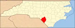 | |
| Towns | ||
| Township | ||
| CDPs | ||
| Unincorporated communities | ||
| Footnotes | ‡This populated place also has portions in an adjacent county or counties | |
| ||

