Lamongan Regency
Lamongan Regency is a regency (kabupaten) of East Java, Indonesia. It has a total land area of approximately 1,812.8 km2 (699.9 sq mi) or + 3.78% of the area of East Java Province. With a length of 47 km (29 mi) along the coastline, the sea area of Lamongan Regency is about 902.4 km2 (348.4 sq mi), if calculated to a distance of 12 miles (19 km) across the ocean surface. At the 2010 census it had a population of 1,179,059;[2] the 2020 Census produced a total of 1,379,628.[3] The administrative centre is the town of Lamongan.
Lamongan Regency
Kabupaten Lamongan | |
|---|---|
 Sunset at the village of Kandangsemangkon | |
 Coat of arms | |
| Motto(s): Memayu Raharjaning Praja (Persistent effort towards well-being of the people) | |
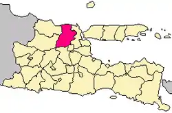 Location within East Java | |
| Coordinates: 7°07′S 112°25′E | |
| Country | Indonesia |
| Province | East Java |
| Capital | Lamongan |
| Government | |
| • Regent | vacant |
| • Vice Regent | Dra. Hj. Kartika Hidayati, M.M, MHP. |
| Area | |
| • Total | 1,812.80 km2 (699.93 sq mi) |
| Elevation | + 5 m (16 ft) |
| Population (2020 Census)[1] | |
| • Total | 1,379,628 |
| • Density | 760/km2 (2,000/sq mi) |
| Time zone | UTC+7 (IWST) |
| Area code | (+62) 322 |
| Website | lamongankab.go.id |


Lamongan Regency is surrounded by:
- Northern side : Java Sea
- Southern side : Mojokerto Regency and Jombang Regency
- Eastern side : Gresik Regency
- Western side : Tuban Regency and Bojonegoro Regency
The economy is mainly supported by agriculture, fishery, and commerce, especially home industry.
Administrative districts
Lamongan Regency consists of twenty-seven districts (kecamatan), tabulated below with their areas and population totals from the 2010 Census[4] and the 2020 Census.[5] The table also includes the number of administrative villages (rural desa and urban kelurahan) in each district, and its postal codes.
| Name | Area in km2 | Population Census 2010[6] | Population Census 2020[7] | Number of villages | Post codes |
|---|---|---|---|---|---|
| Sukorame | 41.47 | 20,126 | 21,671 | 9 | 62276 |
| Bluluk | 54.15 | 21,429 | 23,106 | 9 | 62274 |
| Ngimbang | 114.33 | 43,678 | 49,008 | 19 | 62273 |
| Sambeng | 195.44 | 47,998 | 52,727 | 22 | 62284 |
| Mantup | 93.07 | 42,750 | 46,795 | 15 | 62283 |
| Kembangbahu | 63.84 | 46,032 | 50,154 | 18 | 62282 |
| Sugio | 91.29 | 54,478 | 63,069 | 21 | 62256 |
| Kedungpring | 84.43 | 50,313 | 62,642 | 23 | 62272 |
| Modo | 77.80 | 44,988 | 51,386 | 17 | 62275 |
| Babat | 62.95 | 76,178 | 92,301 | 23 | 62271 |
| Pucuk | 44.84 | 39,053 | 49,785 | 17 | 62257 |
| Sukodadi | 52.32 | 50,682 | 57,823 | 20 | 62253 |
| Lamongan (town) | 40.38 | 65,083 | 69,517 | 20 | 62211 -62218 |
| Tikung | 52.99 | 41,483 | 45,983 | 13 | 62280 |
| Sarirejo | 47.39 | 22,503 | 24,958 | 9 | 62281` |
| Deket | 50.05 | 41,045 | 44,030 | 17 | 62291 |
| Glagah | 40.52 | 35,014 | 41,539 | 29 | 62292 |
| Karangbinangun | 52.88 | 33,285 | 40,445 | 21 | 62293 |
| Turi | 58.69 | 47,711 | 54,273 | 19 | 62252 |
| Kalitengah | 43.35 | 30,094 | 35,867 | 20 | 62255 |
| Karanggeneng | 51.32 | 36,609 | 43,702 | 18 | 62254 |
| Sekaran | 49.65 | 33,443 | 48,091 | 21 | 62260 |
| Maduran | 30.15 | 26,288 | 36,474 | 17 | 62261 |
| Laren | 95.00 | 36,492 | 51,399 | 20 | 62262 |
| Solokuro | 101.02 | 39,530 | 48,057 | 10 | 62265 |
| Paciran | 47.89 | 90,700 | 97,803 | 17 | 62264 |
| Brondong | 74.59 | 62,074 | 77,023 | 10 | 62263 |
| Totals | 1,812.80 | 1,179,059 | 1,379,628 | 474 |
Climate
Lamongan has a tropical savanna climate (Aw) with moderate to little rainfall from May to November and heavy rainfall from December to April. The following climate data is for the town of Lamongan.
| Climate data for Lamongan | |||||||||||||
|---|---|---|---|---|---|---|---|---|---|---|---|---|---|
| Month | Jan | Feb | Mar | Apr | May | Jun | Jul | Aug | Sep | Oct | Nov | Dec | Year |
| Average high °C (°F) | 30.5 (86.9) |
30.5 (86.9) |
30.7 (87.3) |
31.4 (88.5) |
31.6 (88.9) |
31.5 (88.7) |
31.1 (88.0) |
31.9 (89.4) |
32.6 (90.7) |
33.2 (91.8) |
32.9 (91.2) |
31.3 (88.3) |
31.6 (88.9) |
| Daily mean °C (°F) | 26.9 (80.4) |
26.8 (80.2) |
26.9 (80.4) |
27.3 (81.1) |
27.3 (81.1) |
27.0 (80.6) |
26.4 (79.5) |
26.9 (80.4) |
27.5 (81.5) |
28.4 (83.1) |
28.3 (82.9) |
27.4 (81.3) |
27.3 (81.0) |
| Average low °C (°F) | 23.4 (74.1) |
23.2 (73.8) |
23.2 (73.8) |
23.3 (73.9) |
23.1 (73.6) |
22.5 (72.5) |
21.8 (71.2) |
21.9 (71.4) |
22.4 (72.3) |
23.6 (74.5) |
23.8 (74.8) |
23.5 (74.3) |
23.0 (73.4) |
| Average rainfall mm (inches) | 280 (11.0) |
267 (10.5) |
272 (10.7) |
141 (5.6) |
107 (4.2) |
54 (2.1) |
33 (1.3) |
16 (0.6) |
13 (0.5) |
49 (1.9) |
118 (4.6) |
237 (9.3) |
1,587 (62.3) |
| Source: Climate-Data.org[8] | |||||||||||||
Paciran Port
On 29 April 2013, Paciran Port (Class I ASDP) was officially opened to support the overloaded Tanjung Perak Port.[9]
Sport
Persela is a football team based in Lamongan. Former Persela Lamongan goalkeeper Choirul Huda was from Lamongan.
References
- Badan Pusat Statistik, Jakarta, 2021.
- Biro Pusat Statistik, Jakarta, 2011.
- Badan Pusat Statistik, Jakarta, 2021.
- Biro Pusat Statistik, Jakarta, 2011.
- Badan Pusat Statistik, Jakarta, 2021.
- Biro Pusat Statistik, Jakarta, 2011.
- Badan Pusat Statistik, Jakarta, 2021.
- "Climate: Lamongan". Climate-Data.org. Retrieved 16 November 2020.
- "Hari Ini Menhub Resmikan Pelabuhan Paciran Lamongan". April 29, 2013. Archived from the original on June 6, 2013. Retrieved April 29, 2013.
