Kennedy Highway
The Kennedy Highway is a highway in northern Queensland, Australia. It runs as National Route 1 for approximately 243 km from Smithfield, on the northern outskirts of Cairns, to the Gulf Developmental Road in the vicinity of Forty Mile Scrub and Undara Volcanic national parks (at Minnamoolka, about 40 kilometres south of Mount Garnet).[1] South of this junction, the road continues as the Kennedy Developmental Road (State Highway 62) to Boulia about 936 kilometres away, via Hughenden. West of the junction, National Route 1 continues as the Gulf Developmental Road to Normanton.
Kennedy Highway Kennedy Developmental Road | |
|---|---|
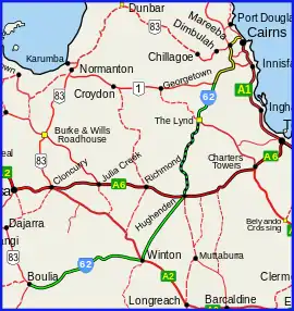 | |
| Kennedy Hwy (yellow on black), Kennedy Developmental (green on black) | |
| General information | |
| Type | Highway |
| Length | 1,179.8 km (733 mi) |
| Route number(s) | (Smithfield – Minnamoolka) (Minnamoolka – Boulia) |
| Major junctions | |
| NE end | |
| |
| SW end | |
| Location(s) | |
| Major settlements | Mareeba, Ravenshoe, Hughenden, Winton |
| Highway system | |
Route description

From Smithfield, the highway climbs up into the Atherton Tableland before heading in a general south-westerly direction to the aforementioned junction. The highway is mostly two-lanes. Major towns on, or just off, the Kennedy Highway include Smithfield, Kuranda, Mareeba, Atherton, Ravenshoe and Mount Garnet. Past Mount Garnet, the Kennedy Highway has several long sections of single lane bitumen. The section between The Lynd Roadhouse junction at Conjuboy and Hughenden is mostly unsealed and is also known as the Hann Highway.[2]
For a distance of more than 100 km, from the crossing on the Diamantina River to a point southwest of Middleton, the Kennedy Developmental Road passes across a roughly circular zone measuring some 130 km (81 mi) across that has been identified by Geoscience Australia as a crustal anomaly, the Diamantina River ring feature. Proof is currently lacking as to the cause, but it is believed likely that the anomaly was caused by an asteroid strike that happened about 300 million years ago.[3]
Development proposal
Two northern councils (Etheridge and Flinders) have proposed development of the Hann Highway which would allow for the transport of products from Far North Queensland to markets in New South Wales and Victoria considerably quicker than via existing coastal routes which have rougher terrain and are sometimes impassable due to floods.[4]
Upgrades
The Northern Australia Roads Program announced in 2016 included two projects for the Kennedy Developmental Road.
Road widening
The project for widening a section of road from a one-lane seal to a two-lane seal between Mount Garnet and The Lynd was completed in early 2018 at a total cost of $3.3 million.[5]
Road upgrading
The project for upgrading sections of the road between The Lynd and Hughenden was completed in early 2020 at a total cost of $47.9 million.[6]
Major intersections
| LGA | Location | km | mi | Destinations | Notes |
|---|---|---|---|---|---|
| Cairns | Smithfield | 0 | 0.0 | south (National Route 1) Cairns | North-eastern end of Kennedy Highway (National Route 1) From here to Kuranda the road is more commonly known as Kuranda Range road. |
| Barron River | 12.6 | 7.8 | Bridge at Kuranda | ||
| Barron River | 47.3 | 29.4 | Bridge at Mareeba | ||
| Mareeba | Mareeba | 48.1 | 29.9 | Mareeba Connection Road – north – Mareeba | |
| 48.9 | 30.4 | ||||
| Tablelands | Atherton | 80.3 | 49.9 | Western concurrency terminus with State Route 52 | |
| 81.0 | 50.3 | Eastern concurrency terminus with State Route 52 | |||
| 83.9 | 52.1 | ||||
| Scrubby Creek | 90.1 | 56.0 | Bridge at Wongabel[7] | ||
| Tablelands | Wondecla[8] / Evelyn boundary | 108.4 | 67.4 | ||
| Evelyn | 117.2 | 72.8 | |||
| Wild River, which becomes Herbert River just downstream (south) of this point | 154.9 | 96.3 | Bridge at Millstream[9] / Innot Hot Springs boundary | ||
| Tablelands | Minnamoolka | 243.5 | 151.3 | This intersection is widely known as "Forty Mile Scrub" after the national park situated there. Kennedy Highway continues south as Kennedy Developmental Road (State Route 62) | |
| Etheridge | Conjuboy | 338.4 | 210.3 | This intersection is widely known as "The Lynd" after the roadhouse situated there. From here to Hughenden the road is more commonly known by its former name, the Hann Highway. | |
| Flinders River | 603.7 | 375.1 | Bridge at Hughenden | ||
| Flinders | Hughenden | 604.1 | 375.4 | west – Richmond | Eastern concurrency terminus with Flinders Highway |
| 604.4 | 375.6 | Western concurrency terminus with Flinders Highway. Kennedy Developmental Road continues south-west via Resolution Street. | |||
| Winton | Winton | 819.7 | 509.3 | north-west – Cloncurry | Eastern concurrency terminus with Landsborough Highway. Kennedy Developmental Road enters Winton as Manuka Street. |
| Corfield | 825.6 | 513.0 | Western concurrency terminus with Landsborough Highway | ||
| Boulia | Boulia | 1,179.8 | 733.1 | south-west – Birdsville | Western end of Kennedy Developmental Road (State Route 62) |
1.000 mi = 1.609 km; 1.000 km = 0.621 mi
| |||||
References
| Wikimedia Commons has media related to |
- Hema, Maps (2007). Australia Road and 4WD Atlas (Map). Eight Mile Plains Queensland: Hema Maps. pp. 13–14. ISBN 978-1-86500-456-3.
- ABC news Hann Highway upgrade
- "Potential asteroid impact identified in western Queensland". Geoscience Australia. 17 March 2015. Retrieved 26 June 2016.
- Sam Davis (2 August 2012). "Queensland roads holding back nation's fresh fruit". ABC Far North Queensland. Australian Broadcasting Corporation. Retrieved 21 September 2012.
- "Kennedy Developmental Road (Mount Garnet - The Lynd) Pavement Widening". Department of Infrastructure, Transport, Regional Development and Communications. 13 September 2021. Retrieved 30 March 2022.
- "Kennedy Developmental Road (The Lynd - Hughenden) Progressive Sealing". Department of Infrastructure, Transport, Regional Development and Communications. 13 September 2021. Retrieved 30 March 2022.
- Google (1 August 2017). "Wongabel, Queensland" (Map). Google Maps. Google. Retrieved 1 August 2017.
- Google (1 August 2017). "Wondecla, Queensland" (Map). Google Maps. Google. Retrieved 1 August 2017.
- Google (1 August 2017). "Millstream, Queensland" (Map). Google Maps. Google. Retrieved 1 August 2017.