List of Historic Sites of Japan (Ishikawa)
National Historic Sites
As of 1 August 2019, twenty-six Sites have been designated as being of national significance, including the Kaga Domain Maeda Clan Graves and Kaetsu border castle ruins, which span the prefectural borders with Toyama.[2][3][4]
| Site | Municipality | Comments | Image | Coordinates | Type | Ref. |
|---|---|---|---|---|---|---|
| Chikamori Site チカモリ遺跡 Chikamori iseki |
Kanazawa | Jōmon period settlement trace |  Chikamori Site |
36°33′22″N 136°36′17″E | 1 | 1018 |
| Amenomiya Kofun Cluster 雨の宮古墳群 Amenomiya kofun-gun |
Nakanoto | Kofun period tumuli cluster |  Amenomiya Kofun Cluster |
36°58′15″N 136°51′38″E | 1 | 1015 |
| Kamo Site 加茂遺跡 Kamo iseki |
Tsubata | Nara period settlement trace | 36°41′09″N 136°43′35″E | 2, 6 | 00003892 | |
| Yoshizaki-Suba Site 吉崎・次場遺跡 Yoshizaki-Suba iseki |
Hakui | Yayoi period settlement trace |  Yoshizaki-Suba Site |
36°54′20″N 136°47′24″E | 1 | 1016 |
| Kanazawa Castle Site 金沢城跡 Kanazawa-jō ato |
Kanazawa | Edo period castle |  Kanazawa Castle Site |
36°33′58″N 136°39′33″E | 2 | 00003596 |
| Kutani Ware Kiln Site 九谷磁器窯跡 Kutani-jiki kama ato |
Kaga | Edo period kiln ruins |  Kutani Ware Kiln Site |
36°12′04″N 136°25′18″E | 6 | 1011 |
| Kitsuneyama Kofun 狐山古墳 Kitsuneyama kofun |
Kaga | Kofun period tumulus |  Kitsuneyama Kofun |
36°18′30″N 136°22′46″E | 1 | 992 |
| Okyōzuka Site 御経塚遺跡 Okyōzuka iseki |
Nonoichi | Jōmon period settlement trace |  Okyōzuka Site |
36°32′47″N 136°35′57″E | 1 | 1009 |
| Sandenkanaya Kofun 散田金谷古墳 Sandenkanaya kofun |
Hōdatsushimizu | Kofun period tumulus | 36°51′20″N 136°48′58″E | 1 | 1013 | |
| Jike Site 寺家遺跡 Jike iseki |
Hakui | Jōmon/Yayoi period settlement trace | 36°55′12″N 136°46′21″E | 1 | 00003746 | |
| Nanao Castle ruins 七尾城跡 Nanao-jō ato |
Nanao | Sengoku period castle ruins |  Nanao Castle Site |
37°00′41″N 136°58′53″E | 2 | 993 |
| Suzu Pottery Kiln Sites 珠洲陶器窯跡 Suzu-tōki kama ato |
Suzu, Noto | Kamakura period kiln ruins | 37°23′43″N 137°12′40″E | 6 | 00003600 | |
| Kamiyamada Shell Mound 上山田貝塚 Kamiyamada kaizuka |
Kahoku | Jōmon period shell midden |  Kamiyamada Shell Mound |
36°43′01″N 136°43′01″E | 1 | 1014 |
| Mawaki Site 真脇遺跡 Mawaki iseki |
Noto | Jōmon period settlement trace |  Mawaki Site |
37°18′20″N 137°12′27″E | 1 | 1019 |
| Susoezoana Kofun 須曽蝦夷穴古墳 Susoezoana kofun |
Nanao | Kofun period tumulus |  Susoezoana Kofun |
37°06′28″N 136°58′00″E | 1 | 1012 |
| Mount Sekidō 石動山 Sekidōsan |
Nakanoto | holy mountain in Nara/Heian periods |  Mount Sekidō |
36°57′30″N 136°58′23″E | 3 | 1010 |
| Tatsumi Canal 辰巳用水附土清水塩硝蔵跡 Tatsumi yōsui tsuketari Tsutchōzu enshō-gura ato |
Kanazawa | Edo period civil engineering; designation includes the site of the Tsutchōzu nitre warehouse |  Tatsumi Canal |
36°33′33″N 136°39′59″E | 6 | 00003660 |
| Torigoe Castle ruins 鳥越城跡附二曲城跡 Torigoe-jō ato tsuketari Futoge-jō ato |
Hakusan | Sengoku period castle ruins; designation includes the site of Futoge Castle |  Torigoe Castle Site |
36°21′58″N 136°36′04″E | 2 | 1017 |
| Tōdai-ji Yokoe Shōen ruins 東大寺領横江荘遺跡 Tōdaiji-ryō Yokoe-no-shō iseki |
Kanazawa, Hakusan | Heian period settlement trace; designation includes the Yokoe Manor House (横荘家跡) (pictured) and Kamiaraya (上荒屋遺跡) |  Torigoe Castle Site |
36°32′57″N 136°34′57″E | 6 | 1005 |
| Noto Kokubun-ji ruins 能登国分寺跡附建物群跡 Noto Kokubunji ato tsuketari tatemono-gun ato |
Nanao | Nara/Heian period provincial temple of Noto Province | .jpg.webp) Noto Kokubunji Site |
37°01′30″N 136°57′27″E | 3 | 1006 |
| Nomi Kofun Cluster 能美古墳群 Nomi kofun-gun |
Nomi | Kofun period tumuli cluster; designation comprises five clusters of kofun: the Teraiyama Kofun Cluster (寺井山古墳群), Wadayama Kofun Cluster (和田山古墳群), Matsujiyama Kofun Cluster (末寺山古墳群), Akitsuneyama Kofun Cluster (秋常山古墳群), and Nishiyama Kofun Cluster (西山古墳群) |  Nomi Kofun Cluster |
36°26′50″N 136°30′34″E | 1 | 1007 |
| Hōōzan Cave Tombs 法皇山横穴古墳 Hōōzan yokoana kofun |
Kaga | Kofun period cave-tombs |  Hōōzan Cave Tombs |
36°17′57″N 136°23′35″E | 1 | 991 |
| Suematsu temple ruins 末松廃寺跡 Suematsu Haiji ato |
Nonoichi | Asuka period temple ruins |  Suematsu Haiji Site |
36°30′29″N 136°35′23″E | 3 | 996 |
| Mangyō Site 万行遺跡 Mangyō iseki |
Nanao | Yayoi/Kofun period settlement trace | 37°02′44″N 136°59′35″E | 1 | 3376 | |
| Kaga Domain Maeda Clan Graves 加賀藩主前田家墓所 Kaga-han-shu Maeda-ke bosho |
Kanazawa | Edo period cemetery; designation includes an area of Takaoka in Toyama Prefecture | 36°31′45″N 136°40′06″E | 7 | 00003621 | |
| Kaetsu border castle ruins 加越国境城跡群及び道 切山城跡 松根城跡 小原越 Kaetsu-kuni-zakai shiro ato-gun oyobi michi Kiriyama-jō ato Matsune-jō ato Ohara-goe |
Kanazawa | designation includes the sites of Kiriyama Castle, Matsune Castle, and Ohara Pass and an area of Oyabe in Toyama Prefecture |  Kaetsu Territory Castle Sites and Roads |
36°36′58″N 136°47′00″E | 6 | 00003879 |
Prefectural Historic Sites
As of 1 May 2019, twenty-four Sites have been designated as being of prefectural importance.[4][5]
| Site | Municipality | Comments | Image | Coordinates | Type | Ref. |
|---|---|---|---|---|---|---|
| Ataka Barrier Site 安宅の関跡 Ataka no seki ato | Komatsu |  | 36°25′10″N 136°25′05″E | |||
| Yoshimitsu Ichirizuk 吉光の一里塚 Yoshimitsu no ichirizuka | Nomi | 36°27′10″N 136°29′58″E | ||||
| Chūda Stele 中段の板碑 Chūda no itabi | Wajima | inscribed Shōō 5 (1292) | 37°23′01″N 136°53′01″E | |||
| Gobyō Valley 御廟谷 Gobyō-tani | Kanazawa | graves to the south of Tako Castle (高尾城) | 36°30′16″N 136°37′41″E | |||
| Taira Takitada clan cemetery 平時忠卿及びその一族の墳 Taira Takitada oyobi ichisoku no haka | Suzu | 37°29′18″N 137°11′43″E | ||||
| Asainawate Battlefield 浅井畷古戦場 Asainawate ko-senjō | Komatsu | 36°22′58″N 136°27′04″E | ||||
| Former Fukura Lighthouse 旧福浦灯台 kyū-Fukura-tōdai | Shika | 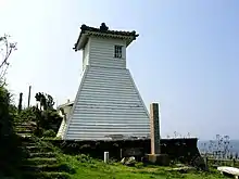 | 37°04′59″N 136°43′23″E | |||
| Ishibotokeyama Ritual Site 祭祀遺跡石仏山 saishi iseki Ishibotokeyama | Noto | matsuri on 1–2 March | 37°16′13″N 137°03′41″E | |||
| Shibagaki Kofun Cluster 柴垣古墳群 Shibagaki kofun-gun | Hakui | 36°56′49″N 136°45′54″E | ||||
| Innaichokushizuka Kofun 院内勅使塚古墳 Innaichokushizuka kofun | Nanao | 37°00′22″N 136°55′55″E | ||||
| Ushitsusakiyama Jōmon Site 宇出津崎山縄文遺跡 Ushitsusakiyama Jōmon iseki | Noto | 37°18′03″N 137°09′01″E | ||||
| Pine-lined Former Entrance to Kanazawa 松並木の旧金沢下口往還 matsunamiki no kyū-Kanazawa shimoguchi ōkan | Kanazawa | 36°37′32″N 136°42′01″E | ||||
| Uketsukagoshi No.1 Kofun 宇気塚越一号墳 Uketsukagoshi ichigō-fun | Kahoku | 36°43′49″N 136°42′54″E | ||||
| Jitō-machi Mediaeval Cave Tombs (Yagura) 地頭町中世墳墓窟(やぐら)群 Jitō-machi chūsei funbo-gutsu (yagura) gun | Shika | 37°08′08″N 136°43′47″E | ||||
| Kanmachi Mandara Kofun Cluster 上町マンダラ古墳群 Kanmachi Mandara kofun-gun | Nanao | 37°07′19″N 136°50′37″E | ||||
| Yōkō-ji 永光寺 Yōkōji | Hakui |  | 36°54′46″N 136°51′04″E | |||
| Myōsen-ji Stone Tō Group 明泉寺石塔群在地 Myōsenji sekitō-gun zaichi | Anamizu | 37°13′49″N 137°03′25″E | ||||
| Akakurayama 赤蔵山 Akakurayama | Nanao | 37°02′41″N 136°52′00″E | ||||
| Suemori Castle ruins 末森城跡 Suemori-jō ato | Hōdatsushimizu |  | 36°50′02″N 136°46′43″E | |||
| Ōumi-Nishiyama Site 大海西山遺跡 Ōumi-Nishiyama iseki | Kahoku | 36°46′32″N 136°45′20″E | ||||
| Kiya Site 気屋遺跡 Kiya iseki | Kahoku | 36°43′29″N 136°43′45″E | ||||
| Ishinotatezuka 石の木塚 Ishinotatezuka | Hakusan | 36°30′44″N 136°30′27″E | ||||
| Otachi Fortified Residence Site 御舘館跡 Otachi tate ato | Hōdatsushimizu | 36°47′56″N 136°46′03″E | ||||
| Hokkoku Kaidō Kurikara Pass Road 北国街道倶利伽羅峠道 Hokkoku kaidō Kurikara-tōge michi | Tsubata | 36°39′42″N 136°49′00″E | ||||
Municipal Historic Sites
As of 1 May 2019, a further one hundred and seventy-seven Sites have been designated as being of municipal importance.[6]


See also
| Wikimedia Commons has media related to National historic sites in Ishikawa prefecture. |
| Wikimedia Commons has media related to Prefectural Historic Sites in Ishikawa Prefecture. |
References
- "Cultural Properties for Future Generations". Agency for Cultural Affairs. Retrieved 30 August 2019.
- 史跡名勝天然記念物 [Number of Monuments of Japan by Prefecture] (in Japanese). Agency for Cultural Affairs. 1 August 2019. Retrieved 30 August 2019.
- "Database of National Cultural Properties: 史跡名勝天然記念物 (史跡, 特別史跡 石川県 2県以上)" (in Japanese). Agency for Cultural Affairs. Archived from the original on 30 June 2019. Retrieved 30 August 2019.
- 石川県内の国・県指定文化財件数 [Number of National and Prefectural Cultural Properties in Ishikawa Prefecture] (in Japanese). Ishikawa Prefecture. 1 February 2019. Retrieved 30 August 2019.
- 都道府県別指定等文化財件数(都道府県分) [Number of Prefectural Cultural Properties by Prefecture] (in Japanese). Agency for Cultural Affairs. 1 May 2019. Retrieved 30 August 2019.
- 都道府県別指定等文化財件数(市町村分) [Number of Municipal Cultural Properties by Prefecture] (in Japanese). Agency for Cultural Affairs. 1 May 2019. Retrieved 30 August 2019.
External links
- (in Japanese) Cultural Properties of Ishikawa Prefecture
This article is issued from Wikipedia. The text is licensed under Creative Commons - Attribution - Sharealike. Additional terms may apply for the media files.