Drinkstone
Drinkstone is a small settlement and civil parish in Suffolk, England. Its name is derived from Dremic's homestead. It was located in the hundred of Thedwastre.[2] It is near the A14 road and is 6 miles (10 km) southeast of the town of Bury St Edmunds. It is mentioned in the Domesday Book, 1086.
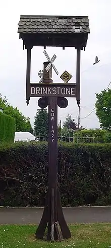
Signpost in Drinkstone
| Drinkstone | |
|---|---|
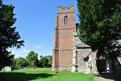 All Saints Church, Drinkstone | |
 Drinkstone Location within Suffolk | |
| Area | 9.081 km2 (3.506 sq mi) |
| Population | 548 (2011)[1] |
| • Density | 60/km2 (160/sq mi) |
| OS grid reference | TL9561 |
| District | |
| Shire county | |
| Region | |
| Country | England |
| Sovereign state | United Kingdom |
| Post town | Bury St. Edmunds |
| Postcode district | IP30 |
| Dialling code | 01449 |
| Police | Suffolk |
| Fire | Suffolk |
| Ambulance | East of England |
All Saint's Church dates from the 14th century. The tower was added c.1760 and the church restored in 1866–72. It is a grade II* listed building.[3]
Drinkstone windmills are a pair of windmills in the parish consisting of a post mill and a smock mill.
Second World War
The 2024 Quartermaster Truck Company (Aviation) of the United States Army Air Force was stationed here in 1945.[4]
Notable people
- Joshua Grigby MP, settled in Drinkstone, building a mansion at Drinkstone Park in 1760.[2]
References
- "Civil Parish population 2011". Neighbourhood Statistics. Office for National Statistics. Retrieved 20 August 2016.
- Goult, Wendy (1990). Survey of Suffolk Parish History West Suffolk (PDF). Ipswich: Suffolk County Council. ISBN 0860551393.
- Historic England. "CHURCH OF ALL SAINTS (1352345)". National Heritage List for England. Retrieved 11 April 2014.
- Vogels, Fred. "Thursday 18 January 1945". Back to Normandy. Retrieved 29 June 2020.
External links
![]() Media related to Drinkstone at Wikimedia Commons
Media related to Drinkstone at Wikimedia Commons
| Boroughs or districts | |
|---|---|
| Major settlements | |
| Topics | |
This article is issued from Wikipedia. The text is licensed under Creative Commons - Attribution - Sharealike. Additional terms may apply for the media files.