2021–22 Australian region cyclone season
The 2021–22 Australian region cyclone season was a below average tropical cyclone season for the waters surrounding Australia between longitudes 90°E and 160°E. The current season began from 1 November 2021 and ended on 30 April 2022, but a tropical cyclone could form at any time between 1 July 2021 and 30 June 2022 and would count towards the season total. During the season, tropical cyclones will be officially monitored by one of the three tropical cyclone warning centres (TCWCs) for the region which are operated by the Australian Bureau of Meteorology, National Weather Service of Papua New Guinea and the Indonesian Agency for Meteorology, Climatology and Geophysics. The United States Joint Typhoon Warning Center (JTWC) and other national meteorological services including Météo-France and the Fiji Meteorological Service will also monitor the basin during the season.
| 2021–22 Australian region cyclone season | |
|---|---|
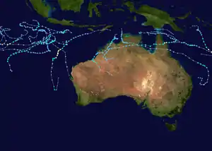 Season summary map | |
| Seasonal boundaries | |
| First system formed | 9 November 2021 |
| Last system dissipated | 29 April 2022 |
| Strongest storm | |
| Name | Vernon |
| • Maximum winds | 185 km/h (115 mph) (10-minute sustained) |
| • Lowest pressure | 950 hPa (mbar) |
| Seasonal statistics | |
| Tropical lows | 29 |
| Tropical cyclones | 9 |
| Severe tropical cyclones | 2 |
| Total fatalities | 2 |
| Total damage | > $36,000 (2021 USD) |
| Related articles | |
Season summary


A tropical low developed to the north of the Western Region on 9 November, starting the season and the overall Southern Hemisphere season as well. After passing near the Cocos Islands with rainfall, it exiting the basin into the South-West Indian Ocean region on 14 November. Three days later, Tropical Low 02U formed near the Christmas Island and later became Tropical Cyclone Paddy, the first named cyclone in this season.[1] On 22 November, Tropical Low 03U formed and it exited the basin on 28 November. On 1 December, Tropical Cyclone Teratai was designated by TCWC Jakarta, but BoM downgraded to a tropical low later that day due to limited deep convection.[2] Ex-Teratai was monitored for redevelopment for a few days, and on 7 December, the system was re-upgraded to tropical storm status. The system later dissipated on 11 December.[2][3] On 9 December, BoM designated Tropical Low 07U and later became Tropical Cyclone Ruby, which peaked as a Category 1-equivalent tropical cyclone before entering the South Pacific basin.[4] About two weeks later, Tropical Low 08U was monitored for development but made landfall before further strengthening could occur. The tropical low later entered the Coral Sea where Tropical Cyclone Seth peaked with winds of 70 mph.[5] A couple days after Seth dissipated, Tropical Low 10U quickly organized and was named Tiffany. The tropical cyclone rapidly intensified to a Category 1-equivalent tropical cyclone before making landfall over Northern Queensland.[6] Land interaction and wind shear significantly weakened the system. Tiffany later made a second landfall over Northern Territory without restrengthening much over the Gulf of Carpentaria. On 23 January, a tropical low was monitored for a couple days before entering the South-West Indian Ocean, which later became Cyclone Batsirai and caused devastation to Madagascar. On 29 January, BoM started to track Tropical Low 16U and exited the basin without affecting land. Meanwhile, Tropical Low 14U caused record flooding in the Kimberly Region.[7] A week later, Tropical Low 17U formed and initially the system had deep convection and a well defined center, but easterly shear and dry air prevented strengthening and was last noted on 14 February. The same day that 17U was designated, Tropical Low 18U was briefly monitored before entering the South Pacific basin and became Severe Tropical Cyclone Dovi.[8] On 13 February, Tropical Low 19U formed southeast of Christmas Island and exited the basin a few days later, which was later designated as Moderate Tropical Storm Fezile. On 23 February, Tropical Low 22U quickly developed deep convection and an inner core, and BoM upgraded the system to Tropical Cyclone Vernon. Afterward, the system underwent rapid intensification and peaked as a Category 4 severe tropical cyclone before interacting with Tropical Low 25U. While Vernon stayed out to sea and entered the South-West Indian Ocean, Tropical Low 21U developed in the Torres Strait, but high wind shear prevented further development. At the same time, Tropical Low 23U was monitored in the Timor Sea and later became Tropical Cyclone Anika before making landfall northeast of Kalumburu. Anika made a second landfall east of Pardoo, and briefly developed a better inner core inland due to the brown ocean effect.[9] Tropical Low 26U was also monitored for development east of Christmas Island and attained tropical storm force winds, but high easterly wind shear caused the system to disintegrate. On 11 March, Tropical Low 27U formed south of Java and quickly developed an inner core before being named Billy and stayed out to sea as the system eventually succumbed to high wind shear.[10] A few days later, Tropical Low 28U formed southwest of Sumba and was later named Charlotte. The tropical cyclone rapidly intensified quicker than expected and peaked as a Category 3-equivalent tropical cyclone while attempting to clear out a pinhole eye.[11] However, the peak was relatively short-lived as the convection got sheared and Charlotte transitioned to an extratropical cyclone. On 30 March, a tropical low formed on Christmas Island and dissipated a couple days later. Another tropical low formed on 8 April, but did not impact any habitable areas. In mid-April, Tropical Low 33U formed in the Gulf of Carpentaria and dissipated a few days later.[12] Tropical Low 34U also formed, but did not impact land. Around its peak, there was an eye-like feature, but northwesterly shear caused the system to become disorganized.[13]
Systems
Tropical Cyclone Paddy
| Category 1 tropical cyclone (Australian scale) | |
| Tropical storm (SSHWS) | |
  | |
| Duration | 18 November – 25 November |
|---|---|
| Peak intensity | 75 km/h (45 mph) (10-min) 995 hPa (mbar) |
During 18 November, the BoM reported that Tropical Low 02U had developed in a trough of low pressure, just to the west of Christmas Island.[14][15] Over the next couple of days, the system remained slow-moving near the island before it started to move south-eastwards.[16][17] On 21 November of 04:00 UTC, the JTWC issued a Tropical Cyclone Formation Alert (TCFA) for Invest 90S which the agency was tracking very recently.[18] By 03:00 UTC of 22 November, the BoM upgraded the tropical low to a Category 1 tropical cyclone on the Australian scale and named it Paddy, becoming the first named cyclone in this season.[19][1] The JTWC later did the same thing at 09:00 UTC.[20]
At this time, it started to incline south-southeastwards with its pressure bottoming to 997 mbar (29.44 inHg). Three hours later, the BoM noted that Paddy continued to organize, with gale-force winds circling along its western and southern sides, according to scatterometer passes. The agency also nudged the system's intensity to 40 kn (75 km/h; 45 mph), which would eventually be Paddy's eventual maximum 10-minute sustained winds. Sea surface temperatures around 28 °C (82 °F), low wind shear and favorable upper-level divergence were the factors behind Paddy's intensification.[21] Convection started to decrease by 12:00 UTC; however, it managed to maintain its sustained wind speed as Paddy turned towards the south.[22] Early on the next day, dry air started to affect the storm, leading to Paddy's further disorganization as the system turned west-southwestwards and southwestwards.[23] As it moved west-northwestwards, it started to weaken and as it turned further westwards by 18:00 UTC of 23 November, the BoM issued its final warning as Paddy weakened into a tropical low.[24][25] On the next day the JTWC issued a final warning.[26] The BoM still tracked the system until 26 November.
Paddy remained far from major landmasses throughout its existence; however, it brought prolonged rainfall to Christmas Island. During a five-day period from 17 to 21 November, the island saw 251.2 mm (9.89 in) of rain.[27]
Tropical Cyclone Teratai
| Category 1 tropical cyclone (Australian scale) | |
| Tropical storm (SSHWS) | |
  | |
| Duration | 30 November – 11 December |
|---|---|
| Peak intensity | 75 km/h (45 mph) (10-min) 996 hPa (mbar) |
On 29 November, BoM predicted a formation of a tropical low which they designated as 05U.[28] On the next day, 05U formed which was located adjoining regions to the Christmas Island and the island of Java.[29] At 23:30 UTC of the same day, the JTWC issued a TCFA for the system as the agencies found that the convection in associated with the system had increased.[30] At 09:00 UTC, the JTWC upgraded the system to a tropical storm, as it briefly attained sufficient convection.[31] Later, the BoM briefly upgraded it to a Category 1 tropical cyclone on the Australian scale at 12:00 UTC of 1 December, and named it Teratai which was given by TCWC Jakarta.[2] But at 18:00 UTC, the BoM downgraded to a tropical low as deep convection had become limited, with the LLCC displaced towards the south. This was caused due to the lack of sufficient outflow caused by the northerly strait line flow which inhibited the system from further intensifying, despite favorable conditions.[2][32] The JTWC followed the suite two hours later.[32] During the next few days, the BoM monitored ex-Teratai for redevelopment as the system executed a clockwise loop.[33] On 6 December the JTWC issued a TCFA,[34] and the next day it re-upgraded the system to a tropical storm.[3] However, by 09:00 UTC of 9 December, JTWC issued its final warning.[35] The BoM continued to track the system until 11 December.[36]
Tropical Cyclone Ruby
| Category 2 tropical cyclone (Australian scale) | |
| Category 1 tropical cyclone (SSHWS) | |
  | |
| Duration | 9 December – 13 December (Exited basin) |
|---|---|
| Peak intensity | 110 km/h (70 mph) (10-min) 982 hPa (mbar) |
On 6 December 2021, the BoM predicted that a tropical low could form near the Solomon Sea.[37] Two days later, the BoM designated it as 07U when the system was expected to develop further.[38] The JTWC later issued a TCFA.[39] The system had fully organised into a tropical low, when the BoM had begun initiating advisories on 10 December. On the next day the JTWC upgrade to tropical storm.[40] and it was latter upgraded to Category 1 Tropical Cyclone on the Australian scale named it Ruby on 12 December, according to BoM.[41] At 18:00 UTC BoM upgrade to Category 2 system and JTWC following and upgrade to category 1-equivalent tropical cyclone,[4][42] and the next day Ruby crossed into the South Pacific basin.[43][44][45]
Tropical Cyclone Seth
| Category 2 tropical cyclone (Australian scale) | |
| Tropical storm (SSHWS) | |
  | |
| Duration | 24 December – 6 January |
|---|---|
| Peak intensity | 110 km/h (70 mph) (10-min) 983 hPa (mbar) |
On 21 December 2021, the BoM started to monitor a possible tropical low near the Arafura Sea.[46] The JTWC also classified the system as Invest 97S late on 22 December. On the next day, the BoM designated the disturbance as Tropical Low 08U.[47] By 24 December, BoM began issuing advisories on the system, predicting a Category 1 intensity before landfall, while the JTWC issued a TCFA at 21:00 UTC on the same day.[48] However, the TCFA was cancelled at 18:00 UTC on 25 December, since the system moved inland, and the BoM ceased issuing advisories as well. However, the tropical low kept moving eastward and entered the Coral Sea. At 02:30 UTC on 30 December, the JTWC issued a TCFA again on the system; however, at 02:30 UTC on 31 December, the TCFA was cancelled, due to the system developing subtropical characteristics. At 03:00 UTC on the same day, the BoM upgraded the low to a Category 1 tropical cyclone on the Australian scale and named it Seth. At 15:00 UTC, the JTWC finally classified it as a tropical cyclone, designating the system with the identifier 04P. The cyclone reached its peak intensity at 18:00 UTC that day, while the BoM upgraded it to a Category 2 tropical cyclone, with sustained winds of 110 km/h (70 mph). At 00:00 UTC on 1 January, the BoM downgraded the system to a Category 1 tropical cyclone. At 06:00 UTC on the next day, the BoM classified the system as a subtropical cyclone, in their final advisory on the system.[5] As a post-tropical cyclone, Seth killed 2 people; one in Queensland and the other in New South Wales.[49][50]
Tropical Cyclone Tiffany
| Category 2 tropical cyclone (Australian scale) | |
| Category 1 tropical cyclone (SSHWS) | |
  | |
| Duration | 8 January – 17 January |
|---|---|
| Peak intensity | 95 km/h (60 mph) (10-min) 989 hPa (mbar) |
On 4 January, the BoM started to monitor a possible tropical low near the Coral Sea.[51] By 8 January, BoM began issuing advisories on the system.[52] On the next day the BoM designated it as 10U.[53] Within few hours since the BoM began issuing advisories, the low was named as Tropical Cyclone Tiffany as it was rapidly consolidating itself.[6] It was followed by the rapid intensification for a span of 12 hours since it named from 06:00 UTC to 18:00 UTC of 9 January by windspeed increasing from 65 kmph to 120 kmph. With the same intensity on 00:00 UTC of 10 January, the storm made landfall over Northern Queensland. Due to land interaction, it rapidly weakened overland and became a weak tropical low. The low entered into the Gulf of Carpentaria with that intensity by the same night. Despite the considerable increase in wind shear, the low again re-intensified into a Category 1 tropical cyclone in Australian scale while meandering over the same area. The JTWC estimated secondary peak intensity of 100 kmph windspeed in one minute mean. On 00:00 UTC of 11 January, the storm made second landfall over the Northern Territory region and was followed by rapid weakening. The JTWC stopped issuing advisories by the same time.
Tiffany brought gusty winds and heavy rainfall exceeding 100 mm (3.9 in) to the Top End. A house near Katherine suffered around A$50,000 (US$36,000) in damage from fallen trees.[54]
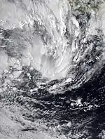
Tropical Low (Batsirai)
| Tropical low (Australian scale) | |
_2022-01-24_6000Z.jpg.webp)  | |
| Duration | 23 January – 25 January (Exited basin) |
|---|---|
| Peak intensity | Winds not specified 1003 hPa (mbar) |
On 23 January, the BoM reported that a tropical low had formed in the northwestern portion of the basin.[55][56] The system moved in a westward direction until it was last tracked on 25 January, when it had exited the basin and moved into the South-West Indian Ocean.[57] At its peak intensity in the Australian region, the BoM estimated the system's minimum atmospheric pressure as 1003 hPa.[58] The MFR began tracking the system, with the system intensifying into Moderate Tropical Storm Batsirai on 27 January.[59][60]
Tropical Low 16U
| Tropical low (Australian scale) | |
| Tropical storm (SSHWS) | |
  | |
| Duration | 29 January – 3 February (Exited basin) |
|---|---|
| Peak intensity | 65 km/h (40 mph) (10-min) 995 hPa (mbar) |
On 29 January, the BoM started tracking a tropical low. They designated it as 16U. The JTWC upgraded it to a tropical cyclone and designated it as Tropical Cyclone 09P late on 31 January. On 3 February, 16U exited the basin and entered the South Pacific Basin.
Tropical Low 14U
| Tropical low (Australian scale) | |
  | |
| Duration | 30 January – 6 February |
|---|---|
| Peak intensity | Winds not specified 1003 hPa (mbar) |
Tropical Low 14U formed on 30 January and dissipated on 6 February.
In Western Australia, prolific rains affected the Kimberly Region with some areas recording accumulations not seen in over a century. Country Downs measured 843 mm (33.2 in) by 2 February, including 652.2 mm (25.68 in) in a 24-hour span. The latter constituted the second-highest daily rainfall on record in the state. Flooding occurred along the Fitzroy River, covering roads, washing out topsoil, knocking down fences, and toppling trees. More than 80,000 lightning strikes were observed around Broome.[61] Rainfall in the city reached 352.8 mm (13.89 in) on 30 January, surpassing the total rainfall seeing during the entirety of 2021.[7]
Tropical Low 17U
| Tropical low (Australian scale) | |
  | |
| Duration | 5 February – 14 February |
|---|---|
| Peak intensity | Winds not specified |
Tropical Low 17U formed on 5 February and was last noted on 14 February when it had exited the basin.
Tropical Low 18U (Dovi)
| Tropical low (Australian scale) | |
_2022-02-06_0250Z.jpg.webp)  | |
| Duration | 5 February – 6 February (Exited basin) |
|---|---|
| Peak intensity | Winds not specified |
Tropical Low 18U formed on 5 February near New Caledonia and the next day 18U crossed into the South Pacific basin, with the system intensifying into Tropical Cyclone Dovi on 9 February.[8]
Tropical Low 19U (Fezile)
| Tropical low (Australian scale) | |
| Monsoon depression | |
  | |
| Duration | 13 February – 16 February (Exited basin) |
|---|---|
| Peak intensity | 55 km/h (35 mph) (1-min) 999 hPa (mbar) |
On 11 February, the BoM predicted that a tropical low could form in the next few days around southeast of Christmas Island, and was therefore designated as 19U. The area fully developed into a tropical low two days later.
Tropical Low 20U
| Tropical low (Australian scale) | |
 | |
| Duration | 17 February – 19 February |
|---|---|
| Peak intensity | Winds not specified |
Tropical Low 20U formed on 17 February and dissipated on 19 February.
Severe Tropical Cyclone Vernon
| Category 4 severe tropical cyclone (Australian scale) | |
| Category 3 tropical cyclone (SSHWS) | |
  | |
| Duration | 23 February – 26 February (Exited basin) |
|---|---|
| Peak intensity | 185 km/h (115 mph) (10-min) 950 hPa (mbar) |
On 20 February, the BoM predicted that a weak tropical low could develop near the Cocos Islands, and thus, designating it as 22U. Moving westwards, the system had fully developed into a tropical low three days later. Later, “22U” formed into Tropical Cyclone Vernon as it continued tracking west southwest and continued to intensify as it started to move out of the Western region and into the Indian Ocean basin.
Tropical Low 21U
| Tropical low (Australian scale) | |
  | |
| Duration | 24 February – 1 March |
|---|---|
| Peak intensity | 45 km/h (30 mph) (10-min) |
On 20 February, the BoM noted a possible formation of a tropical low that was located in the Arafura Sea, and thus, designating it as 21U. By 24 February, the system was already a developing tropical low as it was located in the Torres Strait.
Tropical Cyclone Anika
| Category 2 tropical cyclone (Australian scale) | |
| Tropical storm (SSHWS) | |
  | |
| Duration | 24 February – 3 March |
|---|---|
| Peak intensity | 95 km/h (60 mph) (10-min) 987 hPa (mbar) |
A tropical low designated by the BoM of 23U has formed in the Timor Sea.[62] On 25 February, the low intensified and turned into tropical cyclone Anika. “Anika” only intensified briefly to a Category 2 cyclone as it tracked towards the Northern Kimberley and made landfall. Danger alerts for northern Australia were issued by the BoM.[63] The storm made landfall in Kimberley, causing trees to fall and more than 260 mm of precipitation was recorded according to the BoM.[9] The system then weakened into a tropical low and continued to track over the coast, soon the ex-cyclone tracked west into the Kuri Bay and it re-intensified into a Category 1 cyclone as it started to made landfall again. It then started to re-weaken to a tropical low as it tracked eastward and quickly dissipated over the eastern Kimberley.
Tropical Low 26U
| Tropical low (Australian scale) | |
| Tropical storm (SSHWS) | |
  | |
| Duration | 27 February – 4 March |
|---|---|
| Peak intensity | 65 km/h (40 mph) (1-min) |
On 27 February, the BoM started to a tropical low that was located to the east of Christmas Island. By 1 March, the BoM had designated the low as 26U. On 2 March, the JTWC upgraded the system to Tropical Cyclone 17S. However, the JTWC issued their final warning for it on 3 March.
Tropical Cyclone Billy
| Category 1 tropical cyclone (Australian scale) | |
| Tropical storm (SSHWS) | |
  | |
| Duration | 11 March – 17 March |
|---|---|
| Peak intensity | 85 km/h (50 mph) (10-min) 991 hPa (mbar) |
On 11 March, the BoM began to track a tropical low that was developing to the south of Java. On 14 March, the low intensified according to the BoM, and was elevated to a "tropical cyclone", being named Billy.[10]
Severe Tropical Cyclone Charlotte
| Category 4 severe tropical cyclone (Australian scale) | |
| Category 2 tropical cyclone (SSHWS) | |
  | |
| Duration | 15 March – 26 March |
|---|---|
| Peak intensity | 165 km/h (105 mph) (10-min) 956 hPa (mbar) |
On 15 March, a tropical low formed near south Indonesia. On 20 March, the BoM designated this low pressure area as 28U. Five days later, the BoM upgraded the low into a Category 1 storm, naming the system Charlotte. On the same day, BoM upgraded Charlotte to a Category 2-equivalent tropical cyclone. Charlotte intensified and reached its peak on 22 March as a Category 4 severe tropical cyclone with a minimum pressure of 956 hPa and winds of 165 km/h (105 mph).[11] On 23 March, Charlotte weakened into a Category 2 tropical cyclone. Charlotte later dissipated on 26 March.[64]
Tropical Low 33U
| Tropical low (Australian scale) | |
  | |
| Duration | 16 April – 19 April |
|---|---|
| Peak intensity | 45 km/h (30 mph) (1-min) 1005 hPa (mbar) |
On 16 April, The BoM tracked a tropical low near the Top End and the Gulf of Carpentaria. 33U slowly headed towards Cape York Peninsula. The BoM issued its final warning on the storm on 19 April.[12]
Tropical Low 34U
| Tropical low (Australian scale) | |
  | |
| Duration | 23 April – 29 April |
|---|---|
| Peak intensity | 75 km/h (45 mph) (10-min) 996 hPa (mbar) |
A tropical low formed 420 kilometers from Christmas Island, according to the Bureau Of Meteorology technical bulletin, and was designated 34U.[65] The cyclone intensified and the agency released unusual bulletins about the possibility of reaching category 1, even though it did not pose a threat to any habitable areas so far.[13] The low dissipated on 29 April.
Other systems

The Australian Bureau of Meteorology first noted the formation of a possible low-pressure system to the southwest of the island of Sumatra by 4 November.[66] This forecast was materialized when the BoM started to track a weak tropical low outside the Western Region on 9 November, while located at 400 kilometres (250 mi) to the north-northeast of the Cocos Islands.[67] It then entered the region by the next day while tracking slowly towards the island. Environmental conditions were analyzed to be unfavorable for further development and as such, the BoM only forecast a "very low" chance of the low becoming a tropical cyclone.[68] The tropical low then passed to the south of the archipelago before turning westwards and exiting the basin into the South-West Indian Ocean region by 14 November.[69][70][71]
On 22 November, a weak tropical low formed north of the Western Region, which was designated as 03U.[72] By 24 November, the tropical low had entered the region and was located 560 kilometres (350 mi) west-northwest of the Cocos Islands.[73] It meandered near the Cocos Islands, before moving westwards and exited the basin on 28 November.[74]
On 7 December, the BoM noted on a possibility of a weak tropical low developing over the northern part of the Arafura Sea.[75] The BoM designated the system as 06U.[76] By 13 December, the BoM stated that 06U was already forming.[77] The system was last noted on 15 December.[78]
On 26 December, a weak tropical low formed close to the Cocos Islands. It meandered over the same area and dissipated on 3 January.
On 6 January, the BoM first noted the possible formation of a weak tropical low.[79] By 13 January, 11U formed while moving west-southwestward, it dissipated by the next day.[80][81]
On 22 January, a weak tropical low formed north of the Timor Sea.[82] It was moving east before it changed to west. The system was last noted on 25 January.[83]
On 26 February, Tropical Low 25U (Tropical Depression 08) briefly moved into the western portion of the basin while undergoing a fujiwhara interacton with Severe Tropical Cyclone Vernon.[84]
The Bureau of Meteorology reported that a tropical low formed on Christmas Island on 30 March.[85] The cyclone lost its tropical characteristics on 1 April and was downgraded to a low pressure common on the high seas.[86]
According to a bulletin released by the Bureau of Meteorology on the morning of 8 April, a new tropical low has formed in Papua New Guinea.[87] It lost its tropical characteristics on 9 April without affecting any habitable areas.[88]
Storm names
Bureau of Meteorology
The Australian Bureau of Meteorology (TCWC Melbourne) monitors all tropical cyclones that form within the Australian region, including any within the areas of responsibility of TCWC Jakarta or TCWC Port Moresby.[89] Should a tropical low reach tropical cyclone strength within the BoM's area of responsibility, it will be assigned the next name from the following naming list. The names that was used for 2021–22 season is listed below:
|
|
TCWC Jakarta
TCWC Jakarta monitors Tropical Cyclones from the Equator to 11S and from 90E to 145E. Should a Tropical Depression reach Tropical Cyclone strength within TCWC Jakarta's Area of Responsibility then it will be assigned the next name from the following list.[89] The name that was used for 2021–22 season is listed below:
|
TCWC Port Moresby
Tropical cyclones that develop north of 11°S between 151°E and 160°E are assigned names by the Tropical Cyclone Warning Centre in Port Moresby, Papua New Guinea. Tropical cyclone formation in this area is rare, with no cyclones being named in it since 2007.[90] As names are assigned in a random order, the whole list is shown below:
|
|
Season effects
| Name | Dates | Peak intensity | Areas affected | Damage (US$) |
Deaths | |||
|---|---|---|---|---|---|---|---|---|
| Category | Wind speed (km/h (mph)) |
Pressure (hPa) | ||||||
| TL | 9–14 Nov. | Tropical low | Not specified | 1006 | None | None | 0 | |
| Paddy | 18–25 Nov. | Category 1 tropical cyclone | 75 (45) | 995 | Christmas Island | None | 0 | |
| 03U | 22–28 Nov. | Tropical low | Not specified | 1006 | None | None | 0 | |
| Teratai | 30 Nov. – 11 Dec. | Category 1 tropical cyclone | 65 (40) | 998 | Christmas Island | None | 0 | |
| Ruby | 9–13 Dec. | Category 2 tropical cyclone | 110 (70) | 982 | Solomon Islands | None | 0 | |
| 06U | 13–15 Dec. | Tropical low | Not specified | 1007 | None | None | 0 | |
| Seth | 24 Dec. – 6 Jan. | Category 2 tropical cyclone | 95 (60) | 983 | Northern Territory, Queensland | None | 2 | |
| TL | 26 Dec. – 3 Jan. | Tropical low | Not specified | Not specified | None | None | 0 | |
| Tiffany | 8–17 Jan. | Category 2 tropical cyclone | 95 (60) | 989 | Queensland, Northern Territory | >36,000 | 0 | [54] |
| 11U | 13–14 Jan. | Tropical low | Not specified | 1008 | None | None | 0 | |
| TL | 22–25 Jan. | Tropical low | Not specified | 1005 | None | None | 0 | |
| Batsirai | 23–25 Jan. | Tropical low | Not specified | 1003 | None | None | 0 | |
| 16U | 29 Jan. – 3 Feb. | Tropical low | 65 (40) | 995 | None | None | 0 | |
| 14U | 30 Jan. – 6 Feb. | Tropical low | Not specified | 1003 | Western Australia | Unknown | 0 | |
| 17U | 5–14 Feb. | Tropical low | Not specified | Not specified | None | None | 0 | |
| 18U (Dovi) | 5–6 Feb. | Tropical low | Not specified | Not specified | None | None | 0 | |
| 19U (Fezile) | 13–16 Feb. | Tropical low | 55 (35) | 999 | None | None | 0 | |
| 20U | 17–19 Feb. | Tropical low | Not specified | Not specified | None | None | 0 | |
| Vernon | 23–26 Feb. | Category 4 severe tropical cyclone | 185 (115) | 950 | None | None | 0 | |
| 21U | 24 Feb. – 1 Mar. | Tropical low | Not specified | Not specified | Northern Queensland | None | 0 | |
| Anika | 24 Feb. – 3 Mar. | Category 2 tropical cyclone | 95 (60) | 987 | Northern Territory, Western Australia | Unknown | 0 | [91] |
| 25U | 26–27 Feb. | Tropical low | Not specified | Not specified | None | None | 0 | |
| 26U | 27 Feb. – 4 Mar. | Tropical low | Not specified | Not specified | None | None | 0 | |
| Billy | 11–17 Mar. | Category 1 tropical cyclone | 85 (50) | 991 | None | None | 0 | |
| Charlotte | 15–26 Mar. | Category 4 severe tropical cyclone | 165 (105) | 956 | Lesser Sunda Islands | None | 0 | |
| 30U | 30 Mar. – 1 Apr. | Tropical low | Not specified | Not specified | None | None | 0 | |
| 32U | 8–9 Apr. | Tropical low | Not specified | Not specified | None | None | 0 | |
| 33U | 16–19 Apr. | Tropical low | 45 (30) | 1005 | Northern Territory | None | 0 | |
| 34U | 23–29 Apr. | Tropical low | 75 (45) | 996 | None | None | 0 | |
| Season aggregates | ||||||||
| 29 systems | 9 Nov. – 29 Apr. | 185 (115) | 950 | 36,000 | 2 | |||
See also
- Weather of 2021 and 2022
- List of Southern Hemisphere cyclone seasons
- Tropical cyclones in 2021, 2022
- Atlantic hurricane seasons: 2021, 2022
- Pacific hurricane seasons: 2021, 2022
- Pacific typhoon seasons: 2021, 2022
- North Indian Ocean cyclone seasons: 2021, 2022
- 2021–22 South-West Indian Ocean cyclone season
- 2021–22 South Pacific cyclone season
References
- "Updated Tropical Cyclone Outlook for the Western Region issued at 12:26 pm WST on Monday, 22 November 2021 for the period until 00:00 WST Thursday, 25 November 2021". Australian Bureau of Meteorology. 22 November 2021. Archived from the original on 22 November 2021. Retrieved 22 November 2021.
- "Tropical Cyclone Technical Bulletin for Tropical Cyclone Teratai (05U)". Australian Bureau of Meteorology. 1 December 2021. Archived from the original on 1 December 2021. Retrieved 2 December 2021.
- Prognostic Reasoning for Tropical Cyclone 02S (Teratai) Warning No. 3 (Report). United States Joint Typhoon Warning Center. 7 December 2021. Archived from the original on 7 December 2021. Retrieved 7 December 2021.
- "Tropical Cyclone Technical Bulletin Number 12 for Tropical Cyclone Ruby". bom.gov.au. Australian Bureau of Meteorology. 12 December 2021. Archived from the original on 2 January 2021. Retrieved 13 December 2021.
- "Season 2021-2022 Tropical Cyclone SETH Track Map".
- "TROPICAL CYCLONE FORECAST TRACK Map for Tropical Cyclone Tiffany". Australian Bureau of Meteorology. 4 January 2022. Archived from the original on 8 January 2022. Retrieved 8 January 2022.
- Mills, Vanessa; Parke, Erin; Tomlin, Sam (30 January 2022). "Streets flooded and rivers rising as monsoon hits the Kimberley". ABC News. Retrieved 10 April 2022.
- "Tropical Cyclone Dovi Category 1 Tropical Cyclone Warning Number 5 issued 0721 UTC 9 February 2022, forecasts from BOM we're still forecasting that the system could still possibly be able to cross into the Australian region, the system intensified further & started tracking south meaning the risk of Dovi entering the region wouldn't be possible, the system started tracking south east & started weakening as it approached New Zealand". RSMC (Fiji Meteorological Service). Archived from the original on 9 February 2022. Retrieved 9 February 2022.
- "Cyclone Anika downgraded as it passes through North Kimberley, no injuries reported". ABC News. 27 February 2022.
- "TROPICAL CYCLONE FORECAST TRACK Map for Tropical Cyclone Billy". Australian Bureau of Meteorology. 14 March 2022. Archived from the original on 14 March 2022. Retrieved 14 March 2022.
- "TROPICAL CYCLONE FORECAST TRACK Map for Severe Tropical Cyclone Charlotte". Bureau Of Meteorology. 20 March 2022. Archived from the original on 21 March 2022. Retrieved 21 March 2022.
- "Tropical Cyclone Outlook (19 April 2022)". Bureau Of Meteorology. 19 April 2022. Archived from the original on 19 April 2022. Retrieved 19 April 2022.
- "Tropical cyclone technical bulletin- Western region (25 April 2022)". Bureau Of Meteorology. 25 April 2022. Archived from the original on 25 April 2022. Retrieved 25 April 2022.
- "The Australian Tropical Cyclone Database" (CSV). Australian Bureau of Meteorology. A guide on how to read the database is available here.
- "Tropical Climate Update: 16 November 2021". Australian Bureau of Meteorology. 16 November 2021. Archived from the original on 17 November 2021. Retrieved 17 November 2021.
- "Tropical Cyclone Outlook for the Western Region issued at 2:00 pm WST on Thursday, 18 November 2021 for the period until 12:00 am WST Sunday, 21 November 2021". Australian Bureau of Meteorology. 18 November 2021. Archived from the original on 24 November 2020. Retrieved 18 November 2021.
- "Tropical Cyclone Outlook for the Western Region issued at 2:00 pm WST on Saturday, 20 November 2021 for the period until 12:00 am WST Tuesday, 23 November 2021". Australian Bureau of Meteorology. 18 November 2021. Archived from the original on 20 November 2021. Retrieved 18 November 2021.
- Tropical Cyclone Formation Alert (Invest 90S) (Report). United States Joint Typhoon Warning Center. 21 November 2021. Archived from the original on 22 November 2021. Retrieved 22 November 2021.
- "Tropical Cyclone Information Bulletin issued at 12:07 p.m WST on Monday, 22 November 2021". Australian Bureau of Meteorology. 22 November 2021. Archived from the original on 22 November 2021. Retrieved 22 November 2021.
- Prognostic Reasoning for Tropical Cyclone 01S (Paddy) Warning No. 1 (Report). United States Joint Typhoon Warning Center. 22 November 2021. Archived from the original on 22 November 2021. Retrieved 22 November 2021.
- "Tropical Cyclone Technical Bulletin for Tropical Cyclone Paddy, Issued at 07:26 UTC of 22 November 2021". Australian Bureau of Meteorology. 22 November 2021. Archived from the original on 22 November 2021. Retrieved 24 November 2021.
- "Tropical Cyclone Technical Bulletin for Tropical Cyclone Paddy, Issued at 19:08 UTC of 22 November 2021". Australian Bureau of Meteorology. 22 November 2021. Archived from the original on 22 November 2021. Retrieved 24 November 2021.
- "Tropical Cyclone Technical Bulletin for Tropical Cyclone Paddy, Issued at 00:55 UTC of 23 November 2021". Australian Bureau of Meteorology. 23 November 2021. Archived from the original on 23 November 2021. Retrieved 24 November 2021.
- "Tropical Cyclone Technical Bulletin for Tropical Cyclone Paddy, Issued at 19:19 UTC of 23 November 2021". Australian Bureau of Meteorology. 23 November 2021. Archived from the original on 23 November 2021. Retrieved 24 November 2021.
- "Updated Tropical Cyclone Outlook for the Western Region Issued at 12:48 WST on Wednesday, 24 November 2021, for the period until 00:00 WST of Saturday, 27 November 2021". Australian Bureau of Meteorology. 24 November 2021. Archived from the original on 24 November 2021. Retrieved 24 November 2021.
- Tropical Cyclone 01S (Paddy) Warning No. 10 (Report). United States Joint Typhoon Warning Center. 24 November 2021. Archived from the original on 24 November 2021. Retrieved 24 November 2021.
- Tropical Cyclone Paddy (Report). Australian Bureau of Meteorology. 2022. Retrieved 10 April 2022.
- "Tropical Cyclone Outlook for the Western Region Issued at 2:00 pm WST on Monday 29 November 2021 for the period until midnight WST Thursday 2 December 2021". Australian Bureau of Meteorology. 29 November 2021. Archived from the original on 30 November 2021. Retrieved 30 November 2021.
- "Tropical Cyclone Outlook for the Western Region, issued at 14:00 WST on Tuesday, 30 November 2021 for the period until 00:00 WST Friday, 3 December 2021". Australian Bureau of Meteorology. 30 November 2021. Archived from the original on 30 November 2021. Retrieved 30 November 2021.
- Tropical Cyclone Formation Alert (Invest 92S) (Report). United States Joint Typhoon Warning Center. 30 November 2021. Archived from the original on 30 November 2021. Retrieved 1 December 2021.
- Prognostic Reasoning for Tropical Cyclone 02S (Two) Warning No. 1 (Report). United States Joint Typhoon Warning Center. 1 December 2021. Archived from the original on 1 December 2021. Retrieved 2 December 2021.
- Prognostic Reasoning for Tropical Cyclone 02S (Teratai) Warning No. 2 (Report). United States Joint Typhoon Warning Center. 1 December 2021. Archived from the original on 1 December 2021. Retrieved 2 December 2021.
- "Tropical Cyclone Outlook for the Western Region Issued at 2:01 pm WST on Tuesday 7 December 2021 for the period until midnight WST Friday 10 December 2021". Australian Bureau of Meteorology. 7 December 2021. Archived from the original on 7 December 2021. Retrieved 7 December 2021.
- Tropical Cyclone Formation Alert (Invest 02S) (Report). United States Joint Typhoon Warning Center. 6 December 2021. Archived from the original on 6 December 2021. Retrieved 6 December 2021.
- Tropical Cyclone 02S (Teratai) Warning No. 6 (Report). United States Joint Typhoon Warning Center. 9 December 2021. Archived from the original on 9 December 2021. Retrieved 9 December 2021.
- "Updated Tropical Cyclone Outlook for the Western Region Issued at 11:47 am WST on Sunday 12 December 2021 for the period until midnight WST Wednesday 15 December 2021". Australian Bureau of Meteorology. 12 December 2021. Archived from the original on 12 December 2021. Retrieved 12 December 2021.
- "Tropical Cyclone Outlook for Coral Sea Issued at 2:40 pm EST on Monday 6 December 2021 for the period until midnight EST Thursday 9 December 2021". Australian Bureau of Meteorology. 6 December 2021. Archived from the original on 6 December 2021. Retrieved 6 December 2021.
- "Tropical Cyclone Outlook for Coral Sea Issued at 2:30 pm EST on Wednesday 8 December 2021 for the period until midnight EST Saturday 11 December 2021". Australian Bureau of Meteorology. 8 December 2021. Archived from the original on 8 December 2021. Retrieved 8 December 2021.
- Tropical Cyclone Formation Alert (Invest 93P) (Report). United States Joint Typhoon Warning Center. 9 December 2021. Archived from the original on 9 December 2021. Retrieved 9 December 2021.
- Prognostic Reasoning for Tropical Cyclone 03P (Three) Warning No. 1 (Report). United States Joint Typhoon Warning Center. 11 December 2021. Archived from the original on 9 December 2021. Retrieved 11 December 2021.
- "Ocean Wind Warning for Tropical Cyclone Ruby (07U) Issued by the Australian Bureau of Meteorology Tropical Cyclone Warning Centre at 0324 UTC 12 DECEMBER 2021". Australian Bureau of Meteorology. 12 December 2021. Archived from the original on 12 December 2021. Retrieved 12 December 2021.
- Tropical Storm 03P (Ruby) Warning No. 5 (Report). United States Joint Typhoon Warning Center. 12 December 2021. Archived from the original on 12 December 2021. Retrieved 12 December 2021.
- "Updated Tropical Cyclone Outlook for Coral Sea Issued at 1:01 pm EST on Monday 13 December 2021 for the period until midnight EST Thursday 16 December 2021". Australian Bureau of Meteorology. 13 December 2021. Archived from the original on 3 February 2020. Retrieved 13 December 2021.
- "MARINE WEATHER BULLETIN FOR ISLANDS AREA EQUATOR TO 25S BETWEEN 160E AND 120W. ISSUED BY FIJI METEOROLOGICAL SERVICE EQUATOR to 25S between 160E and 120W". tgftp.nws.noaa.gov. Fiji Meteorological Service. 12 December 2021. Archived from the original on 2 January 2021. Retrieved 13 December 2021.
- "Tropical cyclone reports on Tropical Cyclone Ruby". Australian Bureau of Meteorology. 14 January 2022. Archived from the original on 14 January 2022. Retrieved 14 January 2022.
- "Tropical Cyclone Outlook for the Northern Region, including the Gulf of Carpentaria Issued at 2:15 pm CST on Tuesday 21 December 2021 for the period until midnight CST Friday 24 December 2021". Australian Bureau of Meteorology. 21 December 2021. Archived from the original on 21 December 2021. Retrieved 21 December 2021.
- "Tropical Cyclone Outlook for the Northern Region, including the Gulf of Carpentaria Issued at 2:16 pm CST on Thursday 23 December 2021 for the period until midnight CST Sunday 26 December 2021. it Became Tropical Cyclone Seth on 30 December 2021". Australian Bureau of Meteorology. 23 December 2021. Archived from the original on 23 December 2021. Retrieved 21 December 2021.
- "Tropical Cyclone Forecast Track Map for Tropical Low (08U)". Australian Bureau of Meteorology. 24 December 2021. Archived from the original on 24 December 2021. Retrieved 24 December 2021.
- Ainslie Drewitt-Smith; Keely Johnson (5 January 2022). "Woman drowns as ex-Tropical Cyclone Seth powers hazardous surf conditions". ABC News. Retrieved 7 January 2022.
- "Man dies after being pulled from Gold Coast surf as ex-tropical cyclone Seth brings abnormally high tides, heatwave". ABC News. 4 January 2022. Retrieved 7 January 2022.
- "Tropical Cyclone Outlook for Coral Sea Issued at 2:32 pm EST on Monday 3 January 2022 for the period until midnight EST Thursday 6 January 2022". Australian Bureau of Meteorology. 4 January 2022. Archived from the original on 21 December 2021. Retrieved 4 January 2022.
- "Tropical Cyclone Forecast Track Map for Tropical Low". Australian Bureau of Meteorology. 8 January 2022. Archived from the original on 8 January 2021. Retrieved 8 January 2022.
- "Ocean Wind Warning for Metarea Issued by the Australian Bureau of Meteorology Tropical Cyclone Warning Centre at 0039 UTC 9 January 2022". Australian Bureau of Meteorology. 9 January 2022. Archived from the original on 9 January 2021. Retrieved 8 January 2022.
- Houlbrook-Walk, Myles (14 January 2022). "Top End locals count cost of damage linked to ex-Tropical Cyclone Tiffany". ABC News. Retrieved 29 January 2022.
- "Tropical Climate Update". Australian Bureau of Meteorology. 25 January 2022. Archived from the original on 25 January 2022. Retrieved 25 January 2022.
- "Tropical Cyclone Outlook for the Western Region Issued at 2:00 pm WST on Sunday 23 January 2022 for the period until midnight WST Wednesday 26 January 2022". Australian Bureau of Meteorology. 23 January 2022. Archived from the original on 23 January 2022. Retrieved 23 January 2022.
- "Tropical Cyclone Outlook for the Western Region Issued at 2:39 pm WST on Tuesday 25 January 2022 for the period until midnight WST Friday 28 January 2022". Australian Bureau of Meteorology. 25 January 2022. Archived from the original on 25 January 2022. Retrieved 26 January 2022.
- "MSLP Analysis, Indian Ocean". Australian Bureau of Meteorology. 25 January 2022. Archived from the original on 25 January 2022. Retrieved 25 January 2022.
- "Tropical Disturbance 2 Warning Number 1/2/20212022" (PDF). La Réunion, France: Météo-France. 26 January 2022. Archived (PDF) from the original on 26 January 2022. Retrieved 26 January 2022.
- "Moderate Tropical Storm 2 (Batsirai) Warning Number 5/2/20212022" (PDF). La Réunion, France: Météo-France. 27 January 2022. Archived (PDF) from the original on 27 January 2022. Retrieved 27 January 2022.
- Williams, Eddie; Fowler, Courtney (2 February 2022). "Kimberley cattle station records West Australia's highest daily rainfall in a century". ABC News. Retrieved 10 April 2022.
- http://www.bom.gov.au/cgi-bin/wrap_fwo.pl?IDW24100.html
- http://www.bom.gov.au/products/IDWP0006.shtml
- "TROPICAL CYCLONE FORECAST TRACK Map for Tropical Low 28U". Bureau Of Meteorology. 20 March 2022. Archived from the original on 20 March 2022. Retrieved 20 March 2022.
- "Tropical cyclone outlook for the Western Region (23 April 2022)". Bureau Of Meteorology. 23 April 2022. Archived from the original on 23 April 2022. Retrieved 23 April 2022.
- "Tropical Cyclone Outlook for the Western Region issued at 2:00 pm WST on Thursday, 4 November 2021 for the period until 12:00 am WST Sunday, 7 November 2021". Australian Bureau of Meteorology. 4 November 2021. Archived from the original on 10 November 2021. Retrieved 10 November 2021.
- "Tropical Cyclone Outlook for the Western Region issued at 12:07 pm WST on Tuesday, 9 November 2021 for the period until 12:00 am WST Friday, 12 November 2021". Australian Bureau of Meteorology. 9 November 2021. Archived from the original on 9 November 2021. Retrieved 10 November 2021.
- "Tropical Cyclone Outlook for the Western Region issued at 2:00 pm WST on Wednesday, 10 November 2021 for the period until 12:00 am WST Saturday, 13 November 2021". Australian Bureau of Meteorology. 10 November 2021. Archived from the original on 10 November 2021. Retrieved 10 November 2021.
- "Tropical Cyclone Outlook for the Western Region issued at 2:00 pm WST on Thursday, 11 November 2021 for the period until 12:00 am WST Sunday, 14 November 2021". Australian Bureau of Meteorology. 11 November 2021. Archived from the original on 12 November 2021. Retrieved 14 November 2021.
- "Tropical Cyclone Outlook for the Western Region issued at 2:00 pm WST on Saturday, 13 November 2021 for the period until 12:00 am WST Tuesday, 16 November 2021". Australian Bureau of Meteorology. 13 November 2021. Archived from the original on 14 November 2021. Retrieved 14 November 2021.
- "Asia MSL Pressure Analysis for 14 November 2021, Valid 00UTC". Australian Bureau of Meteorology. 14 November 2021. Archived from the original on 14 November 2021. Retrieved 14 November 2021.
- "Updated Tropical Cyclone Outlook for the Western Region issued at 12:26 WST on Monday, 22 November 2021 for the period until 00:00 WST Thursday, 25 November 2021". Australian Bureau of Meteorology. 22 November 2021. Archived from the original on 22 November 2021. Retrieved 22 November 2021.
- "Updated Tropical Cyclone Outlook for the Western Region issued at 12:48 WST on Monday, 24 November 2021 for the period until 00:00 WST Thursday, 26 November 2021". Australian Bureau of Meteorology. 24 November 2021. Archived from the original on 24 November 2021. Retrieved 24 November 2021.
- "Updated Tropical Cyclone Outlook for the Western Region issued at 14:08 WST on Monday, 28 November 2021 for the period until 00:00 WST Thursday, 1 December 2021". Australian Bureau of Meteorology. 28 November 2021. Archived from the original on 29 November 2021. Retrieved 29 November 2021.
- "Tropical Cyclone Outlook for the Northern Region, including the Gulf of Carpentaria Issued at 2:37 pm CST on Tuesday 7 December 2021 for the period until midnight CST Friday 10 December 2021". Australian Bureau of Meteorology. 13 December 2021. Archived from the original on 7 December 2021. Retrieved 13 December 2021.
- "Tropical Cyclone Outlook for the Northern Region, including the Gulf of Carpentaria Issued at 2:15 pm CST on Thursday 9 December 2021 for the period until midnight CST Sunday 12 December 2021". Australian Bureau of Meteorology. 13 December 2021. Archived from the original on 9 December 2021. Retrieved 13 December 2021.
- "Updated Tropical Cyclone Outlook for the Northern Region, including the Gulf of Carpentaria Issued at 1:15 pm CST on Monday 13 December 2021 for the period until midnight CST Thursday 16 December 2021". Australian Bureau of Meteorology. 13 December 2021. Archived from the original on 13 December 2021. Retrieved 13 December 2021.
- "Tropical Cyclone Outlook for the Northern Region, including the Gulf of Carpentaria Issued at 1:32 pm CST on Wednesday 15 December 2021 for the period until midnight CST Friday 17 December 2021". Australian Bureau of Meteorology. 15 December 2021. Archived from the original on 15 December 2021. Retrieved 15 December 2021.
- "Tropical Cyclone Outlook for the Western Region Issued at 2:00 pm WST on Thursday 6 January 2022 for the period until midnight WST Sunday 9 January 2022". Australian Bureau of Meteorology. 6 January 2022. Archived from the original on 6 January 2022. Retrieved 6 January 2022.
- "Tropical Cyclone Outlook for the Western Region Issued at 2:00 pm WST on Thursday 13 January 2022 for the period until midnight WST Sunday 16 January 2022". Australian Bureau of Meteorology. 13 January 2022. Archived from the original on 21 December 2021. Retrieved 13 January 2022.
- "Tropical Cyclone Outlook for the Western Region Issued at 2:00 pm WST on Friday 14 January 2022 for the period until midnight WST Monday 17 January 2022". Australian Bureau of Meteorology. 14 January 2022. Archived from the original on 14 January 2022. Retrieved 13 January 2022.
- "Tropical Cyclone Outlook for the Western Region Issued at 2:00 pm WST on Saturday 22 January 2022 for the period until midnight WST Tuesday 25 January 2022". Australian Bureau of Meteorology. 23 January 2022. Archived from the original on 21 December 2021. Retrieved 23 January 2022.
- "Tropical Cyclone Outlook for the Western Region Issued at 2:39 pm WST on Tuesday 25 January 2022 for the period until midnight WST Friday 28 January 2022". Australian Bureau of Meteorology. 25 January 2022. Archived from the original on 26 December 2021. Retrieved 26 January 2022.
- "Tropical Cyclone Outlook for the Western Region Issued at 2:00 pm WST on Friday 25 February 2022 for the period until midnight WST Monday 28 January 2022". Australian Bureau of Meteorology. 25 February 2022. Archived from the original on 25 February 2021. Retrieved 26 February 2022.
- "Tropical cyclone outlook for the Western Region". Bureau Of Meteorology. 30 March 2022. Archived from the original on 30 March 2022. Retrieved 30 March 2022.
- "Tropical cyclone outlook for the Western Region (Final bulletin)". Bureau Of Meteorology. 1 April 2022. Archived from the original on 1 April 2022. Retrieved 1 April 2022.
- "Tropical Cyclone Outlook for The Coral Sea (8 April 2022)". Bureau Of Meteorology. 8 April 2022. Archived from the original on 8 April 2022. Retrieved 8 April 2022.
- "Tropical Cyclone Outlook for The Coral Sea (10 April 2022)". Bureau Of Meteorology. 10 April 2022. Archived from the original on 10 April 2022. Retrieved 10 April 2022.
- RA V Tropical Cyclone Committee (3 November 2021). Tropical Cyclone Operational Plan for the South-East Indian Ocean and the Southern Pacific Ocean 2021 (PDF) (Report). World Meteorological Organization. pp. I-4–II-9 (9–21). Retrieved 11 November 2021.
- Gary Padgett (2008). "Monthly Global Tropical Cyclone Summary October". Australian Severe Weather. Archived from the original on 4 July 2013. Retrieved 1 July 2013.
- Samantha Goerling (27 February 2022). "Cyclone Anika downgraded as it passes through North Kimberley, no injuries reported". www.abc.net.au. Retrieved 27 February 2022.
External links
| Wikimedia Commons has media related to 2021-22 Australian region cyclone season. |
- Australian Bureau of Meteorology
- Joint Typhoon Warning Center
- Tropical Cyclone Warning Center Jakarta (in Indonesian)
- Papua New Guinea National Weather Service
Tropical cyclones of the 2021–22 Australian region cyclone season | ||
|---|---|---|
| ||
| ||