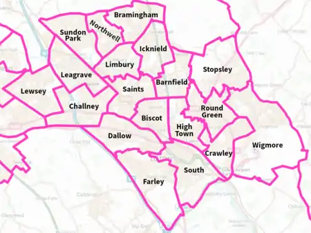
Borough of Luton
The Borough of Luton is a unitary authority area with borough status in the ceremonial county of Bedfordshire, England. Its council is based in Luton, its namesake and principal settlement. The borough contains most of one large urban area, the 31st largest in the United Kingdom the Luton/Dunstable Urban Area. This urban area (which includes the adjacent towns of Dunstable and Houghton Regis) had a population at the 2011 census of 258,018.[7]


There are 48 councillors on Luton Borough Council, representing 19 wards. The Council is controlled by the Labour group, who have 36 Local Councillors compared to the Liberal Democrats with eight seats and the Conservative Party with four.[8] In mid-2019, the district had an estimated population of 213,052 (mid-2019 est.)[5]
Formation
On 1 April 1974, under the Local Government Act 1972, the pre-existing county borough was reconstituted as a non-metropolitan district with the same boundaries as the county borough,[9][10] on 1 April 1997 Luton became a unitary authority area.[11]
Council and cabinet
| Party | Seats | Gains | Losses | Net gain/loss | Seats % | Votes % | Votes | +/− | |
|---|---|---|---|---|---|---|---|---|---|
| Labour | 32 | 0 | 3 | 66.7 | 56.7 | 55,649 | |||
| Liberal Democrats | 12 | 4 | 0 | 25.0 | 17.2 | 16,944 | |||
| Conservative | 4 | 0 | 1 | 8.3 | 19.2 | 18,897 | |||
| Independent | 0 | 0 | 0 | 0.0 | 3.9 | 3,796 | |||
| UKIP | 0 | 0 | 0 | 0.0 | 1.5 | 1,440 | |||
| Best4Luton | 0 | 0 | 0 | 0.0 | 1.1 | 1,057 | |||
| Green | 0 | 0 | 0 | 0.0 | 0.5 | 445 | |||
See also
References
- Relief of Luton's coat of arms and motto on the gate of Wardown Park
- "Luton - Coat of arms (crest) of Luton". Heraldry-wiki.com.
- Luton: Straw Hat Boom Town (PDF). Luton Cultural Services Trust. 2011. p. 9. Archived from the original (PDF) on 15 October 2013. Retrieved 25 April 2019.
The aspiration contained in its motto: Scientiae et labori detur (May it be given to skill and industry)
- Leadership=Mayor & Cabinet
- "Population Estimates for UK, England and Wales, Scotland and Northern Ireland, Mid-2019". Office for National Statistics. 6 May 2020. Retrieved 6 May 2020.
- Office for National Statistics, Neighbourhood.statistics.gov.uk
- UK Census (2011). "Local Area Report – Luton Built-up area (E34004983)". Nomis. Office for National Statistics. Retrieved 20 April 2022.
- "06/04/11 - 2011 Local election results". Archived from the original on 9 May 2011. Retrieved 29 January 2022.
- "The English Non-metropolitan Districts (Definition) Order 1972". Legislation.gov.uk. Retrieved 22 April 2022.
- "The English Non-metropolitan Districts (Names) Order 1973". Legislation.gov.uk. Retrieved 22 April 2022.
- "The Bedfordshire (Borough of Luton) (Structural Change) Order 1995". Legislation.gov.uk. Retrieved 22 April 2022.
- "Luton Council Website - Election Maps".
External links
| Unitary authorities | |
|---|---|
| Major settlements | |
| Topics |
|


.jpg)