Camiri
Camiri (Camirito, La Bomba, Choreti, Capital Petrolera de Bolivia) is a city in Bolivia, Santa Cruz Department, Cordillera Province. It is the seat of the Camiri Municipality. The town has an estimated population of 65,897 inhabitants,[1] also known as "Camireños." Camiri is on the banks of the Parapeti River in a small valley surrounded by rolling hills on the east, north, and south, and by the Aguarague mountain range on the west.
Camiri | |
|---|---|
City | |
    | |
| Nickname(s): "Capital Petrolera de Bolivia" | |
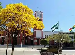
 Camiri Location in Bolivia | |
| Coordinates: 20°6′0″S 63°32′0″W | |
| Country | |
| Department | |
| Province | Cordillera Province |
| Municipality | Camiri Municipality |
| Area | |
| • Total | 22 km2 (8 sq mi) |
| • Land | 19 km2 (7 sq mi) |
| • Water | 3 km2 (1 sq mi) |
| Elevation | 812 m (2,664 ft) |
| Population (2012) | |
| • Total | 35,712 |
| • Density | 1,600/km2 (4,200/sq mi) |
| Time zone | UTC-4 (BOT) |
| Area code(s) | +591 3952 |
| Climate | Cwa |
| Website | Official website |
Camiri's Chaco ecosystem encompasses subtropical dry forests with low canopy, and intense xerophilic overgrowth with a large diversity of wildlife.
On February 3, 2007, local protesters shut down a natural gas pipeline in Camiri that serves southern Bolivia. The protesters were seeking an expansion of the nationalization of the natural gas industry and a renewal of the promise of construction of facilities for YPFB, the national petroleum company.
Climate


Camiri has a humid subtropical climate (Köppen: Cwa).
| Climate data for Camiri | |||||||||||||
|---|---|---|---|---|---|---|---|---|---|---|---|---|---|
| Month | Jan | Feb | Mar | Apr | May | Jun | Jul | Aug | Sep | Oct | Nov | Dec | Year |
| Daily mean °C (°F) | 25.6 (78.1) |
25.1 (77.2) |
23.9 (75.0) |
21.7 (71.1) |
19.8 (67.6) |
17.2 (63.0) |
17.8 (64.0) |
19.9 (67.8) |
22.7 (72.9) |
24.8 (76.6) |
25.7 (78.3) |
26.0 (78.8) |
22.5 (72.5) |
| Average precipitation mm (inches) | 157 (6.2) |
141 (5.6) |
111 (4.4) |
57 (2.2) |
22 (0.9) |
13 (0.5) |
8 (0.3) |
8 (0.3) |
16 (0.6) |
39 (1.5) |
75 (3.0) |
146 (5.7) |
793 (31.2) |
| Source: Climate-Data.org[2] | |||||||||||||